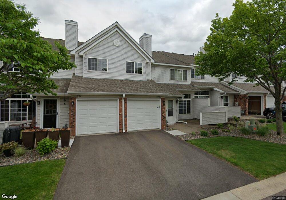
1967 N Ruby Ct Saint Paul, MN 55122
Estimated Value: $235,813 - $252,000
2
Beds
2
Baths
1,200
Sq Ft
$201/Sq Ft
Est. Value
About This Home
This home is located at 1967 N Ruby Ct, Saint Paul, MN 55122 and is currently estimated at $241,453, approximately $201 per square foot. 1967 N Ruby Ct is a home located in Dakota County with nearby schools including Deerwood Elementary School, Black Hawk Middle School, and Eagan Senior High School.
Ownership History
Date
Name
Owned For
Owner Type
Purchase Details
Closed on
Oct 30, 2012
Sold by
Nelson Christopher D
Bought by
Grogan Lori E
Current Estimated Value
Home Financials for this Owner
Home Financials are based on the most recent Mortgage that was taken out on this home.
Original Mortgage
$84,000
Interest Rate
3.38%
Mortgage Type
New Conventional
Purchase Details
Closed on
Dec 8, 2005
Sold by
Prill John D
Bought by
Nelson Christopher D and Grogan Lori E
Purchase Details
Closed on
Oct 30, 1998
Sold by
Torguson Bobbi L and Torguson Daniel A
Bought by
Prill John and Prill Daniel
Create a Home Valuation Report for This Property
The Home Valuation Report is an in-depth analysis detailing your home's value as well as a comparison with similar homes in the area
Home Values in the Area
Average Home Value in this Area
Purchase History
| Date | Buyer | Sale Price | Title Company |
|---|---|---|---|
| Grogan Lori E | -- | Land Title | |
| Nelson Christopher D | $168,300 | -- | |
| Prill John | $99,000 | -- |
Source: Public Records
Mortgage History
| Date | Status | Borrower | Loan Amount |
|---|---|---|---|
| Previous Owner | Grogan Lori E | $84,000 |
Source: Public Records
Tax History
| Year | Tax Paid | Tax Assessment Tax Assessment Total Assessment is a certain percentage of the fair market value that is determined by local assessors to be the total taxable value of land and additions on the property. | Land | Improvement |
|---|---|---|---|---|
| 2024 | $2,254 | $228,400 | $34,400 | $194,000 |
| 2023 | $2,254 | $220,100 | $34,100 | $186,000 |
| 2022 | $1,926 | $211,900 | $34,000 | $177,900 |
| 2021 | $1,872 | $186,000 | $29,600 | $156,400 |
| 2020 | $1,802 | $175,100 | $28,200 | $146,900 |
| 2019 | $1,548 | $165,100 | $26,800 | $138,300 |
| 2018 | $1,414 | $152,400 | $24,900 | $127,500 |
| 2017 | $1,365 | $137,500 | $22,600 | $114,900 |
| 2016 | $1,218 | $128,500 | $21,500 | $107,000 |
| 2015 | $1,151 | $92,797 | $16,101 | $76,696 |
| 2014 | -- | $89,091 | $14,913 | $74,178 |
| 2013 | -- | $83,423 | $13,113 | $70,310 |
Source: Public Records
Map
Nearby Homes
- 4125 Ruby Ln
- 4048 Cinnabar Dr
- 4130 Rahn Rd Unit 209
- 4130 Rahn Rd Unit B119
- 4130 Rahn Rd Unit B206
- 4110 Rahn Rd Unit 201
- 4110 Rahn Rd Unit 317
- 1898 Southpointe Terrace Unit B1898
- 3906 Mica Trail
- 1780 Talon Trail
- 1955 Timber Wolf Trail S
- 2002 Diffley Rd
- 4100 Meadowlark Ln
- 4143 Meadowlark Point
- 1978 Timber Wolf Trail S
- 4305 Eagle Crest Dr
- 1741 Sartell Ave
- 4004 Cedar Grove Ln
- 4002 Cedar Grove Ln
- 3904 Rahn Rd
- 1965 N Ruby Ct
- 1961 N Ruby Ct Unit 29
- 1959 N Ruby Ct
- 1969 N Ruby Ct Unit 33
- 1957 1957 Ruby-Court-n
- 1957 N Ruby Ct
- 1963 N Ruby Ct
- 1963 N Ruby Ct
- 1963 N Ruby Ct
- 1971 N Ruby Ct Unit 34
- 1955 N Ruby Ct Unit 26
- 1955 N Ruby Ct
- 1973 N Ruby Ct
- 1973 N Ruby Ct Unit 35
- 1975 N Ruby Ct
- 1953 N Ruby Ct
- 1953 N Ruby Ct Unit 25
- 1943 N Ruby Ct Unit 20
- 1945 N Ruby Ct
- 1947 N Ruby Ct
Your Personal Tour Guide
Ask me questions while you tour the home.