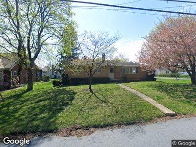
1968 Focht Ave Allentown, PA 18104
South Whitehall Township NeighborhoodEstimated Value: $388,000 - $424,000
3
Beds
3
Baths
1,849
Sq Ft
$219/Sq Ft
Est. Value
About This Home
This home is located at 1968 Focht Ave, Allentown, PA 18104 and is currently estimated at $405,711, approximately $219 per square foot. 1968 Focht Ave is a home located in Lehigh County with nearby schools including Kratzer Elementary School, Orefield Middle School, and Parkland High School.
Ownership History
Date
Name
Owned For
Owner Type
Purchase Details
Closed on
Jan 24, 2019
Sold by
Szoldatits Alfonz J
Bought by
Muzzelo Lori A
Current Estimated Value
Home Financials for this Owner
Home Financials are based on the most recent Mortgage that was taken out on this home.
Original Mortgage
$213,750
Interest Rate
4.6%
Mortgage Type
New Conventional
Purchase Details
Closed on
Mar 10, 2000
Sold by
Janny Joseph and Janny Pauline
Bought by
Szoldatits Alfonz and Szoldatits Catherine
Create a Home Valuation Report for This Property
The Home Valuation Report is an in-depth analysis detailing your home's value as well as a comparison with similar homes in the area
Home Values in the Area
Average Home Value in this Area
Purchase History
| Date | Buyer | Sale Price | Title Company |
|---|---|---|---|
| Muzzelo Lori A | $225,000 | None Available | |
| Szoldatits Alfonz | -- | -- |
Source: Public Records
Mortgage History
| Date | Status | Borrower | Loan Amount |
|---|---|---|---|
| Open | Muzzelo Lori A | $215,500 | |
| Closed | Muzzelo Lori A | $213,750 |
Source: Public Records
Tax History Compared to Growth
Tax History
| Year | Tax Paid | Tax Assessment Tax Assessment Total Assessment is a certain percentage of the fair market value that is determined by local assessors to be the total taxable value of land and additions on the property. | Land | Improvement |
|---|---|---|---|---|
| 2025 | $5,392 | $221,700 | $36,500 | $185,200 |
| 2024 | $5,210 | $221,700 | $36,500 | $185,200 |
| 2023 | $5,099 | $221,700 | $36,500 | $185,200 |
| 2022 | $5,079 | $221,700 | $185,200 | $36,500 |
| 2021 | $5,079 | $221,700 | $36,500 | $185,200 |
| 2020 | $5,079 | $221,700 | $36,500 | $185,200 |
| 2019 | $4,984 | $221,700 | $36,500 | $185,200 |
| 2018 | $4,820 | $221,700 | $36,500 | $185,200 |
| 2017 | $4,653 | $221,700 | $36,500 | $185,200 |
| 2016 | -- | $221,700 | $36,500 | $185,200 |
| 2015 | -- | $221,700 | $36,500 | $185,200 |
| 2014 | -- | $221,700 | $36,500 | $185,200 |
Source: Public Records
Map
Nearby Homes
- 1959 Whitehall Ave
- 2357 Albright Ave
- 1995 Pierce Dr
- 2110 Huckleberry Rd
- 1590 Abigail Ln Unit LOT 59
- 1590 Abigail Ln
- 1711 Elmhurst Dr
- 2210 Grove St
- 1881 Redwood Dr
- 1825 W Columbia St
- 28 Lincoln Place
- 1150 N 19th St
- 1942 Schadt Ave
- 2117 W Highland St
- 1424 Mauch Chunk Rd
- 1319 Overlook Rd
- 36 Peachtree Cir
- 1134 N 26th St
- 119 Cornerstone Place
- 1703 Saratoga Ct