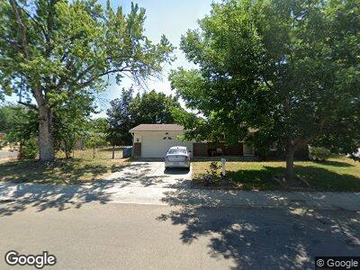
1969 N Middlefield Rd Boise, ID 83704
West Boise NeighborhoodEstimated Value: $394,000 - $404,000
3
Beds
2
Baths
1,416
Sq Ft
$282/Sq Ft
Est. Value
About This Home
This home is located at 1969 N Middlefield Rd, Boise, ID 83704 and is currently estimated at $399,311, approximately $281 per square foot. 1969 N Middlefield Rd is a home located in Ada County with nearby schools including Morley Nelson Elementary School, Fairmont Junior High School, and Capital High School.
Ownership History
Date
Name
Owned For
Owner Type
Purchase Details
Closed on
Sep 7, 2022
Sold by
Boren Ronald D
Bought by
Ronald D Boren Family Trust
Current Estimated Value
Purchase Details
Closed on
Aug 2, 2018
Sold by
Boren Ronald D and Boren Cleo I
Bought by
Boren Ronald D
Purchase Details
Closed on
Jul 15, 1998
Sold by
Christine Molyneux Lori and Christine Lori Christine
Bought by
Boren Ronald D and Boren Cleo I
Home Financials for this Owner
Home Financials are based on the most recent Mortgage that was taken out on this home.
Original Mortgage
$73,200
Interest Rate
7%
Mortgage Type
Purchase Money Mortgage
Create a Home Valuation Report for This Property
The Home Valuation Report is an in-depth analysis detailing your home's value as well as a comparison with similar homes in the area
Home Values in the Area
Average Home Value in this Area
Purchase History
| Date | Buyer | Sale Price | Title Company |
|---|---|---|---|
| Ronald D Boren Family Trust | -- | -- | |
| Boren Ronald D | -- | None Available | |
| Boren Ronald D | -- | Transnation Title & Escrow I |
Source: Public Records
Mortgage History
| Date | Status | Borrower | Loan Amount |
|---|---|---|---|
| Previous Owner | Boren Ronald D | $129,247 | |
| Previous Owner | Boren Ronald D | $135,880 | |
| Previous Owner | Boren Ronald D | $73,200 |
Source: Public Records
Tax History Compared to Growth
Tax History
| Year | Tax Paid | Tax Assessment Tax Assessment Total Assessment is a certain percentage of the fair market value that is determined by local assessors to be the total taxable value of land and additions on the property. | Land | Improvement |
|---|---|---|---|---|
| 2024 | $2,003 | $344,400 | -- | -- |
| 2023 | $2,003 | $334,700 | $0 | $0 |
| 2022 | $2,287 | $388,600 | $0 | $0 |
| 2021 | $1,968 | $305,000 | $0 | $0 |
| 2020 | $1,709 | $243,900 | $0 | $0 |
| 2019 | $1,720 | $226,700 | $0 | $0 |
| 2018 | $1,479 | $194,700 | $0 | $0 |
| 2017 | $1,385 | $173,200 | $0 | $0 |
| 2016 | $1,294 | $158,000 | $0 | $0 |
| 2015 | $1,108 | $142,600 | $0 | $0 |
| 2012 | -- | $95,900 | $0 | $0 |
Source: Public Records
Map
Nearby Homes
- 1717 N Regal Dr
- 2260 N Camden Dr
- 2044 N Fairmeadow Dr
- TBD N Kimball St
- TBD N Ash Park Ln
- 2155 N Fairmeadow Dr
- 1420 N Oakwood Ln
- 2571 N Bird St
- 2579 N Maywood Place
- 2702 N Camden Place
- 8482 W Marcum Ct
- 1444 N Cole Cottage Ln
- 1250 N Sable Ln
- 9030 W Sunflower Ln
- 1251 N Arrow Ln
- 8212 W Pomona Ct
- 8736 W Canterbury St
- 3001 N Network Ln
- 8875 W Irving St Unit 101
- 1067 N Elk Ln
- 1969 N Middlefield Rd
- 1940 N Camden Dr
- 1995 N Middlefield Rd
- 1970 N Middlefield Rd
- 8122 W Holt St
- 1930 N Camden Dr
- 1935 N Camden Dr
- 8129 W Holt St
- 2021 N Regal Dr
- 2010 N Middlefield Rd
- 1920 N Camden Dr
- 8116 W Holt St
- 2015 N Middlefield Rd
- 8121 W Holt St
- 8290 W Amherst Dr
- 2025 N Regal Dr
- 8119 W Holt St
- 8235 W Winchester Dr
- 2017 N Regal Dr