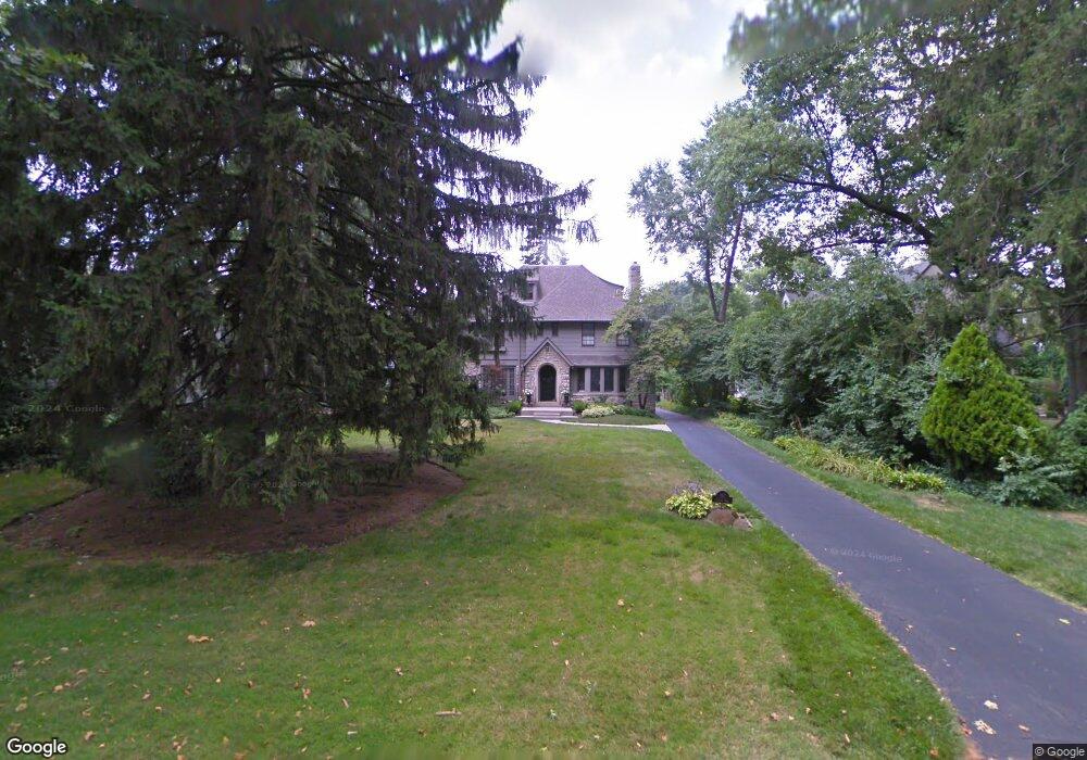
197 Preston Rd Columbus, OH 43209
Estimated Value: $1,201,164 - $1,581,000
5
Beds
5
Baths
5,031
Sq Ft
$268/Sq Ft
Est. Value
About This Home
This home is located at 197 Preston Rd, Columbus, OH 43209 and is currently estimated at $1,348,291, approximately $267 per square foot. 197 Preston Rd is a home located in Franklin County with nearby schools including Ohio Avenue Elementary School, Champion Middle School, and East High School.
Ownership History
Date
Name
Owned For
Owner Type
Purchase Details
Closed on
Jun 28, 1983
Bought by
Williams Mary M
Current Estimated Value
Create a Home Valuation Report for This Property
The Home Valuation Report is an in-depth analysis detailing your home's value as well as a comparison with similar homes in the area
Home Values in the Area
Average Home Value in this Area
Purchase History
| Date | Buyer | Sale Price | Title Company |
|---|---|---|---|
| Williams Mary M | $160,000 | -- |
Source: Public Records
Tax History
| Year | Tax Paid | Tax Assessment Tax Assessment Total Assessment is a certain percentage of the fair market value that is determined by local assessors to be the total taxable value of land and additions on the property. | Land | Improvement |
|---|---|---|---|---|
| 2025 | $14,398 | $320,810 | $127,750 | $193,060 |
| 2024 | $14,398 | $320,810 | $127,750 | $193,060 |
| 2023 | $14,214 | $320,810 | $127,750 | $193,060 |
| 2022 | $12,076 | $232,830 | $70,460 | $162,370 |
| 2021 | $12,097 | $232,830 | $70,460 | $162,370 |
| 2020 | $12,113 | $232,830 | $70,460 | $162,370 |
| 2019 | $12,797 | $210,950 | $64,050 | $146,900 |
| 2018 | $12,740 | $210,950 | $64,050 | $146,900 |
| 2017 | $12,789 | $210,950 | $64,050 | $146,900 |
| 2016 | $14,002 | $211,370 | $70,000 | $141,370 |
| 2015 | $12,710 | $211,370 | $70,000 | $141,370 |
| 2014 | $12,742 | $211,370 | $70,000 | $141,370 |
| 2013 | $5,713 | $192,150 | $63,630 | $128,520 |
Source: Public Records
Map
Nearby Homes
- 211 Preston Rd
- 57 Preston Rd
- 1847 Oak St
- 2417 Fair Ave
- 1905 Clifton Ave
- 1779 E Main St
- 140 N Parkview Ave
- 2465 E Broad St
- 592 Rhoads Ave Unit 594
- 423 Stoddart Ave
- 572 Bulen Ave
- 1707 E Main St Unit 1705
- 422-424 Morrison Ave
- 409-411 Morrison Ave
- 1670 E Broad St Unit 206
- 1670 E Broad St Unit 309
- 377 Berkeley Rd
- 389-391 Berkeley Rd
- 1571 Franklin Ave
- 54 Woodland Ave
Your Personal Tour Guide
Ask me questions while you tour the home.