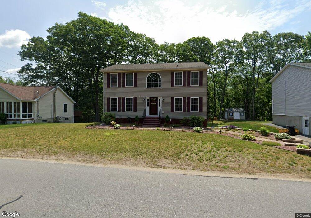
197 Rochdale St Auburn, MA 01501
West Auburn NeighborhoodEstimated Value: $581,644 - $640,000
3
Beds
3
Baths
2,136
Sq Ft
$285/Sq Ft
Est. Value
About This Home
This home is located at 197 Rochdale St, Auburn, MA 01501 and is currently estimated at $609,411, approximately $285 per square foot. 197 Rochdale St is a home located in Worcester County with nearby schools including Auburn Senior High School, Canterbury Street School, and Shrewsbury Montessori School - Auburn Campus.
Ownership History
Date
Name
Owned For
Owner Type
Purchase Details
Closed on
Jan 9, 2004
Sold by
Delollis David P
Bought by
Letourneau Geneva M and Letourneau Paul G
Current Estimated Value
Home Financials for this Owner
Home Financials are based on the most recent Mortgage that was taken out on this home.
Original Mortgage
$246,760
Outstanding Balance
$115,240
Interest Rate
5.88%
Mortgage Type
Purchase Money Mortgage
Estimated Equity
$494,171
Create a Home Valuation Report for This Property
The Home Valuation Report is an in-depth analysis detailing your home's value as well as a comparison with similar homes in the area
Home Values in the Area
Average Home Value in this Area
Purchase History
| Date | Buyer | Sale Price | Title Company |
|---|---|---|---|
| Letourneau Geneva M | $308,910 | -- |
Source: Public Records
Mortgage History
| Date | Status | Borrower | Loan Amount |
|---|---|---|---|
| Open | Letourneau Geneva M | $246,760 |
Source: Public Records
Tax History Compared to Growth
Tax History
| Year | Tax Paid | Tax Assessment Tax Assessment Total Assessment is a certain percentage of the fair market value that is determined by local assessors to be the total taxable value of land and additions on the property. | Land | Improvement |
|---|---|---|---|---|
| 2025 | $64 | $448,900 | $117,400 | $331,500 |
| 2024 | $6,727 | $450,600 | $113,000 | $337,600 |
| 2023 | $6,417 | $404,100 | $102,800 | $301,300 |
| 2022 | $5,968 | $354,800 | $102,800 | $252,000 |
| 2021 | $5,761 | $317,600 | $90,700 | $226,900 |
| 2020 | $5,710 | $317,600 | $90,700 | $226,900 |
| 2019 | $5,718 | $310,400 | $89,900 | $220,500 |
| 2018 | $5,621 | $304,800 | $84,100 | $220,700 |
| 2017 | $5,447 | $297,000 | $76,300 | $220,700 |
| 2016 | $5,326 | $294,400 | $78,700 | $215,700 |
| 2015 | $5,054 | $292,800 | $78,700 | $214,100 |
| 2014 | $4,921 | $284,600 | $74,800 | $209,800 |
Source: Public Records
Map
Nearby Homes
- Lot 2 Leicester St
- 37 Inwood Rd
- 30 Briarcliff Dr
- 88 Wallace Ave
- 3 Old Cart Rd
- 707 Stafford St
- 7 Sara Dr
- 19-20 Williams St
- 381 Oxford St N
- 28 Lorna Dr
- 16 Homestead Ave
- 177 Oxford St N
- 88 Vine St
- 5 Main St
- 19 Virginia Dr Unit 19
- 6 Ryans Way Unit 6
- 34 Rockland Rd
- 5 Virginia Dr Unit 5B
- 8 Garden St
- 25 Vinal St Unit 30
- 195 Rochdale St
- 199 Rochdale St
- 0 Leicester St
- 210 Rochdale St
- 191 Rochdale St
- 362 Leicester St
- 208 Rochdale St
- 189 Rochdale St
- 360 Leicester St
- 2 Rotary Rd
- 401 Leicester St
- 187 Rochdale St
- 206 Rochdale St
- 356 Leicester St
- 404 Leicester St
- 4 Rotary Rd
- 403 Leicester St
- 294 Rochdale St
- 204 Rochdale St
- 346 Leicester St