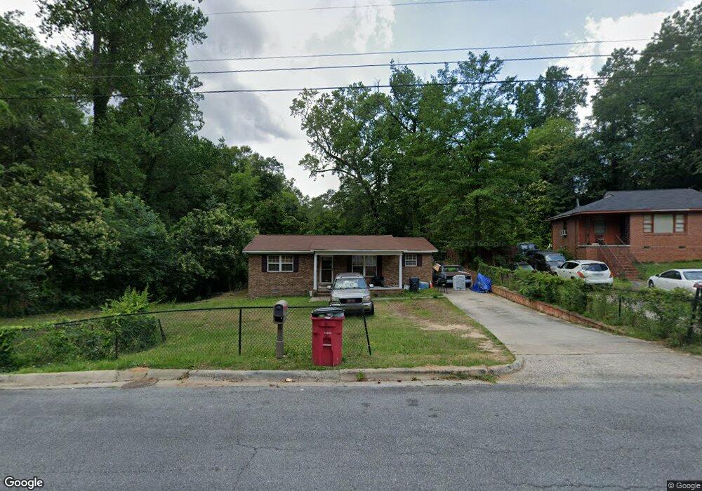
1970 Knightsbridge Rd Unit 213 Macon, GA 31211
Estimated Value: $80,673 - $147,000
3
Beds
2
Baths
1,056
Sq Ft
$107/Sq Ft
Est. Value
About This Home
This home is located at 1970 Knightsbridge Rd Unit 213, Macon, GA 31211 and is currently estimated at $113,418, approximately $107 per square foot. 1970 Knightsbridge Rd Unit 213 is a home located in Bibb County with nearby schools including Martin Luther King Jr. Elementary School, Appling Middle School, and Northeast High School.
Ownership History
Date
Name
Owned For
Owner Type
Purchase Details
Closed on
Jul 31, 2017
Sold by
Merriweather Catherine Benson
Bought by
Merriweather Tyson Augustus
Current Estimated Value
Purchase Details
Closed on
May 31, 2011
Sold by
Merriweather Tyson A
Bought by
Merriweather Tyson A and Merriweather Catherine Denise
Home Financials for this Owner
Home Financials are based on the most recent Mortgage that was taken out on this home.
Original Mortgage
$66,276
Outstanding Balance
$45,617
Interest Rate
4.75%
Mortgage Type
FHA
Estimated Equity
$67,801
Purchase Details
Closed on
May 8, 2006
Sold by
Gollsby John W
Bought by
Whithy Clifford
Create a Home Valuation Report for This Property
The Home Valuation Report is an in-depth analysis detailing your home's value as well as a comparison with similar homes in the area
Home Values in the Area
Average Home Value in this Area
Purchase History
| Date | Buyer | Sale Price | Title Company |
|---|---|---|---|
| Merriweather Tyson Augustus | -- | None Available | |
| Merriweather Tyson A | -- | None Available | |
| Merriweahter Tyson A | $68,000 | None Available | |
| Whithy Clifford | $10,000 | None Available |
Source: Public Records
Mortgage History
| Date | Status | Borrower | Loan Amount |
|---|---|---|---|
| Open | Merriweahter Tyson A | $66,276 |
Source: Public Records
Tax History Compared to Growth
Tax History
| Year | Tax Paid | Tax Assessment Tax Assessment Total Assessment is a certain percentage of the fair market value that is determined by local assessors to be the total taxable value of land and additions on the property. | Land | Improvement |
|---|---|---|---|---|
| 2025 | $867 | $35,268 | $4,640 | $30,628 |
| 2024 | $787 | $30,995 | $2,900 | $28,095 |
| 2023 | $693 | $27,303 | $1,740 | $25,563 |
| 2022 | $636 | $18,368 | $2,864 | $15,504 |
| 2021 | $525 | $13,815 | $1,826 | $11,989 |
| 2020 | $483 | $12,434 | $1,826 | $10,608 |
| 2019 | $477 | $12,182 | $1,826 | $10,356 |
| 2018 | $910 | $12,182 | $1,826 | $10,356 |
| 2017 | $418 | $11,147 | $1,826 | $9,321 |
| 2016 | $371 | $10,719 | $1,826 | $8,893 |
| 2015 | $525 | $10,719 | $1,826 | $8,893 |
| 2014 | $475 | $14,514 | $2,656 | $11,858 |
Source: Public Records
Map
Nearby Homes
- 2458 Tredway Dr
- 2371 Kensington Rd
- 2761 Walnut Creek Rd
- 2630 Pauladale Dr
- 2557 Hyde Park Rd
- 2146 Melton Ave
- 2229 New Clinton Rd
- 2792 Skyline Dr
- 2130 New Clinton Rd
- 2066 Melton Ave
- 2029 Kitchens Rd
- 837 Artic Cir
- 2815 New Clinton Rd
- 1840 Kinder Kare Dr
- 1818 Kinder Kare Dr
- 875 Artic Cir
- 1957 Kitchens Rd
- 875 Artic Place
- 1008 Sunnydale Dr
- 240 Neptune Ct
- 1970 Knightsbridge Rd
- 1978 Knightsbridge Rd
- 1954 Knightsbridge Rd
- 2395 Tredway Dr
- 1986 Knightsbridge Rd
- 2415 Tredway Dr
- 1965 Knightsbridge Rd
- 1981 Knightsbridge Rd
- 1946 Knightsbridge Rd
- 2423 Tredway Dr
- 1957 Knightsbridge Rd
- 1992 Knightsbridge Rd
- 1989 Knightsbridge Rd
- 2431 Tredway Dr
- 1949 Knightsbridge Rd
- 1938 Knightsbridge Rd
- 2439 Tredway Dr
- 1997 Knightsbridge Rd
- 1941 Knightsbridge Rd
- 1962 Bayswater Rd