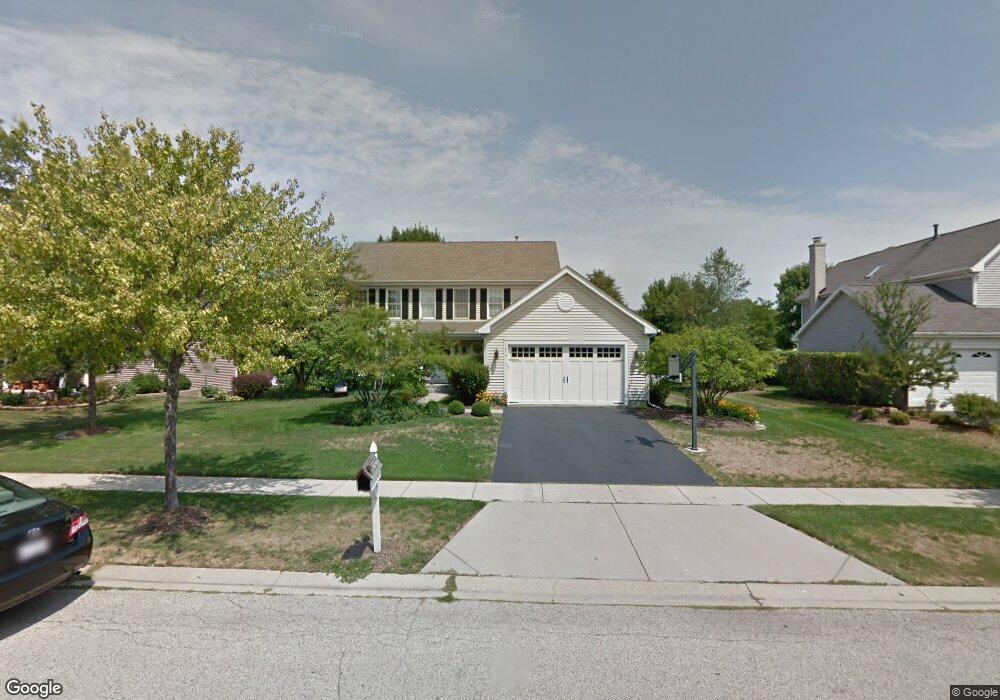
1970 Peach Tree Ln Algonquin, IL 60102
Estimated Value: $478,000 - $528,000
4
Beds
3
Baths
2,580
Sq Ft
$192/Sq Ft
Est. Value
About This Home
This home is located at 1970 Peach Tree Ln, Algonquin, IL 60102 and is currently estimated at $495,752, approximately $192 per square foot. 1970 Peach Tree Ln is a home located in Kane County with nearby schools including Westfield Community School, United Junior High School, and Harry D Jacobs High School.
Ownership History
Date
Name
Owned For
Owner Type
Purchase Details
Closed on
Nov 7, 2017
Sold by
Rizzuto Richard P and Rizzuto Julie A
Bought by
Barrett Timothy J and Barrett Nancy J
Current Estimated Value
Home Financials for this Owner
Home Financials are based on the most recent Mortgage that was taken out on this home.
Original Mortgage
$288,000
Outstanding Balance
$200,551
Interest Rate
3.85%
Mortgage Type
New Conventional
Estimated Equity
$295,201
Create a Home Valuation Report for This Property
The Home Valuation Report is an in-depth analysis detailing your home's value as well as a comparison with similar homes in the area
Home Values in the Area
Average Home Value in this Area
Purchase History
| Date | Buyer | Sale Price | Title Company |
|---|---|---|---|
| Barrett Timothy J | $960,000 | Landtrust Natl Title |
Source: Public Records
Mortgage History
| Date | Status | Borrower | Loan Amount |
|---|---|---|---|
| Open | Barrett Timothy J | $288,000 |
Source: Public Records
Tax History Compared to Growth
Tax History
| Year | Tax Paid | Tax Assessment Tax Assessment Total Assessment is a certain percentage of the fair market value that is determined by local assessors to be the total taxable value of land and additions on the property. | Land | Improvement |
|---|---|---|---|---|
| 2024 | $9,828 | $139,011 | $25,730 | $113,281 |
| 2023 | $9,400 | $125,077 | $23,151 | $101,926 |
| 2022 | $8,633 | $110,878 | $23,151 | $87,727 |
| 2021 | $8,382 | $104,691 | $21,859 | $82,832 |
| 2020 | $8,246 | $101,183 | $21,368 | $79,815 |
| 2019 | $7,996 | $96,054 | $20,285 | $75,769 |
| 2018 | $8,128 | $94,152 | $19,883 | $74,269 |
| 2017 | $7,803 | $88,075 | $18,600 | $69,475 |
| 2016 | $7,524 | $80,522 | $18,009 | $62,513 |
| 2015 | -- | $73,539 | $17,040 | $56,499 |
| 2014 | -- | $68,602 | $16,569 | $52,033 |
| 2013 | -- | $70,702 | $17,076 | $53,626 |
Source: Public Records
Map
Nearby Homes
- 1971 Peach Tree Ln
- 2043 Peach Tree Ln Unit 4122
- 2101 Peach Tree Ln Unit 4094
- 2161 Burnham Ct
- 000 County Line Rd
- 1900 Waverly Ln
- 30 Arbordale Ct Unit 4284
- 2060 Dorchester Ave
- Adams Plan at Algonquin Meadows - Single Family
- Sequoia Plan at Algonquin Meadows - Single Family
- Bryce Plan at Algonquin Meadows - Single Family
- Rainier Plan at Algonquin Meadows - Single Family
- Santa Rosa Plan at Algonquin Meadows - Single Family
- Biscayne Plan at Algonquin Meadows - Single Family
- Marianne Plan at Algonquin Meadows - Traditional Townhomes
- Darcy Plan at Algonquin Meadows - Traditional Townhomes
- Charlotte Plan at Algonquin Meadows - Traditional Townhomes
- Amherst Plan at Algonquin Meadows - Urban Townhomes
- Chatham Plan at Algonquin Meadows - Urban Townhomes
- Chelsea Plan at Algonquin Meadows - Urban Townhomes
- 1960 Peach Tree Ln
- 1971 White Oak Dr
- 1961 White Oak Dr
- 1950 Peach Tree Ln
- 2000 Peach Tree Ln
- 1961 Peach Tree Ln
- 1981 Peach Tree Ln Unit 3
- 1951 White Oak Dr
- 1940 Peach Tree Ln
- 1951 Peach Tree Ln
- 2001 Peach Tree Ln
- 1941 White Oak Dr
- 1941 Peach Tree Ln Unit 4184
- 2011 Peach Tree Ln
- 1980 Cloverdale Ln
- 2000 Cloverdale Ln Unit 4
- 1930 Peach Tree Ln
- 8 Peach Tree Ct Unit 4141
- 28 Peach Tree Ct Unit 4162
- 4 Peach Tree Ct Unit 4143