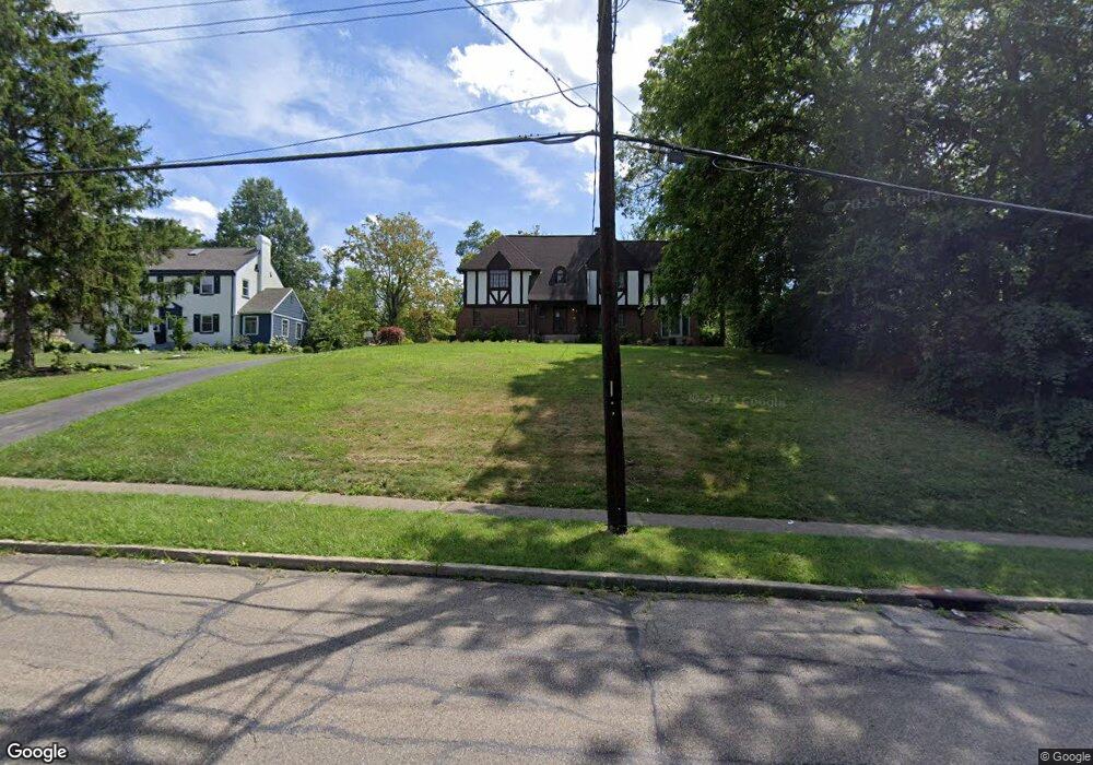
1971 Adams Rd Cincinnati, OH 45231
Estimated Value: $284,000 - $379,000
4
Beds
2
Baths
2,667
Sq Ft
$119/Sq Ft
Est. Value
About This Home
This home is located at 1971 Adams Rd, Cincinnati, OH 45231 and is currently estimated at $318,635, approximately $119 per square foot. 1971 Adams Rd is a home located in Hamilton County with nearby schools including Mt Healthy High School and Central Montessori Academy.
Ownership History
Date
Name
Owned For
Owner Type
Purchase Details
Closed on
Nov 17, 2023
Sold by
Mutters Nicholas Scott and Mutters Kendra
Bought by
Mutters Nicholas Scott and Lang-Mutters Kendra
Current Estimated Value
Purchase Details
Closed on
May 1, 2023
Sold by
Rentschler Patricia Ann and Rentschler Kenneth Edward
Bought by
Mutters Nicholas Scott
Home Financials for this Owner
Home Financials are based on the most recent Mortgage that was taken out on this home.
Original Mortgage
$133,000
Interest Rate
6.42%
Mortgage Type
Construction
Create a Home Valuation Report for This Property
The Home Valuation Report is an in-depth analysis detailing your home's value as well as a comparison with similar homes in the area
Home Values in the Area
Average Home Value in this Area
Purchase History
| Date | Buyer | Sale Price | Title Company |
|---|---|---|---|
| Mutters Nicholas Scott | $500 | None Listed On Document | |
| Mutters Nicholas Scott | $500 | None Listed On Document | |
| Mutters Nicholas Scott | $200,000 | None Listed On Document | |
| Mutters Nicholas Scott | $200,000 | None Listed On Document |
Source: Public Records
Mortgage History
| Date | Status | Borrower | Loan Amount |
|---|---|---|---|
| Previous Owner | Mutters Nicholas Scott | $133,000 |
Source: Public Records
Tax History
| Year | Tax Paid | Tax Assessment Tax Assessment Total Assessment is a certain percentage of the fair market value that is determined by local assessors to be the total taxable value of land and additions on the property. | Land | Improvement |
|---|---|---|---|---|
| 2025 | $6,089 | $116,120 | $14,084 | $102,036 |
| 2024 | $6,063 | $116,120 | $14,084 | $102,036 |
| 2023 | $6,106 | $116,120 | $14,084 | $102,036 |
| 2022 | $4,016 | $54,635 | $13,832 | $40,803 |
| 2021 | $3,926 | $54,635 | $13,832 | $40,803 |
| 2020 | $4,023 | $54,635 | $13,832 | $40,803 |
| 2019 | $3,380 | $48,350 | $12,240 | $36,110 |
| 2018 | $3,401 | $48,350 | $12,240 | $36,110 |
| 2017 | $3,213 | $48,350 | $12,240 | $36,110 |
| 2016 | $3,557 | $52,966 | $11,281 | $41,685 |
| 2015 | $3,578 | $52,966 | $11,281 | $41,685 |
| 2014 | $3,557 | $52,966 | $11,281 | $41,685 |
| 2013 | $4,001 | $60,190 | $12,821 | $47,369 |
Source: Public Records
Map
Nearby Homes
- 1967 Compton Rd
- 9125 Tag Dr
- 1725 Hastings Ave
- 2175 Carlsbory Dr
- 9369 Ranchill Dr
- 1980 Stevens Ave
- 7718 Hamilton Ave
- 9577 Creekhill Dr
- 1545 Mcmakin Ave
- 7310 Forest Ave
- 1579 Meredith Dr
- 1559 Meredith Dr
- 7508 Elizabeth St
- 7404 Joseph St
- 1556 Meredith Dr
- 9231 Coogan Dr
- 1457 Adams Rd
- 9287 Coogan Dr
- 1650 Joseph Ct
- 7918 Southampton Ct
- 1963 Adams Rd
- 1957 Adams Rd
- 1977 Adams Rd
- 1947 Adams Rd
- 1939 Adams Rd
- 2019 Adams Rd
- 1936 Adams Rd Unit 4 Cincinnati, OH 452
- 1936 Adams Rd
- 1929 Adams Rd
- 1920 Adams Rd
- 1925 Adams Rd
- 1990 Adams Rd
- 1916 Adams Rd
- 1915 Adams Rd
- 9230 Duvall Place
- 1914 Adams Rd
- 1918 Adams Rd
- 1918 Adams Rd Unit 1918
- 9220 Duvall Place
- 9240 Duvall Place
Your Personal Tour Guide
Ask me questions while you tour the home.