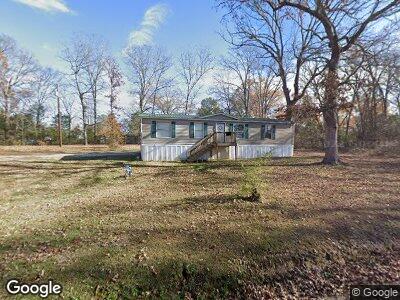
1971 Fender Ln Lancaster, SC 29720
Estimated Value: $159,830 - $315,000
--
Bed
2
Baths
2,032
Sq Ft
$115/Sq Ft
Est. Value
About This Home
This home is located at 1971 Fender Ln, Lancaster, SC 29720 and is currently estimated at $232,708, approximately $114 per square foot. 1971 Fender Ln is a home located in Lancaster County with nearby schools including Brooklyn Springs Elementary School, South Middle School, and Lancaster High School.
Ownership History
Date
Name
Owned For
Owner Type
Purchase Details
Closed on
Aug 26, 2022
Sold by
Eugene Haggins James
Bought by
Haggins Khadija Nicole
Current Estimated Value
Purchase Details
Closed on
Jan 23, 2012
Sold by
Pelham Anthony E and Pelham Teresa M
Bought by
Haggins James Eugene and Haggins Carl Ted
Purchase Details
Closed on
Dec 9, 2010
Sold by
Anthony Chandra
Bought by
Pelham Teresa M
Purchase Details
Closed on
Jan 19, 2010
Sold by
Anthony Eura L
Bought by
Pelham Anthony E and Pelham Teresa M
Purchase Details
Closed on
Jan 5, 2010
Sold by
Ing Usa Annuity & Life Insurance Company
Bought by
Anthony Eura L and Anthony Menzola
Create a Home Valuation Report for This Property
The Home Valuation Report is an in-depth analysis detailing your home's value as well as a comparison with similar homes in the area
Home Values in the Area
Average Home Value in this Area
Purchase History
| Date | Buyer | Sale Price | Title Company |
|---|---|---|---|
| Haggins Khadija Nicole | -- | None Listed On Document | |
| Haggins James Eugene | -- | -- | |
| Pelham Teresa M | -- | -- | |
| Chandra Pelham Teresa M | -- | -- | |
| Pelham Anthony E | -- | -- | |
| Anthony Eura L | -- | -- |
Source: Public Records
Tax History Compared to Growth
Tax History
| Year | Tax Paid | Tax Assessment Tax Assessment Total Assessment is a certain percentage of the fair market value that is determined by local assessors to be the total taxable value of land and additions on the property. | Land | Improvement |
|---|---|---|---|---|
| 2024 | $215 | $1,404 | $1,344 | $60 |
| 2023 | $220 | $1,404 | $1,344 | $60 |
| 2022 | $213 | $1,404 | $1,344 | $60 |
| 2021 | $685 | $2,106 | $2,016 | $90 |
| 2020 | $655 | $2,016 | $2,016 | $0 |
| 2019 | $683 | $7,080 | $2,016 | $5,064 |
| 2018 | $2,304 | $7,080 | $2,016 | $5,064 |
| 2017 | $707 | $0 | $0 | $0 |
| 2016 | $695 | $0 | $0 | $0 |
| 2015 | $1,946 | $0 | $0 | $0 |
| 2014 | $1,946 | $0 | $0 | $0 |
| 2013 | $1,946 | $0 | $0 | $0 |
Source: Public Records
Map
Nearby Homes
- 2138 Athena Rd
- 2141 Athena Rd
- 3017 Crenson Dr
- 3021 Crenson Dr
- 2156 Evans Dr
- 2138 Evans Dr
- 3029 Crenson Dr
- 2115 Athena Rd
- 2118 Evans Dr
- 2111 Athena Rd
- 3024 Crenson Dr
- 3028 Crenson Dr
- 2104 Evans Dr
- 2093 Athena Rd
- 1990 Country Club Dr
- 2085 Crenson Dr
- 3041 Mulberry Ln
- 2075 Athena Rd
- 2060 Athena Rd
- 2056 Athena Rd
- 1971 Fender Ln
- 1985 Powell Ave
- 1971 Powell Ave
- 2040 Old Evans Cir
- 2028 Old Evans Cir
- 2058 State Road S-29-253
- 1978 Powell Ave
- 1947 Powell Ave
- 2022 Old Evans Cir
- 2039 Old Evans Cir
- 2015 Powell Ave
- 2053 Old Evans Cir
- 2072 Old Evans Cir
- 2004 Powell Ave
- 1935 Powell Ave
- 2075 Old Evans Cir
- 2019 Powell Ave
- 2016 Powell Ave
- 2084 Old Evans Cir
- 2096 Lynwood Dr