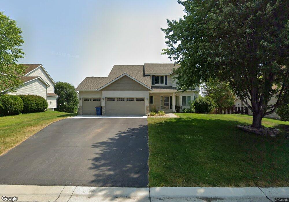
1971 Omega Dr Shakopee, MN 55379
Estimated Value: $480,000 - $556,000
4
Beds
4
Baths
3,152
Sq Ft
$164/Sq Ft
Est. Value
About This Home
This home is located at 1971 Omega Dr, Shakopee, MN 55379 and is currently estimated at $515,456, approximately $163 per square foot. 1971 Omega Dr is a home located in Scott County with nearby schools including Jackson Elementary School, East Middle School, and Shakopee Senior High School.
Ownership History
Date
Name
Owned For
Owner Type
Purchase Details
Closed on
May 27, 2005
Sold by
Amries Naresh K
Bought by
Schwabe Roger W and Schwabe Amanda K
Current Estimated Value
Purchase Details
Closed on
Nov 21, 2003
Sold by
Mw Johnson Construction
Bought by
Neermati Amries Naresh K
Purchase Details
Closed on
Nov 18, 2002
Sold by
Tollefson Development Inc
Bought by
M W Johnson Construction Inc
Create a Home Valuation Report for This Property
The Home Valuation Report is an in-depth analysis detailing your home's value as well as a comparison with similar homes in the area
Home Values in the Area
Average Home Value in this Area
Purchase History
| Date | Buyer | Sale Price | Title Company |
|---|---|---|---|
| Schwabe Roger W | $360,000 | -- | |
| Neermati Amries Naresh K | $284,077 | -- | |
| M W Johnson Construction Inc | $6,878,250 | -- |
Source: Public Records
Tax History Compared to Growth
Tax History
| Year | Tax Paid | Tax Assessment Tax Assessment Total Assessment is a certain percentage of the fair market value that is determined by local assessors to be the total taxable value of land and additions on the property. | Land | Improvement |
|---|---|---|---|---|
| 2025 | $4,796 | $458,900 | $148,500 | $310,400 |
| 2024 | $4,732 | $459,000 | $148,500 | $310,500 |
| 2023 | $4,992 | $441,700 | $142,800 | $298,900 |
| 2022 | $4,658 | $457,600 | $162,300 | $295,300 |
| 2021 | $3,888 | $368,600 | $128,100 | $240,500 |
| 2020 | $4,192 | $338,300 | $122,900 | $215,400 |
| 2019 | $4,172 | $321,400 | $109,200 | $212,200 |
| 2018 | $4,150 | $0 | $0 | $0 |
| 2016 | $4,074 | $0 | $0 | $0 |
| 2014 | -- | $0 | $0 | $0 |
Source: Public Records
Map
Nearby Homes
- 1895 Omega Dr
- 2960 Molina St
- 2113 Sandhill Dr
- 1943 Sparrow Dr
- 2518 Green Ash Ave
- 2529 Green Ash Ave
- 1842 Archer St
- 1858 Archer St
- 1834 Archer St
- 1830 Archer St
- Berkley Plan at Arbor Bluff - Venture Collection
- 2551 Aspen Ct
- Clark Plan at Arbor Bluff - Venture Collection
- 2548 Aspen Ct
- Itasca Plan at Arbor Bluff - Landmark Collection
- Sequoia Plan at Arbor Bluff - Venture Collection
- Markham Plan at Arbor Bluff - Venture Collection
- 2340 Rock Elm Rd
- Lewis Plan at Arbor Bluff - Landmark Collection
- McKinley Plan at Arbor Bluff - Landmark Collection