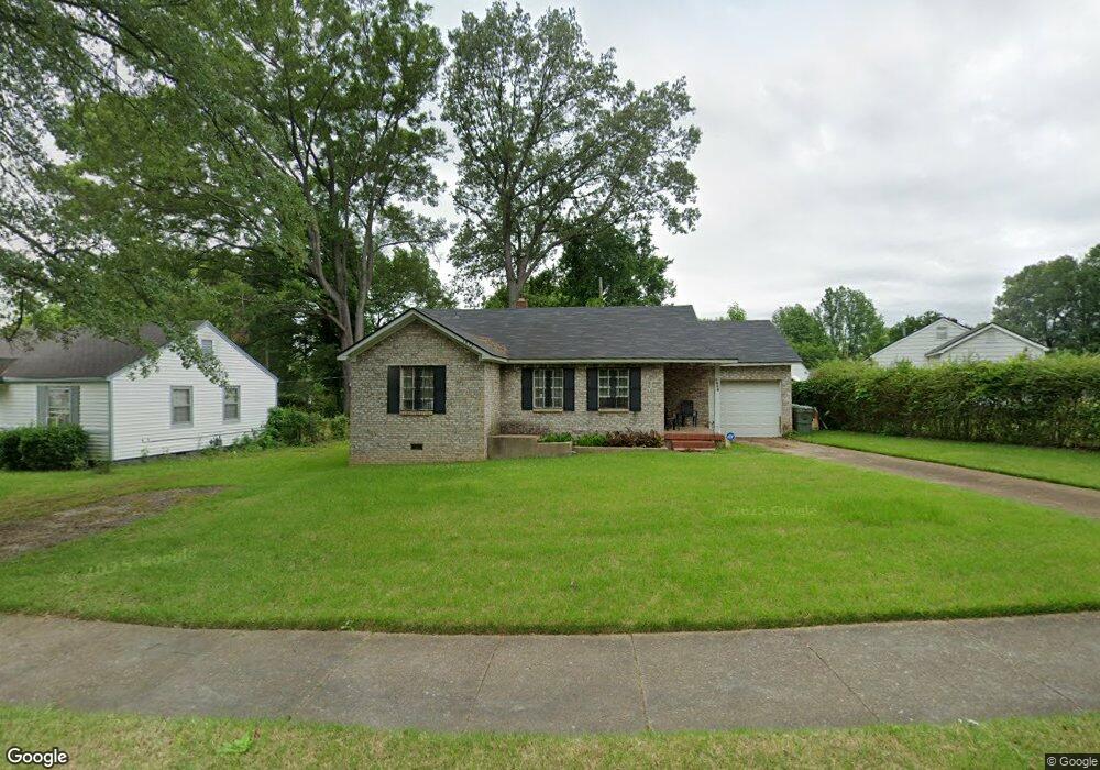
1972 Cloverdale Dr Memphis, TN 38114
Southeast Memphis NeighborhoodEstimated Value: $77,000 - $99,436
3
Beds
2
Baths
1,272
Sq Ft
$69/Sq Ft
Est. Value
About This Home
This home is located at 1972 Cloverdale Dr, Memphis, TN 38114 and is currently estimated at $88,109, approximately $69 per square foot. 1972 Cloverdale Dr is a home located in Shelby County with nearby schools including Hamilton High School, Hanley Schoool - Middle, and Hanley School - Elementary.
Ownership History
Date
Name
Owned For
Owner Type
Purchase Details
Closed on
Jun 1, 2004
Sold by
The Estate Of Willie May S Walten
Bought by
Anderson Marion M
Current Estimated Value
Home Financials for this Owner
Home Financials are based on the most recent Mortgage that was taken out on this home.
Original Mortgage
$45,103
Interest Rate
6.25%
Mortgage Type
FHA
Create a Home Valuation Report for This Property
The Home Valuation Report is an in-depth analysis detailing your home's value as well as a comparison with similar homes in the area
Home Values in the Area
Average Home Value in this Area
Purchase History
| Date | Buyer | Sale Price | Title Company |
|---|---|---|---|
| Anderson Marion M | $45,000 | Chicago Title Insurance Co |
Source: Public Records
Mortgage History
| Date | Status | Borrower | Loan Amount |
|---|---|---|---|
| Closed | Anderson Marion M | $45,103 |
Source: Public Records
Tax History Compared to Growth
Tax History
| Year | Tax Paid | Tax Assessment Tax Assessment Total Assessment is a certain percentage of the fair market value that is determined by local assessors to be the total taxable value of land and additions on the property. | Land | Improvement |
|---|---|---|---|---|
| 2025 | $398 | $18,550 | $3,250 | $15,300 |
| 2024 | $398 | $11,750 | $1,625 | $10,125 |
| 2023 | $716 | $11,750 | $1,625 | $10,125 |
| 2022 | $716 | $11,750 | $1,625 | $10,125 |
| 2021 | $724 | $11,750 | $1,625 | $10,125 |
| 2020 | $777 | $10,725 | $1,625 | $9,100 |
| 2019 | $777 | $10,725 | $1,625 | $9,100 |
| 2018 | $777 | $10,725 | $1,625 | $9,100 |
| 2017 | $441 | $10,725 | $1,625 | $9,100 |
| 2016 | $476 | $10,900 | $0 | $0 |
| 2014 | $476 | $10,900 | $0 | $0 |
Source: Public Records
Map
Nearby Homes
- 1998 Cloverdale Dr
- 1816 Kerr Ave
- 1891 S Parkway E
- 2100 Worthington Cir
- 0 Dublin Ave Unit LOTS 20 & 21 LAST TW
- 0 S Barksdale St
- 1394 Chadwick Cir
- 1812 Parkway Terrace
- 1954 Boyle Ave
- 1804 South Pkwy E
- 1481 Oaklawn St
- 1493 Oaklawn St
- 1783 Parkway Terrace
- 2149 Wabash Ave
- 1971 Boyle Ave
- 2151 Goff Ave
- 1936 Frisco Ave
- 1852 Glenview Ave
- 2255 Deadrick Ave
- 1824 Kendale Ave
- 1968 Cloverdale Dr
- 1971 Clovia Ln
- 1964 Cloverdale Dr
- 1959 Clovia Ln
- 1960 Cloverdale Dr
- 1975 Cloverdale Dr
- 1973 Cloverdale Dr
- 1979 Cloverdale Dr
- 1981 Cloverdale Dr
- 1955 Clovia Ln
- 1969 Cloverdale Dr
- 1965 Cloverdale Dr
- 1987 Cloverdale Dr
- 1952 Timothy Cove
- 1982 Clovia Ln
- 1951 Clovia Ln
- 1958 Cloverdale Dr
- 1954 Timothy Cove
- 1961 Cloverdale Dr
- 1950 Timothy Cove