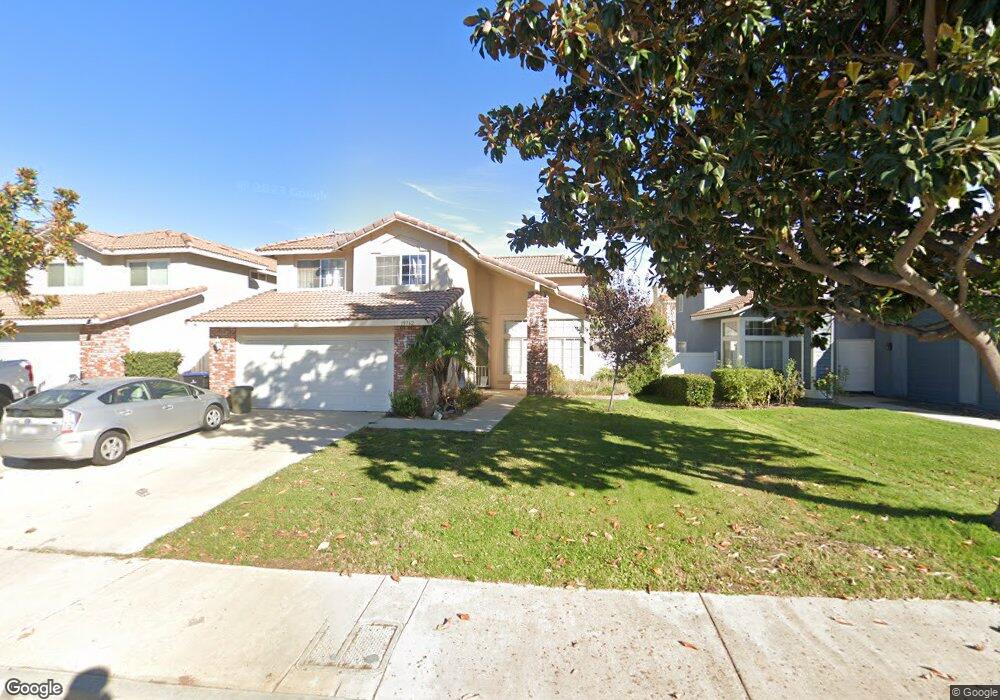
19762 Westerly Dr Riverside, CA 92508
Orangecrest NeighborhoodEstimated Value: $648,214 - $704,000
4
Beds
3
Baths
1,800
Sq Ft
$375/Sq Ft
Est. Value
About This Home
This home is located at 19762 Westerly Dr, Riverside, CA 92508 and is currently estimated at $675,804, approximately $375 per square foot. 19762 Westerly Dr is a home located in Riverside County with nearby schools including Benjamin Franklin Elementary School, Amelia Earhart Middle School, and Martin Luther King Junior High School.
Ownership History
Date
Name
Owned For
Owner Type
Purchase Details
Closed on
Jun 28, 2011
Sold by
Gregston James M and Gregston Maryhelen
Bought by
Meyer Alan Joe and Meyer Glenda Rae
Current Estimated Value
Purchase Details
Closed on
Mar 2, 1994
Sold by
Van Daele/Fieldstone Riverside Partners
Bought by
Gregston James M and Gregston Maryhelen
Home Financials for this Owner
Home Financials are based on the most recent Mortgage that was taken out on this home.
Original Mortgage
$136,732
Interest Rate
8.1%
Mortgage Type
FHA
Create a Home Valuation Report for This Property
The Home Valuation Report is an in-depth analysis detailing your home's value as well as a comparison with similar homes in the area
Home Values in the Area
Average Home Value in this Area
Purchase History
| Date | Buyer | Sale Price | Title Company |
|---|---|---|---|
| Meyer Alan Joe | $220,000 | None Available | |
| Gregston James M | $272,000 | First American Title Ins Co |
Source: Public Records
Mortgage History
| Date | Status | Borrower | Loan Amount |
|---|---|---|---|
| Previous Owner | Gregston James M | $136,732 |
Source: Public Records
Tax History
| Year | Tax Paid | Tax Assessment Tax Assessment Total Assessment is a certain percentage of the fair market value that is determined by local assessors to be the total taxable value of land and additions on the property. | Land | Improvement |
|---|---|---|---|---|
| 2025 | $3,126 | $286,256 | $89,675 | $196,581 |
| 2023 | $3,126 | $275,143 | $86,194 | $188,949 |
| 2022 | $3,055 | $269,749 | $84,504 | $185,245 |
| 2021 | $3,022 | $264,461 | $82,848 | $181,613 |
| 2020 | $2,999 | $261,750 | $81,999 | $179,751 |
| 2019 | $2,943 | $256,619 | $80,392 | $176,227 |
| 2018 | $2,887 | $251,588 | $78,816 | $172,772 |
| 2017 | $2,836 | $246,656 | $77,271 | $169,385 |
| 2016 | $2,655 | $241,820 | $75,756 | $166,064 |
| 2015 | $2,617 | $238,189 | $74,619 | $163,570 |
| 2014 | $2,674 | $233,525 | $73,158 | $160,367 |
Source: Public Records
Map
Nearby Homes
- 19911 Westerly Dr
- 19972 Windwood Cir
- 0 Apn#267-180-003 Unit CV22145370
- 0 Old Frontage Rd Unit OC25137111
- 9036 Limecrest Dr
- 19971 Westerly Dr
- 8470 Lindenhurst St
- 8634 Cabin Place
- 8449 Monique Ct
- 19689 Allenhurst St
- 9146 Rangpur Cir
- 9131 Santa Barbara Dr
- 6932 Lucia St
- 19540 Chinotto Ln
- 8564 Mill Pond Place
- 19435 Fortunello Ave
- 8720 Coyote Bush Rd
- 20329 Red Poppy Ln
- 8345 Carriage Ct
- 19320 Totem Ct
- 19764 Westerly Dr
- 19758 Westerly Dr
- 19770 Westerly Dr
- 19754 Westerly Dr
- 8741 Northstar Dr
- 8731 Northstar Dr
- 8751 Northstar Dr
- 8721 Northstar Dr
- 19774 Westerly Dr
- 19746 Westerly Dr
- 8761 Northstar Dr
- 19755 Westerly Dr
- 19759 Westerly Dr
- 19751 Westerly Dr
- 19761 Westerly Dr
- 8711 Northstar Dr
- 19742 Westerly Dr
- 19778 Westerly Dr
- 19765 Westerly Dr
- 8781 Northstar Dr
Your Personal Tour Guide
Ask me questions while you tour the home.