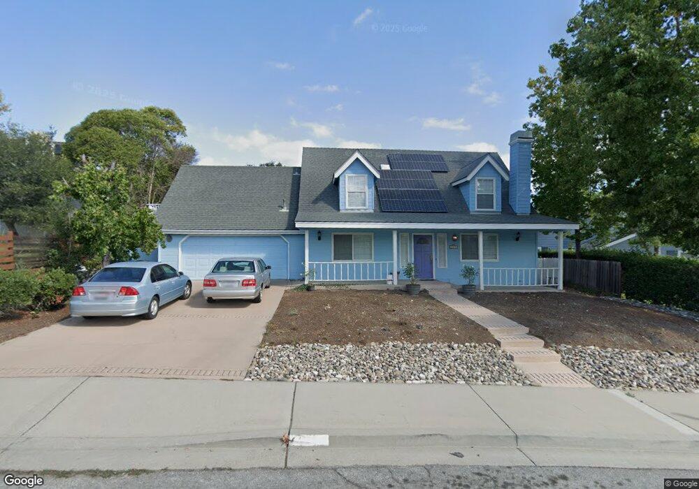
1979 Honey Locust Ct Solvang, CA 93463
Estimated Value: $1,153,473 - $1,414,000
3
Beds
2
Baths
2,060
Sq Ft
$619/Sq Ft
Est. Value
About This Home
This home is located at 1979 Honey Locust Ct, Solvang, CA 93463 and is currently estimated at $1,274,368, approximately $618 per square foot. 1979 Honey Locust Ct is a home located in Santa Barbara County with nearby schools including Solvang Elementary School, Santa Ynez Valley Union High School, and Santa Ynez Valley Charter School.
Ownership History
Date
Name
Owned For
Owner Type
Purchase Details
Closed on
May 25, 2005
Sold by
Lockwood Childs Ronald N and Lockwood Childs Stephanie
Bought by
Lockwood Childs Ii Ronald N and Lockwood Childs Stephanie
Current Estimated Value
Home Financials for this Owner
Home Financials are based on the most recent Mortgage that was taken out on this home.
Original Mortgage
$232,150
Interest Rate
5.74%
Mortgage Type
New Conventional
Purchase Details
Closed on
Oct 26, 1999
Sold by
Allana Bartilet
Bought by
Childs Ii Ronald N and Lockwood Stephanie
Home Financials for this Owner
Home Financials are based on the most recent Mortgage that was taken out on this home.
Original Mortgage
$276,000
Interest Rate
7.25%
Purchase Details
Closed on
Oct 12, 1994
Sold by
Bodenhammer Roseanna
Bought by
Bartilet Allana
Create a Home Valuation Report for This Property
The Home Valuation Report is an in-depth analysis detailing your home's value as well as a comparison with similar homes in the area
Home Values in the Area
Average Home Value in this Area
Purchase History
| Date | Buyer | Sale Price | Title Company |
|---|---|---|---|
| Lockwood Childs Ii Ronald N | -- | Orange Coast Title | |
| Childs Ii Ronald N | $345,000 | Chicago Title Co | |
| Bartilet Allana | -- | -- |
Source: Public Records
Mortgage History
| Date | Status | Borrower | Loan Amount |
|---|---|---|---|
| Closed | Lockwood Childs Ii Ronald N | $232,150 | |
| Closed | Childs Ii Ronald N | $276,000 |
Source: Public Records
Tax History Compared to Growth
Tax History
| Year | Tax Paid | Tax Assessment Tax Assessment Total Assessment is a certain percentage of the fair market value that is determined by local assessors to be the total taxable value of land and additions on the property. | Land | Improvement |
|---|---|---|---|---|
| 2025 | $5,559 | $530,234 | $245,906 | $284,328 |
| 2023 | $5,559 | $509,646 | $236,358 | $273,288 |
| 2022 | $5,375 | $499,654 | $231,724 | $267,930 |
| 2021 | $5,289 | $489,858 | $227,181 | $262,677 |
| 2020 | $5,210 | $484,836 | $224,852 | $259,984 |
| 2019 | $5,105 | $475,331 | $220,444 | $254,887 |
| 2018 | $5,020 | $466,012 | $216,122 | $249,890 |
| 2017 | $4,935 | $456,876 | $211,885 | $244,991 |
| 2016 | $4,765 | $447,919 | $207,731 | $240,188 |
| 2014 | $4,483 | $432,550 | $200,603 | $231,947 |
Source: Public Records
Map
Nearby Homes
- 0 Old Mill Rd
- 1995 Viborg Rd
- 750 Hillside Dr
- 740 Alisal Rd
- 2111 Village Ln
- 793 Alisal Rd
- 1682 Eucalyptus Dr Unit B
- 2210 Hill Haven Rd
- 1665 Laurel Ave
- 1662 Eucalyptus Dr
- 1676 Maple Ave Unit 4
- 851 Adobe Creek Rd
- 1544-1546 Oak St
- 644 Chalk Hill Rd
- 226 Valhalla Dr
- 1546 Oak St
- 224 Valhalla Dr
- 218 Valhalla Dr
- 1975 Honey Locust Ct
- 1983 Old Mission Dr
- 1978 Honey Locust Ct
- 1971 Honey Locust Ct
- 1976 Honey Locust Crt
- 1976 Honey Locust Ct
- 1972 Honey Locust Ct
- 1915 Old Mission Dr
- 601 Aqueduct Way Unit 30
- 1907 Old Mission Dr
- 1980 Old Mission
- 1980 Old Mission Dr Unit C
- 1980 Old Mission Dr
- 1913 Old Mission Dr
- 1909 Old Mission Dr
- 1992 Old Mission Dr Unit 102
- 610 Aqueduct Way Unit 32
- 604 Hillside Dr
- 605 Aqueduct Way Unit 29
- 1905 Old Mission Dr