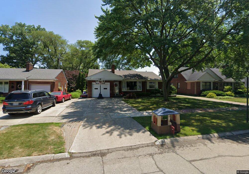
19796 Ida Ln E Grosse Pointe Woods, MI 48236
Estimated Value: $284,000 - $345,000
3
Beds
2
Baths
1,798
Sq Ft
$183/Sq Ft
Est. Value
About This Home
This home is located at 19796 Ida Ln E, Grosse Pointe Woods, MI 48236 and is currently estimated at $328,880, approximately $182 per square foot. 19796 Ida Ln E is a home located in Wayne County with nearby schools including John Monteith Elementary School, Brownell Middle School, and Grosse Pointe North High School.
Ownership History
Date
Name
Owned For
Owner Type
Purchase Details
Closed on
Feb 27, 2006
Sold by
Kappaz Pauline M
Bought by
Fennell Laura E
Current Estimated Value
Purchase Details
Closed on
Jul 1, 2003
Sold by
Kappaz Pauline M and Mushro Lawrence
Bought by
Kappaz Pauline M and Pauline M Kappaz Revocable Living Trust
Create a Home Valuation Report for This Property
The Home Valuation Report is an in-depth analysis detailing your home's value as well as a comparison with similar homes in the area
Home Values in the Area
Average Home Value in this Area
Purchase History
| Date | Buyer | Sale Price | Title Company |
|---|---|---|---|
| Fennell Laura E | $185,000 | Greco | |
| Kappaz Pauline M | -- | -- |
Source: Public Records
Tax History
| Year | Tax Paid | Tax Assessment Tax Assessment Total Assessment is a certain percentage of the fair market value that is determined by local assessors to be the total taxable value of land and additions on the property. | Land | Improvement |
|---|---|---|---|---|
| 2025 | $3,357 | $164,400 | $0 | $0 |
| 2024 | $3,342 | $151,300 | $0 | $0 |
| 2023 | $3,213 | $142,300 | $0 | $0 |
| 2022 | $5,033 | $130,500 | $0 | $0 |
| 2021 | $4,798 | $120,900 | $0 | $0 |
| 2020 | $4,940 | $116,400 | $0 | $0 |
| 2019 | $2,925 | $110,300 | $0 | $0 |
| 2018 | $2,875 | $102,700 | $0 | $0 |
| 2017 | $3,340 | $97,100 | $0 | $0 |
| 2016 | $4,554 | $87,600 | $0 | $0 |
| 2015 | $7,894 | $80,200 | $0 | $0 |
| 2013 | $7,910 | $80,700 | $0 | $0 |
| 2012 | -- | $85,500 | $20,900 | $64,600 |
Source: Public Records
Map
Nearby Homes
- 489 Chalfonte Ave
- 19934 E William Ct
- 20114 Fairway Dr
- 19982 W Doyle Place
- 1744 Huntington Blvd
- 1776 Manchester Blvd
- 1061 N Oxford Rd
- 19806 Wedgewood Dr
- 715 Pear Tree Ln
- 680 Pear Tree Ln
- 1912 Littlestone Rd
- 646 Peachtree Ln
- 19299 Raymond St
- 1557 Lochmoor Blvd
- 963 Lochmoor Blvd
- 419 Maison Rd
- 21602 Newcastle Rd
- 21440 Prestwick Ave
- 535 Ballantyne Rd
- 5228 Hillcrest St
Your Personal Tour Guide
Ask me questions while you tour the home.