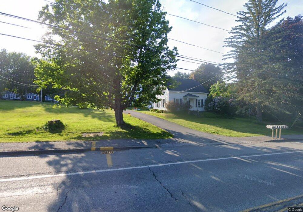
198 Main Rd S Hampden, ME 04444
Estimated Value: $306,000 - $448,000
--
Bed
--
Bath
2,900
Sq Ft
$130/Sq Ft
Est. Value
About This Home
This home is located at 198 Main Rd S, Hampden, ME 04444 and is currently estimated at $377,000, approximately $130 per square foot. 198 Main Rd S is a home located in Penobscot County.
Ownership History
Date
Name
Owned For
Owner Type
Purchase Details
Closed on
May 12, 2021
Sold by
Woodside Sharry A
Bought by
Canoe Creek Llc
Current Estimated Value
Home Financials for this Owner
Home Financials are based on the most recent Mortgage that was taken out on this home.
Original Mortgage
$480,800
Outstanding Balance
$435,725
Interest Rate
3.1%
Mortgage Type
Purchase Money Mortgage
Estimated Equity
-$58,725
Create a Home Valuation Report for This Property
The Home Valuation Report is an in-depth analysis detailing your home's value as well as a comparison with similar homes in the area
Home Values in the Area
Average Home Value in this Area
Purchase History
| Date | Buyer | Sale Price | Title Company |
|---|---|---|---|
| Canoe Creek Llc | -- | None Available |
Source: Public Records
Mortgage History
| Date | Status | Borrower | Loan Amount |
|---|---|---|---|
| Open | Canoe Creek Llc | $480,800 |
Source: Public Records
Tax History Compared to Growth
Tax History
| Year | Tax Paid | Tax Assessment Tax Assessment Total Assessment is a certain percentage of the fair market value that is determined by local assessors to be the total taxable value of land and additions on the property. | Land | Improvement |
|---|---|---|---|---|
| 2024 | $5,180 | $331,000 | $152,200 | $178,800 |
| 2023 | $5,228 | $271,600 | $124,900 | $146,700 |
| 2022 | $4,920 | $237,700 | $109,300 | $128,400 |
| 2021 | $4,734 | $228,700 | $109,300 | $119,400 |
| 2020 | $4,665 | $228,700 | $109,300 | $119,400 |
| 2019 | $4,576 | $224,300 | $106,100 | $118,200 |
| 2018 | $4,396 | $224,300 | $106,100 | $118,200 |
| 2017 | $4,127 | $224,300 | $106,100 | $118,200 |
| 2016 | $4,077 | $224,000 | $106,000 | $118,000 |
| 2015 | $3,920 | $224,000 | $106,000 | $118,000 |
| 2014 | $3,925 | $224,300 | $106,100 | $118,200 |
| 2013 | $3,735 | $224,300 | $106,100 | $118,200 |
Source: Public Records
Map
Nearby Homes
- 238 Main Rd S
- 63 Pleasant St
- 93 Hopkins Rd
- 48 & 50 Highland Ridge Dr
- 22 & 24 Highland Ridge Dr
- 55 & 57 Highland Ridge Dr
- 51 & 53 Highland Ridge Dr
- 16 & 18 Highland Ridge Dr
- 35 Highland Ridge Dr Unit 28
- 10 Orient Ave
- 342 Main Rd S
- 66 Foster Ave
- 29 Foster Ave
- 420 Main Rd S
- 69 Cottage St
- 8 Clark Cir
- 128 Mayo Rd Unit D
- 12 Rowell Rd
- 18 Canoe Club Rd
- 135 Mayo Rd Unit G
- 194 Main Rd S
- 188 Main Rd S
- 201 Main Rd S
- 197 Main Rd S
- 208 Main Rd S
- 209 Main Rd S
- 189 Main Rd S
- 213 Main Rd S
- 170 Main Rd S
- 178 Main Rd S
- 222 Main Rd S
- 181 Main Rd S
- 168 Main Rd S
- 216 Main Rd S
- 166 Main Rd S
- Lot 6 Rt 1a (Honey Hill Estates)
- 236 Main Rd S
- Lot 7 Rt 1a (Honey Hill Estates)
- Lot 12 Rt 1a (Honey Hill Estates)
- Lot 8 Rt 1a (Honey Hill Estates)