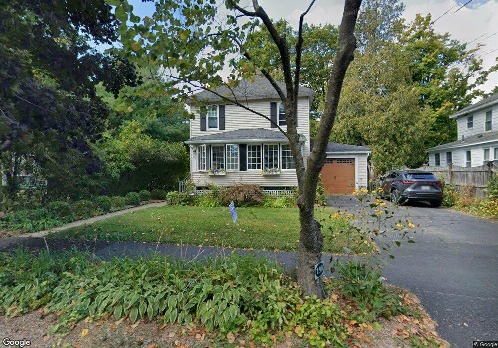
198 N Maple St Florence, MA 01062
Florence NeighborhoodEstimated Value: $538,000 - $576,000
3
Beds
1
Bath
1,634
Sq Ft
$339/Sq Ft
Est. Value
About This Home
This home is located at 198 N Maple St, Florence, MA 01062 and is currently estimated at $554,733, approximately $339 per square foot. 198 N Maple St is a home located in Hampshire County with nearby schools including Northampton High School, The Montessori School of Northampton, and Lander Grinspoon Academy.
Ownership History
Date
Name
Owned For
Owner Type
Purchase Details
Closed on
Oct 6, 2015
Sold by
Mckeever Roxanna P
Bought by
Mckeever James P
Current Estimated Value
Purchase Details
Closed on
Jul 27, 2012
Sold by
Mckeever James P
Bought by
Mckeever James P and Mckeever Roxanna P
Purchase Details
Closed on
Dec 21, 1992
Sold by
Hirschkorn Mark A
Bought by
Mckeever James P and Thaman Jamie Nan
Create a Home Valuation Report for This Property
The Home Valuation Report is an in-depth analysis detailing your home's value as well as a comparison with similar homes in the area
Home Values in the Area
Average Home Value in this Area
Purchase History
| Date | Buyer | Sale Price | Title Company |
|---|---|---|---|
| Mckeever James P | -- | -- | |
| Mckeever James P | -- | -- | |
| Mckeever James P | $118,000 | -- |
Source: Public Records
Mortgage History
| Date | Status | Borrower | Loan Amount |
|---|---|---|---|
| Previous Owner | Mckeever James P | $90,000 | |
| Previous Owner | Mckeever James P | $103,000 | |
| Previous Owner | Mckeever James P | $20,000 | |
| Previous Owner | Mckeever James P | $106,800 |
Source: Public Records
Tax History Compared to Growth
Tax History
| Year | Tax Paid | Tax Assessment Tax Assessment Total Assessment is a certain percentage of the fair market value that is determined by local assessors to be the total taxable value of land and additions on the property. | Land | Improvement |
|---|---|---|---|---|
| 2025 | $7,135 | $512,200 | $149,200 | $363,000 |
| 2024 | $6,753 | $444,600 | $130,200 | $314,400 |
| 2023 | $6,100 | $385,100 | $118,300 | $266,800 |
| 2022 | $5,700 | $318,600 | $110,600 | $208,000 |
| 2021 | $4,853 | $279,400 | $105,200 | $174,200 |
| 2020 | $4,694 | $279,400 | $105,200 | $174,200 |
| 2019 | $4,447 | $256,000 | $105,200 | $150,800 |
| 2018 | $4,337 | $254,500 | $105,200 | $149,300 |
| 2017 | $4,248 | $254,500 | $105,200 | $149,300 |
| 2016 | $4,016 | $248,500 | $105,200 | $143,300 |
| 2015 | $3,866 | $244,700 | $113,300 | $131,400 |
| 2014 | $3,766 | $244,700 | $113,300 | $131,400 |
Source: Public Records
Map
Nearby Homes
- 84 N Main St
- 76 Maple St
- 67 Park St Unit A
- 67 Park St Unit B
- 67 Park St Unit D
- 152 S Main St Unit 8
- 152 S Main St Unit 4
- 225 Nonotuck St Unit C
- 37 Landy Ave
- 36 Landy Ave
- 384 Spring St
- 0 Terrace Ln
- 51 1/2 Hatfield St Unit 6
- 107 Front St
- 76 Cooke Ave
- 0 Haydenville Rd
- 48 Evergreen Rd Unit 306
- 63 Riverside Dr
- 44 Evergreen Rd Unit 302
- 11 Norwood Ave