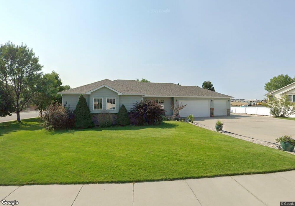
1980 Green Briar Rd Billings, MT 59105
Billings Heights NeighborhoodEstimated Value: $488,173 - $565,000
6
Beds
3
Baths
1,532
Sq Ft
$341/Sq Ft
Est. Value
About This Home
This home is located at 1980 Green Briar Rd, Billings, MT 59105 and is currently estimated at $523,043, approximately $341 per square foot. 1980 Green Briar Rd is a home located in Yellowstone County with nearby schools including Sandstone School, Castle Rock Junior High School, and Skyview High School.
Ownership History
Date
Name
Owned For
Owner Type
Purchase Details
Closed on
May 22, 2009
Sold by
Brookfield Global Relocation Services Ll
Bought by
Nisbet Robert B and Nisbet Carolee J
Current Estimated Value
Home Financials for this Owner
Home Financials are based on the most recent Mortgage that was taken out on this home.
Original Mortgage
$150,000
Outstanding Balance
$94,620
Interest Rate
4.82%
Mortgage Type
Purchase Money Mortgage
Estimated Equity
$428,423
Create a Home Valuation Report for This Property
The Home Valuation Report is an in-depth analysis detailing your home's value as well as a comparison with similar homes in the area
Home Values in the Area
Average Home Value in this Area
Purchase History
| Date | Buyer | Sale Price | Title Company |
|---|---|---|---|
| Nisbet Robert B | -- | None Available |
Source: Public Records
Mortgage History
| Date | Status | Borrower | Loan Amount |
|---|---|---|---|
| Open | Nisbet Robert B | $150,000 |
Source: Public Records
Tax History Compared to Growth
Tax History
| Year | Tax Paid | Tax Assessment Tax Assessment Total Assessment is a certain percentage of the fair market value that is determined by local assessors to be the total taxable value of land and additions on the property. | Land | Improvement |
|---|---|---|---|---|
| 2025 | $4,518 | $552,300 | $75,040 | $477,260 |
| 2024 | $4,518 | $462,700 | $66,182 | $396,518 |
| 2023 | $4,533 | $462,700 | $66,182 | $396,518 |
| 2022 | $3,410 | $361,200 | $0 | $0 |
| 2021 | $3,819 | $361,200 | $0 | $0 |
| 2020 | $4,009 | $365,500 | $0 | $0 |
| 2019 | $3,825 | $365,500 | $0 | $0 |
| 2018 | $3,502 | $326,500 | $0 | $0 |
| 2017 | $3,402 | $326,500 | $0 | $0 |
| 2016 | $3,171 | $307,500 | $0 | $0 |
| 2015 | $3,100 | $307,500 | $0 | $0 |
| 2014 | $2,900 | $152,746 | $0 | $0 |
Source: Public Records
Map
Nearby Homes
- 2030 Gleneagles Blvd
- TBD Gleneagles Blvd
- 2032 Clubhouse Way
- 650 Pinehurst Rd
- 0 Clubhouse Way
- LOT 3 Clubhouse Way
- LOT 4 Clubhouse Way
- 1819 Gleneagles Blvd
- 2107 Morocco Dr
- 2152 Gleneagles Blvd
- 907 Presidio Ln
- 0 Greenbriar Rd
- 2043 Cypress Point
- 00
- 2236 Gleneagles Blvd
- 997 Matador Ave
- 2237 Lindero Blvd
- 2238 Lindero Blvd
- 2253 Gleneagles Blvd
- 00 Winged Foot Drive Lot 10
- 2000 Green Briar Rd
- 1981 Gleneagles Blvd
- 2000 Greenbriar Rd
- 697 Black Diamond Rd
- 720 Black Diamond Rd
- 1989 Gleneagles
- 1997 Gleneagles Blvd
- 1941 Gleneagles Blvd
- 700 Black Diamond Rd
- 698 Hillcrest Dr
- 687 Black Diamond Rd
- 2010 Green Briar Rd
- 2010 Greenbriar Rd
- 690 Black Diamond Rd
- 715 Pinehurst Rd
- 688 Hillcrest Dr
- 1984 Gleneagles Blvd
- 1980 Gleneagles Blvd
- 705 Pinehurst Rd
- 677 Black Diamond Rd