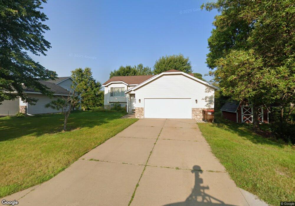
1980 Heath Ave N Saint Paul, MN 55128
Estimated Value: $411,000 - $433,747
5
Beds
2
Baths
2,063
Sq Ft
$206/Sq Ft
Est. Value
About This Home
This home is located at 1980 Heath Ave N, Saint Paul, MN 55128 and is currently estimated at $424,687, approximately $205 per square foot. 1980 Heath Ave N is a home located in Washington County with nearby schools including Eagle Point Elementary School, Skyview Community Middle School, and Tartan Senior High School.
Ownership History
Date
Name
Owned For
Owner Type
Purchase Details
Closed on
Apr 18, 2023
Sold by
Sfr Ii Borrower 2021-3 Llc
Bought by
Dire Ramadan A and Adem Amena Mohammed
Current Estimated Value
Home Financials for this Owner
Home Financials are based on the most recent Mortgage that was taken out on this home.
Original Mortgage
$321,200
Outstanding Balance
$312,273
Interest Rate
6.6%
Mortgage Type
Construction
Estimated Equity
$112,414
Purchase Details
Closed on
Apr 17, 2023
Sold by
Sfr Ii Borrower 2021-3 Llc
Bought by
Dire Ramadan and Adem Amena
Home Financials for this Owner
Home Financials are based on the most recent Mortgage that was taken out on this home.
Original Mortgage
$321,200
Outstanding Balance
$312,273
Interest Rate
6.6%
Mortgage Type
Construction
Estimated Equity
$112,414
Purchase Details
Closed on
Dec 22, 2021
Sold by
Hpa Us1 Llc
Bought by
Sfr Ii Borrower 2021-3 Llc
Purchase Details
Closed on
Jul 21, 2021
Sold by
Paulson Barbara A
Bought by
Hpa Us1 Llc
Create a Home Valuation Report for This Property
The Home Valuation Report is an in-depth analysis detailing your home's value as well as a comparison with similar homes in the area
Home Values in the Area
Average Home Value in this Area
Purchase History
| Date | Buyer | Sale Price | Title Company |
|---|---|---|---|
| Dire Ramadan A | $421,200 | None Listed On Document | |
| Dire Ramadan | $421,200 | -- | |
| Sfr Ii Borrower 2021-3 Llc | $500 | Stewart Title | |
| Hpa Us1 Llc | $375,000 | Realtech Title |
Source: Public Records
Mortgage History
| Date | Status | Borrower | Loan Amount |
|---|---|---|---|
| Open | Dire Ramadan A | $321,200 | |
| Closed | Dire Ramadan | $321,200 |
Source: Public Records
Tax History Compared to Growth
Tax History
| Year | Tax Paid | Tax Assessment Tax Assessment Total Assessment is a certain percentage of the fair market value that is determined by local assessors to be the total taxable value of land and additions on the property. | Land | Improvement |
|---|---|---|---|---|
| 2024 | $4,544 | $393,400 | $141,500 | $251,900 |
| 2023 | $4,544 | $387,500 | $136,500 | $251,000 |
| 2022 | $3,468 | $361,000 | $130,400 | $230,600 |
| 2021 | $3,358 | $294,400 | $110,000 | $184,400 |
| 2020 | $3,402 | $285,000 | $106,000 | $179,000 |
| 2019 | $3,106 | $282,100 | $101,000 | $181,100 |
| 2018 | $2,856 | $260,900 | $95,000 | $165,900 |
| 2017 | $2,864 | $238,800 | $85,000 | $153,800 |
| 2016 | $2,638 | $230,600 | $79,000 | $151,600 |
| 2015 | $2,640 | $207,600 | $70,200 | $137,400 |
| 2013 | -- | $177,600 | $58,500 | $119,100 |
Source: Public Records
Map
Nearby Homes
- 1920 Heath Ave N
- 7697 Upper 20th St N
- 2181 Helena Rd N
- 1754 Helena Rd N
- 2232 Homestead Ave N
- 1612 Helena Rd N
- 1580 Helmo Ave N Unit 1580
- 2404 Helena Ave N
- 7018 19th St N Unit 1
- 7492 Upper 24th St N
- 7061 Upper 17th St N
- 7523 15th Street Ln N
- 2569 Hayward Ave N
- 7602 26th St N
- 7634 13th St N
- 7662 13th St N Unit 1904
- 1310 Hilo Ave N
- 2001 Gresham Ave N Unit 18
- 2033 Gresham Ave N
- 2610 Hydram Ave N
- 1968 Heath Ave N
- 7501 Upper 20th St N
- 1956 Heath Ave N
- 7517 Upper 20th St N
- 1981 Heath Ave N
- 1944 Heath Ave N
- 7491 Upper 20th St N
- 1957 Heath Ave N
- 7531 Upper 20th St N
- 1932 Heath Ave N
- 1945 Heath Ave N
- 7502 Upper 20th St N
- 7508 Upper 20th St N
- 7487 Upper 20th St N
- 7516 Upper 20th St N
- 1982 Helmo Ave N
- 1982 Helena Ct
- 7494 Upper 20th St N
- 1970 Helmo Ave N
- 7545 Upper 20th St N