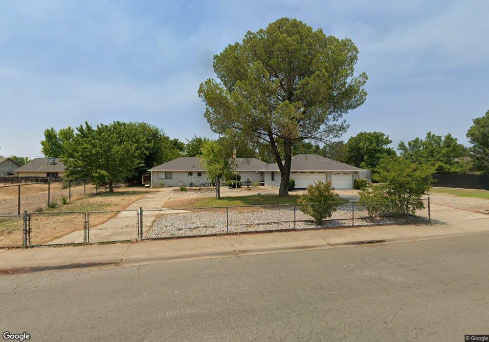
1984 Airstrip Rd Redding, CA 96003
North Shasta View NeighborhoodEstimated Value: $408,725 - $454,000
4
Beds
2
Baths
1,700
Sq Ft
$252/Sq Ft
Est. Value
About This Home
This home is located at 1984 Airstrip Rd, Redding, CA 96003 and is currently estimated at $428,431, approximately $252 per square foot. 1984 Airstrip Rd is a home located in Shasta County with nearby schools including Columbia Elementary School, Mountain View Middle School, and Foothill High School.
Ownership History
Date
Name
Owned For
Owner Type
Purchase Details
Closed on
Apr 18, 2019
Sold by
Warren Tae B
Bought by
Warren Billy John and Warren Tae Bok
Current Estimated Value
Purchase Details
Closed on
May 8, 2013
Sold by
Warren Billy
Bought by
Warren Tae B
Home Financials for this Owner
Home Financials are based on the most recent Mortgage that was taken out on this home.
Original Mortgage
$153,625
Outstanding Balance
$108,517
Interest Rate
3.41%
Mortgage Type
New Conventional
Estimated Equity
$319,914
Purchase Details
Closed on
Dec 31, 2009
Sold by
Bjw & Tbw Family Limited Partnership
Bought by
Warren Tae B
Purchase Details
Closed on
Mar 12, 2008
Sold by
Tae B Warren Family Lp
Bought by
The Bjw & Tbw Family Lp
Purchase Details
Closed on
Mar 23, 2006
Sold by
Warren Tae B
Bought by
The Tae B Warren Family Lp
Purchase Details
Closed on
Sep 1, 2005
Sold by
Warren Billy J
Bought by
Warren Tae B
Home Financials for this Owner
Home Financials are based on the most recent Mortgage that was taken out on this home.
Original Mortgage
$170,000
Interest Rate
5.76%
Mortgage Type
Fannie Mae Freddie Mac
Purchase Details
Closed on
Oct 11, 2004
Sold by
Harrison Randy L and Harrison Deborah A
Bought by
Harrison Randy L and Harrison Deborah A
Purchase Details
Closed on
Feb 23, 2000
Sold by
Balfour Paris L and Balfour Paris L
Bought by
Harrison Randy L and Harrison Deborah A
Home Financials for this Owner
Home Financials are based on the most recent Mortgage that was taken out on this home.
Original Mortgage
$79,877
Interest Rate
8.16%
Mortgage Type
FHA
Create a Home Valuation Report for This Property
The Home Valuation Report is an in-depth analysis detailing your home's value as well as a comparison with similar homes in the area
Home Values in the Area
Average Home Value in this Area
Purchase History
| Date | Buyer | Sale Price | Title Company |
|---|---|---|---|
| Warren Billy John | -- | None Available | |
| Warren Tae B | -- | Orange Coast Title | |
| Warren Tae B | -- | None Available | |
| The Bjw & Tbw Family Lp | -- | None Available | |
| The Tae B Warren Family Lp | -- | None Available | |
| Warren Tae B | -- | Fidelity Natl Title Co Of Ca | |
| Warren Tae B | $326,000 | Fidelity Natl Title Co Of Ca | |
| Harrison Randy L | -- | -- | |
| Harrison Randy L | $80,000 | Placer Title Company |
Source: Public Records
Mortgage History
| Date | Status | Borrower | Loan Amount |
|---|---|---|---|
| Open | Warren Tae B | $153,625 | |
| Previous Owner | Warren Tae B | $170,000 | |
| Previous Owner | Harrison Randy L | $79,877 | |
| Closed | Harrison Randy L | $4,800 |
Source: Public Records
Tax History
| Year | Tax Paid | Tax Assessment Tax Assessment Total Assessment is a certain percentage of the fair market value that is determined by local assessors to be the total taxable value of land and additions on the property. | Land | Improvement |
|---|---|---|---|---|
| 2025 | $4,594 | $445,350 | $122,982 | $322,368 |
| 2024 | $4,618 | $436,619 | $120,571 | $316,048 |
| 2023 | $4,618 | $428,058 | $118,207 | $309,851 |
| 2022 | $3,519 | $330,000 | $55,000 | $275,000 |
| 2021 | $3,190 | $295,000 | $55,000 | $240,000 |
| 2020 | $2,930 | $270,000 | $50,000 | $220,000 |
| 2019 | $2,706 | $250,000 | $65,000 | $185,000 |
| 2018 | $2,506 | $225,000 | $65,000 | $160,000 |
| 2017 | $2,589 | $225,000 | $65,000 | $160,000 |
| 2016 | $2,251 | $205,000 | $55,000 | $150,000 |
| 2015 | $2,195 | $200,000 | $50,000 | $150,000 |
| 2014 | $2,020 | $185,000 | $40,000 | $145,000 |
Source: Public Records
Map
Nearby Homes
- 1637 French Lace Ln
- 10033 Abernathy Ln
- 2935 Snow Fire Ct
- 2571 Erin Ln
- 2093 Victor Ave
- 2295 Chelsa Cir
- 2912 Squire Ave
- 1090 Gibralter Rd
- 10162 Harley Leighton Rd
- 2728 Jasmine Way
- 10129 Harley Leighton Rd
- 2115 Hawn Ave
- 1877 Wheeler St
- 1701 E Cypress Ave
- 1939 Cameo Ct
- 1461 Oakdale Ln
- 3072 Alta Mesa Dr
- 0 Shasta View Unit 25-1945
- 965 Willow Brook Ln
- 3035 Argyle Rd
- 2015 Charade Way
- 1974 Airstrip Rd
- 1997 Airstrip Rd
- 2029 Charade Way
- 1993 Airstrip Rd
- 1968 Airstrip Rd
- 1989 Airstrip Rd
- 1997 Charade Way
- 2041 Charade Way
- 2016 Charade Way
- 1985 Airstrip Rd
- 1962 Airstrip Rd
- 2034 Charade Way
- 2008 Charade Way
- 2022 Charade Way
- 2053 Charade Way
- 1987 Charade Way
- 2046 Charade Way
- 1981 Airstrip Rd
- 1956 Airstrip Rd
Your Personal Tour Guide
Ask me questions while you tour the home.