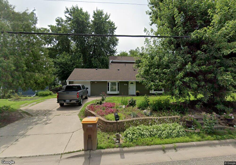
1984 County Road F E Saint Paul, MN 55110
Estimated Value: $347,060 - $388,000
3
Beds
2
Baths
1,728
Sq Ft
$213/Sq Ft
Est. Value
About This Home
This home is located at 1984 County Road F E, Saint Paul, MN 55110 and is currently estimated at $367,265, approximately $212 per square foot. 1984 County Road F E is a home located in Ramsey County with nearby schools including Lakeaires Elementary School, Sunrise Park Middle School, and Gentry Academy High.
Ownership History
Date
Name
Owned For
Owner Type
Purchase Details
Closed on
Feb 4, 2019
Sold by
Howard Swope Ryan Geoffrey
Bought by
Hunn Grant W and Hunn Petra Cristal
Current Estimated Value
Home Financials for this Owner
Home Financials are based on the most recent Mortgage that was taken out on this home.
Original Mortgage
$235,805
Outstanding Balance
$207,315
Interest Rate
4.5%
Mortgage Type
FHA
Estimated Equity
$159,950
Purchase Details
Closed on
May 17, 2013
Sold by
Swope Evelynda Leilani
Bought by
Swope Ryan Geoffrey Howard
Purchase Details
Closed on
Dec 12, 2008
Sold by
Bank Of New York Mellon
Bought by
Swope Ryan
Create a Home Valuation Report for This Property
The Home Valuation Report is an in-depth analysis detailing your home's value as well as a comparison with similar homes in the area
Home Values in the Area
Average Home Value in this Area
Purchase History
| Date | Buyer | Sale Price | Title Company |
|---|---|---|---|
| Hunn Grant W | $257,500 | Titlesmart Inc | |
| Swope Ryan Geoffrey Howard | -- | None Available | |
| Swope Ryan | $129,900 | -- |
Source: Public Records
Mortgage History
| Date | Status | Borrower | Loan Amount |
|---|---|---|---|
| Open | Hunn Grant W | $235,805 |
Source: Public Records
Tax History Compared to Growth
Tax History
| Year | Tax Paid | Tax Assessment Tax Assessment Total Assessment is a certain percentage of the fair market value that is determined by local assessors to be the total taxable value of land and additions on the property. | Land | Improvement |
|---|---|---|---|---|
| 2025 | $3,734 | $330,300 | $71,100 | $259,200 |
| 2023 | $3,734 | $290,900 | $71,100 | $219,800 |
| 2022 | $3,246 | $295,400 | $71,100 | $224,300 |
| 2021 | $3,106 | $252,900 | $71,100 | $181,800 |
| 2020 | $2,902 | $248,900 | $71,100 | $177,800 |
| 2019 | $2,028 | $206,000 | $71,100 | $134,900 |
| 2018 | $2,048 | $171,700 | $71,100 | $100,600 |
| 2017 | $2,082 | $177,400 | $75,100 | $102,300 |
| 2016 | $2,150 | $0 | $0 | $0 |
| 2015 | $2,176 | $174,600 | $70,600 | $104,000 |
| 2014 | $2,280 | $0 | $0 | $0 |
Source: Public Records
Map
Nearby Homes
- 4107 White Bear Ave N
- 4035 Highland Ave
- 4181 White Bear Ave N
- 2184 Floral Dr
- 3979 Mcknight Rd N
- 3982 Mcknight Rd N
- 1795 Cheri Ct
- 3915 Mcknight Rd N
- 3750 Van Dyke St
- 1794 Cheri Ct
- 1792 Cheri Ct
- 2075 Dorothy Ave
- 3823 Linden Ave
- 2086 Dorothy Ave
- 4012 Cranbrook Dr
- 2314 Birch St
- 3743 Kenny Ln
- 1778 Linden Cove
- 1828 Whitaker St
- 3620 Highland Ave
- 1988 County Road F E
- 1960 County Road F E
- 1960 County Road F E
- 1982 County Road F E
- 1952 County Road F E
- 1991 Nicholas Ct
- 1995 Nicholas Ct
- 1969 County Road F E
- 1994 County Road F E
- 1963 County Road F E
- 1999 Nicholas Ct
- 1942 County Road F E
- 2000 County Road F E
- 1990 Nicholas Ct
- 1981 County Road F E
- 1957 County Road F E
- 1947 County Road F E
- 1947 County Road F E
- 1940 County Road F E
- 2004 County Road F E