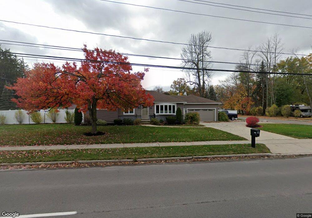
1985 Maple Rd Buffalo, NY 14221
East Amherst NeighborhoodEstimated Value: $357,928 - $412,000
3
Beds
2
Baths
1,547
Sq Ft
$247/Sq Ft
Est. Value
About This Home
This home is located at 1985 Maple Rd, Buffalo, NY 14221 and is currently estimated at $382,732, approximately $247 per square foot. 1985 Maple Rd is a home located in Erie County with nearby schools including Country Parkway Elementary School, Maple East Elementary School, and Transit Middle School.
Ownership History
Date
Name
Owned For
Owner Type
Purchase Details
Closed on
Oct 17, 2008
Sold by
Welch James C
Bought by
Campbell Russell A and Campbell Renee M
Current Estimated Value
Home Financials for this Owner
Home Financials are based on the most recent Mortgage that was taken out on this home.
Original Mortgage
$131,200
Interest Rate
5.94%
Mortgage Type
Purchase Money Mortgage
Purchase Details
Closed on
Jul 25, 2003
Sold by
Kumm Warren E
Bought by
Welch James C
Home Financials for this Owner
Home Financials are based on the most recent Mortgage that was taken out on this home.
Original Mortgage
$106,800
Interest Rate
5.27%
Mortgage Type
Purchase Money Mortgage
Create a Home Valuation Report for This Property
The Home Valuation Report is an in-depth analysis detailing your home's value as well as a comparison with similar homes in the area
Home Values in the Area
Average Home Value in this Area
Purchase History
| Date | Buyer | Sale Price | Title Company |
|---|---|---|---|
| Campbell Russell A | $164,000 | None Available | |
| Welch James C | $133,500 | Jed Carrol |
Source: Public Records
Mortgage History
| Date | Status | Borrower | Loan Amount |
|---|---|---|---|
| Closed | Campbell Russell A | $131,200 | |
| Previous Owner | Welch James C | $106,800 | |
| Previous Owner | Welch James C | $20,000 |
Source: Public Records
Tax History
| Year | Tax Paid | Tax Assessment Tax Assessment Total Assessment is a certain percentage of the fair market value that is determined by local assessors to be the total taxable value of land and additions on the property. | Land | Improvement |
|---|---|---|---|---|
| 2024 | $7,133 | $329,000 | $84,000 | $245,000 |
| 2023 | $6,075 | $172,000 | $47,400 | $124,600 |
| 2022 | $5,744 | $172,000 | $47,400 | $124,600 |
| 2021 | $5,638 | $172,000 | $47,400 | $124,600 |
| 2020 | $8,852 | $172,000 | $47,400 | $124,600 |
| 2019 | $5,370 | $172,000 | $47,400 | $124,600 |
| 2018 | $4,775 | $172,000 | $47,400 | $124,600 |
| 2017 | $2,433 | $172,000 | $47,400 | $124,600 |
| 2016 | $5,256 | $167,000 | $39,800 | $127,200 |
| 2015 | -- | $167,000 | $39,800 | $127,200 |
| 2014 | -- | $167,000 | $39,800 | $127,200 |
Source: Public Records
Map
Nearby Homes
- 363 Country Pkwy
- 434 Sprucewood Terrace
- 11 Sanctuary Ct
- 177 Promenade Ln
- 1155 Youngs Rd Unit A
- 1175 Youngs Rd Unit E
- 306 Sagewood Terrace
- 308 Patrice Terrace
- 93 Lord Byron Ln
- 1075 Youngs Rd Unit H
- 29 Gesel Ln
- 858 Klein Rd
- 1210 Youngs Rd Unit D
- 28 Bragg Ct
- 47 Stoneledge Ct
- 208 Harrogate Square
- 1240 Youngs Rd Unit C
- 141 Patton Place
- 153 Patton Place
- 12 Hampton Hill Dr
- 431 Country Pkwy
- 2005 Maple Rd
- 425 Country Pkwy
- 1959 Maple Rd
- 419 Country Pkwy
- 1990 Maple Rd
- 430 Country Pkwy
- 1980 Maple Rd
- 2000 Maple Rd
- 428 Country Pkwy
- 415 Country Pkwy
- 1970 Maple Rd
- 2025 Maple Rd
- 1955 Maple Rd
- 2010 Maple Rd
- 424 Bauman Rd
- 412 Country Pkwy
- 1948 Maple Rd
- 432 Bauman Rd
- 2020 Maple Rd
Your Personal Tour Guide
Ask me questions while you tour the home.