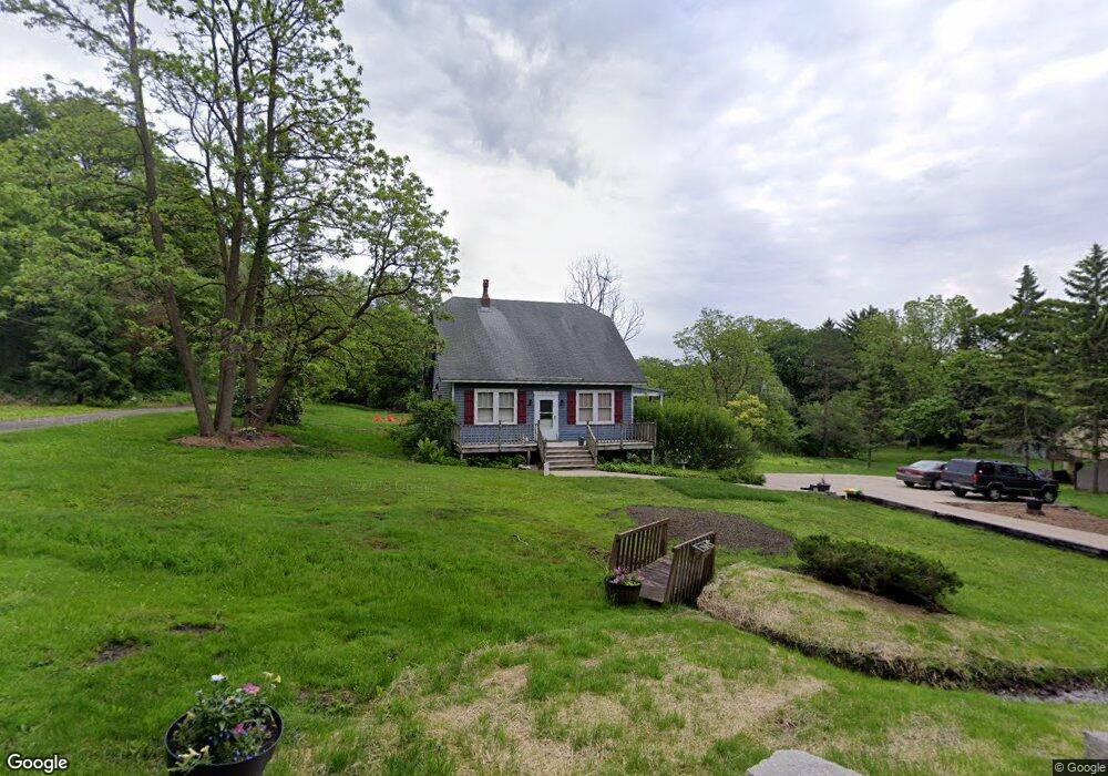
199 Mohawk Trail Algonquin, IL 60102
Merrill Algonquin Hills NeighborhoodEstimated Value: $249,165 - $310,000
2
Beds
2
Baths
1,428
Sq Ft
$196/Sq Ft
Est. Value
About This Home
This home is located at 199 Mohawk Trail, Algonquin, IL 60102 and is currently estimated at $280,541, approximately $196 per square foot. 199 Mohawk Trail is a home located in McHenry County with nearby schools including Eastview Elementary School, Algonquin Middle School, and Dundee-Crown High School.
Ownership History
Date
Name
Owned For
Owner Type
Purchase Details
Closed on
Apr 20, 2001
Sold by
Grant Francis A and Grant Catherine S
Bought by
Grant Francis A and Grant Catherine S
Current Estimated Value
Home Financials for this Owner
Home Financials are based on the most recent Mortgage that was taken out on this home.
Original Mortgage
$128,700
Outstanding Balance
$47,479
Interest Rate
7.03%
Estimated Equity
$233,062
Purchase Details
Closed on
May 31, 1994
Sold by
Algonquin State Bank
Bought by
Grant Francis A and Sullivan Catherine A
Home Financials for this Owner
Home Financials are based on the most recent Mortgage that was taken out on this home.
Original Mortgage
$124,949
Interest Rate
8.45%
Mortgage Type
FHA
Create a Home Valuation Report for This Property
The Home Valuation Report is an in-depth analysis detailing your home's value as well as a comparison with similar homes in the area
Home Values in the Area
Average Home Value in this Area
Purchase History
| Date | Buyer | Sale Price | Title Company |
|---|---|---|---|
| Grant Francis A | -- | Ticor Title | |
| Grant Francis A | $136,000 | -- |
Source: Public Records
Mortgage History
| Date | Status | Borrower | Loan Amount |
|---|---|---|---|
| Open | Grant Francis A | $128,700 | |
| Closed | Grant Francis A | $124,949 |
Source: Public Records
Tax History
| Year | Tax Paid | Tax Assessment Tax Assessment Total Assessment is a certain percentage of the fair market value that is determined by local assessors to be the total taxable value of land and additions on the property. | Land | Improvement |
|---|---|---|---|---|
| 2024 | $4,993 | $76,058 | $20,646 | $55,412 |
| 2023 | $4,709 | $68,024 | $18,465 | $49,559 |
| 2022 | $3,641 | $51,339 | $14,379 | $36,960 |
| 2021 | $3,475 | $47,829 | $13,396 | $34,433 |
| 2020 | $3,375 | $46,136 | $12,922 | $33,214 |
| 2019 | $3,286 | $44,158 | $12,368 | $31,790 |
| 2018 | $3,112 | $40,792 | $11,425 | $29,367 |
| 2017 | $3,028 | $38,429 | $10,763 | $27,666 |
| 2016 | $2,962 | $36,043 | $10,095 | $25,948 |
| 2013 | -- | $36,690 | $9,417 | $27,273 |
Source: Public Records
Map
Nearby Homes
- 1439 Lowe Dr
- 1302 Cary Rd
- 9 Echowood Dr
- lot 021 Route 31 Hwy
- 1625 Powder Horn Dr
- 953 Old Oak Cir
- 1730 Tanglewood Dr
- 1188 E Algonquin Rd
- 9416 3rd Ave
- 600 E Algonquin Rd
- 0 River Dr N Unit MRD12473279
- 108 La Fox Dr
- 3 Sunset Ln
- 2110 Aspen Dr
- 719 Webster St
- 1770 E Algonquin Rd
- Lot 4 b Ryan Pkwy
- 407 La Fox River Dr
- 944 Cynthia Ln
- 1782 Cumberland Pkwy
- 185 Mohawk Trail
- 1420 Pioneer Rd
- 184 Iona Terrace
- 198 Mohawk Trail
- 181 Mohawk Trail
- 209 Mohawk Trail
- 1480 Pioneer Rd
- 1480 Pioneer Rd
- 1480 Pioneer Rd
- 1480 Pioneer Rd
- 166 Mohawk Trail
- 1432 Seminole Rd
- 1438 Seminole Rd
- 1420 Seminole Rd
- 1444 Seminole Rd
- 1410 Seminole Rd
- 183 Iona Terrace
- 208 Mohawk Trail
- 190 Deerpath Rd
- 221 Mohawk Trail
Your Personal Tour Guide
Ask me questions while you tour the home.