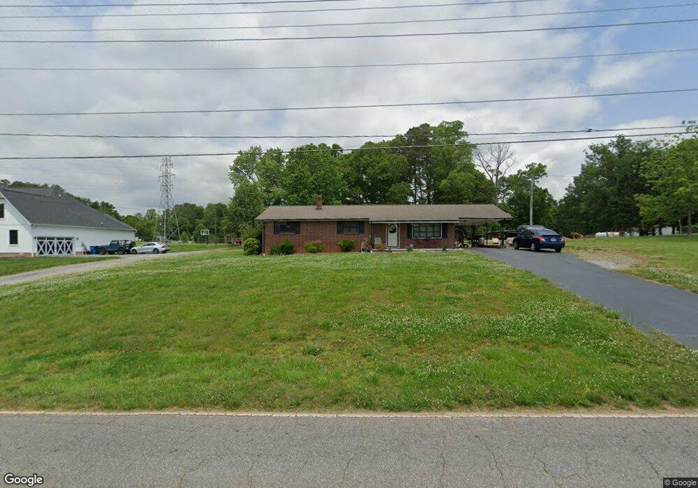
1990 Adam St Conover, NC 28613
Estimated Value: $209,045 - $244,000
3
Beds
2
Baths
1,225
Sq Ft
$189/Sq Ft
Est. Value
About This Home
This home is located at 1990 Adam St, Conover, NC 28613 and is currently estimated at $231,261, approximately $188 per square foot. 1990 Adam St is a home located in Catawba County with nearby schools including Webb A. Murray Elementary School, Saint Stephens High School, and Harry M. Arndt Middle School.
Ownership History
Date
Name
Owned For
Owner Type
Purchase Details
Closed on
Oct 31, 2011
Sold by
Johnson Joie Donald and Johnson Natalie
Bought by
Morrison John R
Current Estimated Value
Home Financials for this Owner
Home Financials are based on the most recent Mortgage that was taken out on this home.
Original Mortgage
$107,800
Outstanding Balance
$74,004
Interest Rate
4.16%
Mortgage Type
VA
Estimated Equity
$157,257
Purchase Details
Closed on
Apr 19, 2001
Purchase Details
Closed on
Feb 1, 1985
Create a Home Valuation Report for This Property
The Home Valuation Report is an in-depth analysis detailing your home's value as well as a comparison with similar homes in the area
Home Values in the Area
Average Home Value in this Area
Purchase History
| Date | Buyer | Sale Price | Title Company |
|---|---|---|---|
| Morrison John R | $108,000 | None Available | |
| -- | $90,000 | -- | |
| -- | $22,500 | -- |
Source: Public Records
Mortgage History
| Date | Status | Borrower | Loan Amount |
|---|---|---|---|
| Open | Morrison John R | $107,800 |
Source: Public Records
Tax History
| Year | Tax Paid | Tax Assessment Tax Assessment Total Assessment is a certain percentage of the fair market value that is determined by local assessors to be the total taxable value of land and additions on the property. | Land | Improvement |
|---|---|---|---|---|
| 2025 | $651 | $169,500 | $15,800 | $153,700 |
| 2024 | $651 | $169,500 | $15,800 | $153,700 |
| 2023 | $626 | $169,500 | $15,800 | $153,700 |
| 2022 | $749 | $107,800 | $15,800 | $92,000 |
| 2021 | $749 | $107,800 | $15,800 | $92,000 |
| 2020 | $749 | $107,800 | $0 | $0 |
| 2019 | $436 | $62,800 | $0 | $0 |
| 2018 | $349 | $95,200 | $15,300 | $79,900 |
| 2017 | $349 | $0 | $0 | $0 |
| 2016 | $349 | $0 | $0 | $0 |
| 2015 | $661 | $95,210 | $15,300 | $79,910 |
| 2014 | $661 | $110,200 | $14,900 | $95,300 |
Source: Public Records
Map
Nearby Homes
- 00 Spencer Rd NE
- 3048 Spencer Rd NE
- 3410 Overbrook Dr
- 3442 Lester St
- 3545 Yorkland Dr
- 1548 Castell Ln
- 1949 Colonial Ln
- 1530 29th St SE
- 1524 29th St SE
- 1212 31st St NE
- 3229 15th Ave NE
- 1276 30th Street Ln NE
- 1284 30th Street Ln NE
- 1292 30th Street Ln NE
- 1330 30th Street Ln NE
- 1308 30th Street Ln NE
- 1249 30th Street Ln NE
- 1300 30th Street Ln NE
- 1524 31st St NE
- 1316 30th Street Ln NE
- 1972 Adam St
- 1998 Adam St
- 1994 Adam St
- 3535 Overbrook Dr
- 1956 Adam St
- 2025 Terry St
- 3527 Overbrook Dr
- 1993 Adam St
- 3515 Overbrook Dr
- 0 Oleander Dr Unit 9539587
- 0 Oleander Dr Unit 9539591
- Oleander Oleander Dr Unit 17
- Oleander Oleander Dr
- 1948 Adam St
- 3562 Coral Way
- 1914 Oleander Dr
- 2030 Adam St
- 3595 Barbara Dr
- 3507 Overbrook Dr
- 2018 Terry St
Your Personal Tour Guide
Ask me questions while you tour the home.