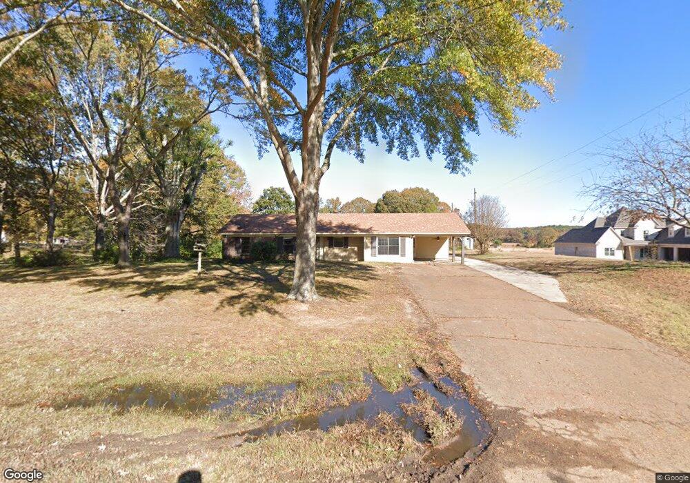
1990 Slocum Rd Hernando, MS 38632
Estimated Value: $307,519 - $492,000
3
Beds
2
Baths
1,900
Sq Ft
$198/Sq Ft
Est. Value
About This Home
This home is located at 1990 Slocum Rd, Hernando, MS 38632 and is currently estimated at $376,630, approximately $198 per square foot. 1990 Slocum Rd is a home located in DeSoto County with nearby schools including Oak Grove Central Elementary School, Hernando Elementary School, and Hernando Hills Elementary.
Ownership History
Date
Name
Owned For
Owner Type
Purchase Details
Closed on
Mar 5, 2021
Sold by
Phillips Billy Ray and Phillips Linda S
Bought by
Moore James P and Moore Alissa D
Current Estimated Value
Create a Home Valuation Report for This Property
The Home Valuation Report is an in-depth analysis detailing your home's value as well as a comparison with similar homes in the area
Home Values in the Area
Average Home Value in this Area
Purchase History
We collect this data history from publicly available records. To have your information removed, we recommend requesting removal directly through your county’s website.
| Date | Buyer | Sale Price | Title Company |
|---|---|---|---|
| Moore James P | -- | None Available |
Source: Public Records
Tax History
| Year | Tax Paid | Tax Assessment Tax Assessment Total Assessment is a certain percentage of the fair market value that is determined by local assessors to be the total taxable value of land and additions on the property. | Land | Improvement |
|---|---|---|---|---|
| 2025 | $902 | $14,398 | $3,020 | $11,378 |
| 2024 | $827 | $11,163 | $3,020 | $8,143 |
| 2023 | $827 | $11,163 | $0 | $0 |
| 2022 | $1,127 | $11,163 | $3,020 | $8,143 |
| 2021 | $1,285 | $12,723 | $4,560 | $8,163 |
| 2020 | $1,219 | $12,070 | $0 | $0 |
| 2019 | $1,219 | $12,070 | $4,560 | $7,510 |
| 2017 | $1,193 | $18,896 | $11,728 | $7,168 |
| 2016 | $1,193 | $11,728 | $4,560 | $7,168 |
| 2015 | $1,193 | $18,896 | $11,728 | $7,168 |
| 2014 | $1,193 | $11,728 | $0 | $0 |
| 2013 | $1,188 | $11,728 | $0 | $0 |
Source: Public Records
Map
Nearby Homes
- 2008 Slocum Rd
- 1724 Slocum Rd
- 2195 Breanna Ln
- 2332 Slocum Rd
- 5112 Grays Valley Dr
- 5220 Sophia Ln
- 5064 Sophia Ln
- 5042 Sophia Ln
- 0 Kimber Cove
- 5073 Sophia Ln
- 2401 Lauren Way
- 2382 Lauren Way
- 10 Plank Rd
- 2603 Plank Rd
- 9 Plank Rd
- 8 Plank Rd
- 7 Plank Rd
- 0 Ginners Lane and Plank Rd Unit 4148728
- 5823 Ginners Ln
- 5721 Ginners Ln
- 2054 Slocum Rd
- 1910 Slocum Rd
- 1923 Slocum Rd
- 1989 Slocum Rd
- 1960 Slocum Rd
- 1891 Slocum Rd
- 2092 Slocum Rd
- 2130 Slocum Rd
- 1890 Slocum Rd
- 1857 Slocum Rd
- 5453 Grays Valley Dr
- 1829 Slocum Rd
- 5307 Grays Valley Dr
- 1800 Slocum Rd
- 5181 Grays Valley Dr
- 0 60 Estates of Grays Valley
- 1823 Slocum Rd
- 5161 Grays Valley Dr
- 1782 Slocum Rd
- 5448 Grays Valley Dr
Your Personal Tour Guide
Ask me questions while you tour the home.