Estimated Value: $424,443 - $476,000
4
Beds
2
Baths
1,719
Sq Ft
$262/Sq Ft
Est. Value
About This Home
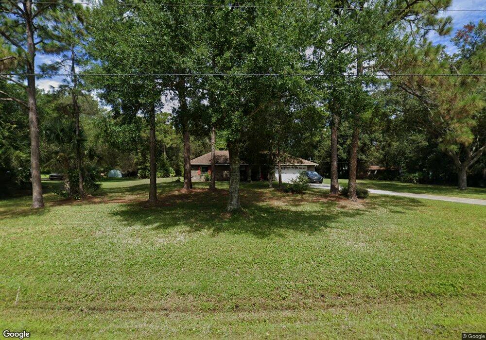
This home is located at 1991 Juniper Dr, Cocoa, FL 32926 and is currently estimated at $450,611, approximately $262 per square foot. 1991 Juniper Dr is a home located in Brevard County with nearby schools including Saturn Elementary School and Cocoa High School.
Ownership History
Date
Name
Owned For
Owner Type
Purchase Details
Closed on
Sep 10, 2024
Sold by
Malsin Willard J and Malsin Carmen R
Bought by
Willard J Malsin And Carmen R Malsin Revocabl and Malsin
Current Estimated Value
Purchase Details
Closed on
Sep 15, 2008
Sold by
Vancleave Alice and The Malsin Family Living Trust
Bought by
Malsin Willard
Purchase Details
Closed on
Jul 27, 1999
Sold by
Malsin Willard James
Bought by
Malsin Eileen Elizabeth
Purchase Details
Closed on
Mar 24, 1999
Sold by
Sternagel John Alfred and Sternagel Marcia L
Bought by
Malsin Eileen Elizabeth and Malsin Willard James
Create a Home Valuation Report for This Property
The Home Valuation Report is an in-depth analysis detailing your home's value as well as a comparison with similar homes in the area
Home Values in the Area
Average Home Value in this Area
Purchase History
| Date | Buyer | Sale Price | Title Company |
|---|---|---|---|
| Willard J Malsin And Carmen R Malsin Revocabl | $100 | None Listed On Document | |
| Malsin Willard | -- | Attorney | |
| Malsin Willard | -- | Attorney | |
| Malsin Eileen Elizabeth | -- | -- | |
| Malsin Eileen Elizabeth | -- | -- | |
| Malsin Eileen Elizabeth | $118,200 | -- |
Source: Public Records
Tax History
| Year | Tax Paid | Tax Assessment Tax Assessment Total Assessment is a certain percentage of the fair market value that is determined by local assessors to be the total taxable value of land and additions on the property. | Land | Improvement |
|---|---|---|---|---|
| 2025 | $1,927 | $146,580 | -- | -- |
| 2024 | $1,889 | $142,450 | -- | -- |
| 2023 | $1,889 | $138,310 | $0 | $0 |
| 2022 | $1,764 | $134,290 | $0 | $0 |
| 2021 | $1,783 | $130,380 | $0 | $0 |
| 2020 | $1,725 | $128,580 | $0 | $0 |
| 2019 | $1,666 | $125,690 | $0 | $0 |
| 2018 | $1,663 | $123,350 | $0 | $0 |
| 2017 | $1,667 | $120,820 | $0 | $0 |
| 2016 | $1,681 | $118,340 | $35,350 | $82,990 |
| 2015 | $1,697 | $117,520 | $35,350 | $82,170 |
| 2014 | $1,698 | $116,590 | $27,780 | $88,810 |
Source: Public Records
Map
Nearby Homes
- 5121 Dalehurst Dr
- 5101 Craig Rd
- 5070 Junedale Dr
- 4920 Shade Tree St
- 2524 Trotters Trail
- TBD Rayburn Rd
- 4651 N Friday Cir
- 4412 Talbot Blvd
- 4641 Talbot Blvd
- 1870 Britt Rd
- 4901 Talbot Blvd
- 4600 Janet Rd
- 1709 Morely Dr
- 6331 Quarterhorse Cir
- 931 Unknown
- 495 Outer Dr Unit 201
- 336 Horseshoe Bend Cir Unit 197
- 634 Outer Dr
- 5092 Talbot Blvd
- 427 Horseshoe Bend Cir Unit 151
- 1981 Juniper Dr
- 5025 Yorkshire Rd
- 2001 Juniper Dr
- 1990 Juniper Cir
- 5035 Yorkshire Rd
- 5100 Dalehurst Dr
- 1960 Juniper Dr
- 2000 Juniper Dr
- 5096 Dalehurst Dr
- 5005 Yorkshire Rd
- 5090 Dalehurst Dr
- 5045 Yorkshire Rd
- 1980 Juniper Cir
- 5020 Yorkshire Rd
- 1970 Juniper Cir
- 5030 Yorkshire Rd
- 5010 Yorkshire Rd
- 5080 Dalehurst Dr
- 5040 Yorkshire Rd
- 1950 Juniper Dr
Your Personal Tour Guide
Ask me questions while you tour the home.