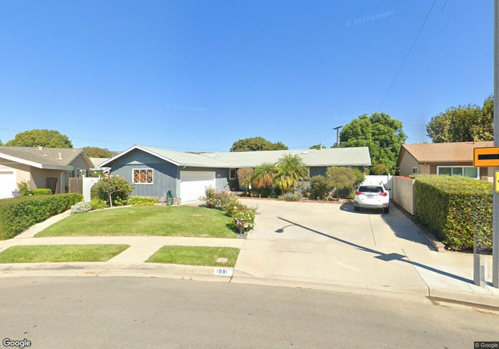
1991 Rowland Ave Camarillo, CA 93010
Estimated Value: $872,000 - $944,100
5
Beds
2
Baths
1,840
Sq Ft
$492/Sq Ft
Est. Value
About This Home
This home is located at 1991 Rowland Ave, Camarillo, CA 93010 and is currently estimated at $904,525, approximately $491 per square foot. 1991 Rowland Ave is a home located in Ventura County with nearby schools including Monte Vista Middle School, University Preparation Charter School at CSU Channel Islands, and Camarillo Academy of Progressive Education.
Ownership History
Date
Name
Owned For
Owner Type
Purchase Details
Closed on
Feb 7, 2003
Sold by
Bluechel Ted and Bluechel Carol
Bought by
Bluechel Theodore and Bluechel Carol
Current Estimated Value
Purchase Details
Closed on
Oct 23, 1997
Sold by
Henry Padron
Bought by
Bluechel Ted and Bluechel Carol
Home Financials for this Owner
Home Financials are based on the most recent Mortgage that was taken out on this home.
Original Mortgage
$154,000
Interest Rate
4.95%
Create a Home Valuation Report for This Property
The Home Valuation Report is an in-depth analysis detailing your home's value as well as a comparison with similar homes in the area
Home Values in the Area
Average Home Value in this Area
Purchase History
| Date | Buyer | Sale Price | Title Company |
|---|---|---|---|
| Bluechel Theodore | -- | -- | |
| Bluechel Ted | $224,000 | American Title Co |
Source: Public Records
Mortgage History
| Date | Status | Borrower | Loan Amount |
|---|---|---|---|
| Previous Owner | Bluechel Ted | $154,000 |
Source: Public Records
Tax History Compared to Growth
Tax History
| Year | Tax Paid | Tax Assessment Tax Assessment Total Assessment is a certain percentage of the fair market value that is determined by local assessors to be the total taxable value of land and additions on the property. | Land | Improvement |
|---|---|---|---|---|
| 2025 | $3,904 | $357,634 | $143,050 | $214,584 |
| 2024 | $3,904 | $350,622 | $140,245 | $210,377 |
| 2023 | $3,764 | $343,748 | $137,496 | $206,252 |
| 2022 | $3,750 | $337,008 | $134,800 | $202,208 |
| 2021 | $3,615 | $330,400 | $132,156 | $198,244 |
| 2020 | $3,602 | $327,013 | $130,801 | $196,212 |
| 2019 | $3,583 | $320,602 | $128,237 | $192,365 |
| 2018 | $3,517 | $314,317 | $125,723 | $188,594 |
| 2017 | $3,310 | $308,155 | $123,258 | $184,897 |
| 2016 | $3,230 | $302,114 | $120,842 | $181,272 |
| 2015 | $3,196 | $297,578 | $119,028 | $178,550 |
| 2014 | $3,121 | $291,751 | $116,698 | $175,053 |
Source: Public Records
Map
Nearby Homes
- 1265 Bedford Dr
- 2174 Wilcox St
- 2047 Euclid Ave
- 1461 Lexington Ct
- 2113 Euclid Ave
- 865 Mobil Ave
- 1709 Las Posas Rd
- 1566 Edgemont Dr
- 876 Palmer Ave
- 741 Guy Turner Dr
- 755 Guy Turner Dr
- 745 Guy Turner Dr
- 747 Guy Turner Dr
- 1519 Lyndhurst Ave
- 2201 Camilar Dr
- 2229 Camilar Dr
- 124 Reddington Ct
- 76 Nancy St
- 2280 Camilar Dr
- 2251 Camilar Dr
- 1290 Rowland Ave
- 1290 Rowland Ave
- 1987 Rowland Ave
- 1998 Edgemont Dr
- 1986 Edgemont Dr
- 1286 Rowland Ave
- 1965 Rowland Ave
- 1974 Edgemont Dr
- 1986 Rowland Ave
- 1422 Anacapa Dr
- 1315 Mobil Ave
- 1323 Mobil Ave
- 1268 Rowland Ave
- 1953 Rowland Ave
- 1297 Mobil Ave
- 1351 Mobil Ave
- 1958 Edgemont Dr
- 1269 Rowland Ave
- 1964 E Rowland Ave
- 1964 Rowland Ave