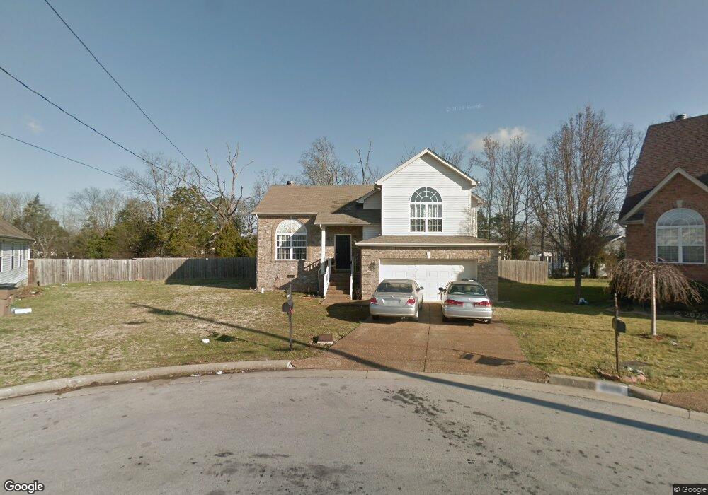
1992 Port James Cir Antioch, TN 37013
Summerfield Village NeighborhoodEstimated Value: $350,000 - $383,000
3
Beds
3
Baths
1,745
Sq Ft
$214/Sq Ft
Est. Value
About This Home
This home is located at 1992 Port James Cir, Antioch, TN 37013 and is currently estimated at $374,038, approximately $214 per square foot. 1992 Port James Cir is a home located in Davidson County with nearby schools including Mt. View Elementary School, John F. Kennedy Middle School, and Antioch High School.
Ownership History
Date
Name
Owned For
Owner Type
Purchase Details
Closed on
Dec 27, 2024
Sold by
Fawzy Ashraf
Bought by
Fawzy Ashraf and Helmy Moshera
Current Estimated Value
Purchase Details
Closed on
Apr 2, 2013
Sold by
Davis William Louis
Bought by
Secretary Of Housing & Urban Development
Purchase Details
Closed on
Nov 26, 2008
Sold by
Goodman Kenneth A and Goodman Margaret M
Bought by
Davis William L
Purchase Details
Closed on
Jul 1, 2003
Sold by
Tf Homes Llc
Bought by
Goodman Kenneth A and Goodman Margaret M
Home Financials for this Owner
Home Financials are based on the most recent Mortgage that was taken out on this home.
Original Mortgage
$150,592
Interest Rate
5.29%
Mortgage Type
FHA
Create a Home Valuation Report for This Property
The Home Valuation Report is an in-depth analysis detailing your home's value as well as a comparison with similar homes in the area
Home Values in the Area
Average Home Value in this Area
Purchase History
| Date | Buyer | Sale Price | Title Company |
|---|---|---|---|
| Fawzy Ashraf | -- | None Listed On Document | |
| Fawzy Ashraf | -- | None Listed On Document | |
| Secretary Of Housing & Urban Development | $93,600 | None Available | |
| Davis William L | $140,000 | Homeland Title Llc | |
| Goodman Kenneth A | $151,783 | Service Escrow & Title Inc |
Source: Public Records
Mortgage History
| Date | Status | Borrower | Loan Amount |
|---|---|---|---|
| Previous Owner | Goodman Kenneth A | $150,592 |
Source: Public Records
Tax History Compared to Growth
Tax History
| Year | Tax Paid | Tax Assessment Tax Assessment Total Assessment is a certain percentage of the fair market value that is determined by local assessors to be the total taxable value of land and additions on the property. | Land | Improvement |
|---|---|---|---|---|
| 2024 | $2,222 | $68,300 | $11,250 | $57,050 |
| 2023 | $2,222 | $68,300 | $11,250 | $57,050 |
| 2022 | $2,587 | $68,300 | $11,250 | $57,050 |
| 2021 | $2,246 | $68,300 | $11,250 | $57,050 |
| 2020 | $1,860 | $44,075 | $7,750 | $36,325 |
| 2019 | $1,391 | $44,075 | $7,750 | $36,325 |
Source: Public Records
Map
Nearby Homes
- 3824 Swan Ridge Dr
- 4105 Lavergne Couchville Pike
- 1141 Lakewalk Dr
- 1125 Lakewalk Dr
- 3793 Pin Hook Rd
- 3766 Pin Hook Rd
- 7431 Maroney Dr
- 7427 Maroney Dr
- 605 Big River Run
- 1120 Alcove Way
- 844 Trailside Cir
- 1188 Alcove Way
- 1413 Priestshore Bay
- 4284 Laurenwood Dr
- 0 Maxwell Rd
- 4772 Greystone St
- 4933 Deerhaven Dr
- 5536 Hamilton Cir
- 5538 Hamilton Cir
- 4214 Laurenwood Dr
- 1984 Port James Cir
- 1996 Port James Cir
- 2216 Beachfront Ave
- 2220 Beachfront Ave
- 1980 Port James Cir
- 2212 Beachfront Ave
- 1880 Lakewood Village Dr
- 1991 Port James Cir
- 2208 Beachfront Ave
- 1872 Lakewood Village Dr
- 1987 Port James Cir
- 2224 Beachfront Ave
- 1884 Lakewood Village Dr
- 1868 Lakewood Village Dr
- 1976 Port James Cir
- 2217 Beachfront Ave
- 2213 Beachfront Ave
- 1877 Lakewood Village Dr
- 1864 Lakewood Village Dr
- 1881 Lakewood Village Dr