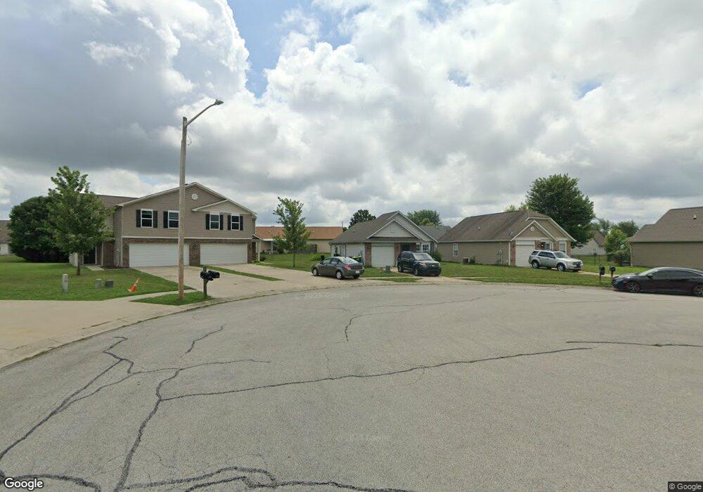
1995 Falcon Ct Franklin, IN 46131
Estimated Value: $200,723 - $227,000
3
Beds
2
Baths
1,068
Sq Ft
$199/Sq Ft
Est. Value
About This Home
This home is located at 1995 Falcon Ct, Franklin, IN 46131 and is currently estimated at $212,681, approximately $199 per square foot. 1995 Falcon Ct is a home located in Johnson County with nearby schools including Northwood Elementary School, Franklin Community Middle School, and Custer Baker Intermediate School.
Ownership History
Date
Name
Owned For
Owner Type
Purchase Details
Closed on
Apr 20, 2009
Sold by
Mortgage Electornic Registrations System
Bought by
Citibank N A
Current Estimated Value
Purchase Details
Closed on
Apr 17, 2009
Sold by
Citibank N A
Bought by
Coop Alisha J and Coop Rickey W
Purchase Details
Closed on
Feb 19, 2009
Sold by
Brown Willie
Bought by
Mortgage Electronic Registrations System
Purchase Details
Closed on
Sep 28, 2006
Sold by
Dura Builders Inc
Bought by
Brown Willie
Home Financials for this Owner
Home Financials are based on the most recent Mortgage that was taken out on this home.
Original Mortgage
$19,975
Interest Rate
6.49%
Mortgage Type
Unknown
Create a Home Valuation Report for This Property
The Home Valuation Report is an in-depth analysis detailing your home's value as well as a comparison with similar homes in the area
Home Values in the Area
Average Home Value in this Area
Purchase History
We collect this data history from publicly available records. To have your information removed, we recommend requesting removal directly through your county’s website.
| Date | Buyer | Sale Price | Title Company |
|---|---|---|---|
| Citibank N A | -- | None Available | |
| Coop Alisha J | -- | None Available | |
| Mortgage Electronic Registrations System | $68,461 | None Available | |
| Brown Willie | -- | Stewart Title Services Of In |
Source: Public Records
Mortgage History
We collect this data history from publicly available records. To have your information removed, we recommend requesting removal directly through your county’s website.
| Date | Status | Borrower | Loan Amount |
|---|---|---|---|
| Previous Owner | Brown Willie | $19,975 | |
| Previous Owner | Brown Willie | $59,925 |
Source: Public Records
Tax History
| Year | Tax Paid | Tax Assessment Tax Assessment Total Assessment is a certain percentage of the fair market value that is determined by local assessors to be the total taxable value of land and additions on the property. | Land | Improvement |
|---|---|---|---|---|
| 2025 | $4,023 | $180,400 | $13,800 | $166,600 |
| 2024 | $3,728 | $168,500 | $14,100 | $154,400 |
| 2023 | $3,527 | $158,500 | $14,100 | $144,400 |
| 2022 | $3,381 | $151,600 | $14,100 | $137,500 |
| 2021 | $2,747 | $123,200 | $9,200 | $114,000 |
| 2020 | $2,491 | $111,700 | $9,200 | $102,500 |
| 2019 | $2,379 | $106,700 | $8,000 | $98,700 |
| 2018 | $2,062 | $102,100 | $8,000 | $94,100 |
| 2017 | $1,930 | $96,000 | $8,000 | $88,000 |
| 2016 | $1,520 | $92,100 | $8,000 | $84,100 |
| 2014 | $573 | $70,100 | $8,900 | $61,200 |
| 2013 | $573 | $67,500 | $8,900 | $58,600 |
Source: Public Records
Map
Nearby Homes
- 2024 Galaxy Dr
- 1943 Acorn Dr
- 1941 Acorn Dr
- 1117 Harvest Ridge Cir
- 1098 Meadowview Ct
- 1816 Acorn Rd
- 1824 Explorer Ct
- 1630 Alder Rd
- 1245 Fiesta Dr
- 2055 Pelican Dr
- 2039 Flamingo Way
- 1225 S Aberdeen Dr
- 988 Canary Creek Dr
- 1179 N Aberdeen Dr
- 1424 Crabapple Rd
- 2488 Woodfield Blvd
- 1325 Pamela Dr
- 1462 Lochry Rd
- 2021 Younce St
- 57 14th St
- 1994 Falcon Ct
- 1992 Falcon Ct
- 1984 Falcon Ct
- 2004 Falcon Ct
- 00 Falcon Ct
- 0 Falcon Ct Unit 21052474
- Lot 63A Falcon Ct
- 1982 Falcoln Ct
- 1982 Falcon Ct
- 2012 Falcon Ct
- 2014 Falcon Ct
- 1110 Cobra Dr
- 1974 Falcon Ct
- 1993 Falcon Ct
- 1112 Cobra Dr
- 1983 Falcon Ct
- 1114 Cobra Dr
- 1975 Falcon Ct
- 1116 Cobra Dr
- 2025 Falcon Ct
Your Personal Tour Guide
Ask me questions while you tour the home.