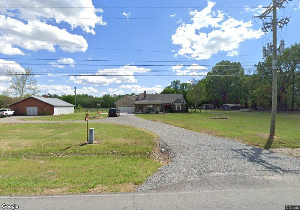
1995 Gentry Rd Lonoke, AR 72086
Estimated Value: $196,000 - $252,000
Studio
2
Baths
1,526
Sq Ft
$144/Sq Ft
Est. Value
About This Home
This home is located at 1995 Gentry Rd, Lonoke, AR 72086 and is currently estimated at $220,500, approximately $144 per square foot. 1995 Gentry Rd is a home located in Lonoke County with nearby schools including Lonoke Primary School, Lonoke Elementary School, and Lonoke Middle School.
Ownership History
Date
Name
Owned For
Owner Type
Purchase Details
Closed on
Nov 24, 2025
Sold by
James Freddy H and Beard Karyn James
Bought by
Freddy H James Revocable Trust and James
Current Estimated Value
Purchase Details
Closed on
Feb 24, 2017
Sold by
Bates Rachel Ann and Bates Charles R
Bought by
James Freddy Hugh and Beard Karyn M
Purchase Details
Closed on
Jun 11, 2007
Sold by
Perrine Lawrence J and Perrine Corene
Bought by
Bates Charles R and Bates Rachael A
Purchase Details
Closed on
Jun 7, 2007
Sold by
Perrine Lawrence J and Perrine Corene
Bought by
Bates Charles R and Bates Rachael A
Purchase Details
Closed on
Feb 1, 1979
Bought by
Perrine Lawrence
Create a Home Valuation Report for This Property
The Home Valuation Report is an in-depth analysis detailing your home's value as well as a comparison with similar homes in the area
Home Values in the Area
Average Home Value in this Area
Purchase History
| Date | Buyer | Sale Price | Title Company |
|---|---|---|---|
| Freddy H James Revocable Trust | -- | None Listed On Document | |
| James Freddy Hugh | $118,000 | Professional Land Title | |
| Bates Charles R | -- | -- | |
| Bates Charles R | -- | -- | |
| Perrine Lawrence | -- | -- |
Source: Public Records
Tax History Compared to Growth
Tax History
| Year | Tax Paid | Tax Assessment Tax Assessment Total Assessment is a certain percentage of the fair market value that is determined by local assessors to be the total taxable value of land and additions on the property. | Land | Improvement |
|---|---|---|---|---|
| 2025 | $1,172 | $31,240 | $2,160 | $29,080 |
| 2024 | $1,172 | $31,240 | $2,160 | $29,080 |
| 2023 | $1,172 | $31,240 | $2,160 | $29,080 |
| 2022 | $1,222 | $20,220 | $2,160 | $18,060 |
| 2021 | $653 | $20,220 | $2,160 | $18,060 |
| 2020 | $640 | $18,450 | $2,160 | $16,290 |
| 2019 | $605 | $18,450 | $2,160 | $16,290 |
| 2018 | $630 | $18,450 | $2,160 | $16,290 |
| 2017 | $752 | $19,610 | $2,750 | $16,860 |
| 2016 | $511 | $19,610 | $2,750 | $16,860 |
| 2015 | $752 | $21,990 | $2,750 | $19,240 |
| 2014 | $511 | $21,990 | $2,750 | $19,240 |
Source: Public Records
Map
Nearby Homes
- 305 Rifle Ln
- Lot 40 S Kittyhawk Ln
- 281 Gautney Ln
- 141 Highway 294
- 00 Allison Ln
- 00 Helen Dr
- 226 Warren Rd
- 180 Welch Rd
- 2430 S Kerr Rd
- 00 Calvary Cir
- 215 Williamson Blvd
- 235 Bradley
- 2804 Arkansas 294
- 614 Delaney Rd
- 905 Graham Rd
- 1375 Robin Rd
- 176 John Shelton Rd
- 110 Branch St
- 703 W 4th St
- 221 Adams St