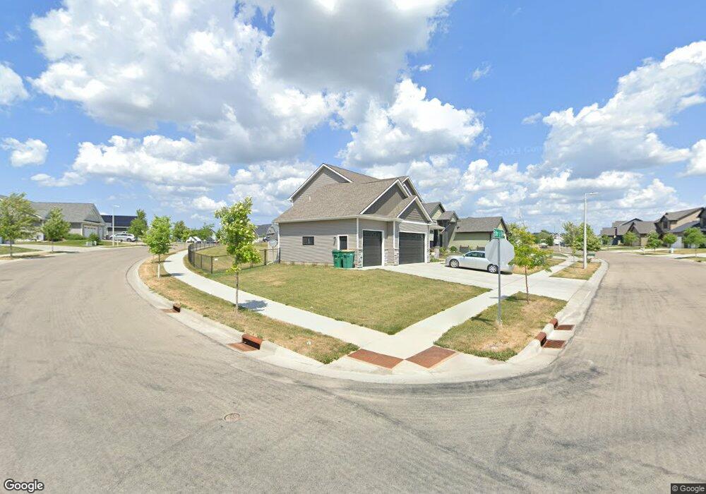
1997 Esther (L7b2) Ln SW Rochester, MN 55902
Estimated Value: $587,000 - $688,000
4
Beds
3
Baths
2,276
Sq Ft
$279/Sq Ft
Est. Value
About This Home
This home is located at 1997 Esther (L7b2) Ln SW, Rochester, MN 55902 and is currently estimated at $634,544, approximately $278 per square foot. 1997 Esther (L7b2) Ln SW is a home located in Olmsted County with nearby schools including Bamber Valley Elementary School, Willow Creek Middle School, and Mayo Senior High School.
Ownership History
Date
Name
Owned For
Owner Type
Purchase Details
Closed on
Aug 3, 2020
Sold by
Norrie Nate and Dunbar Debra
Bought by
Hill Colton C and Hill Emily N
Current Estimated Value
Home Financials for this Owner
Home Financials are based on the most recent Mortgage that was taken out on this home.
Original Mortgage
$373,150
Outstanding Balance
$331,621
Interest Rate
3.1%
Mortgage Type
New Conventional
Estimated Equity
$302,923
Purchase Details
Closed on
Feb 25, 2019
Sold by
Norrie Nate
Bought by
Borrie Nate and Dunbar Debra
Home Financials for this Owner
Home Financials are based on the most recent Mortgage that was taken out on this home.
Original Mortgage
$310,000
Interest Rate
4.12%
Mortgage Type
Adjustable Rate Mortgage/ARM
Purchase Details
Closed on
Jul 31, 2018
Sold by
Gp Devleopment Inc
Bought by
Norrie Nate
Create a Home Valuation Report for This Property
The Home Valuation Report is an in-depth analysis detailing your home's value as well as a comparison with similar homes in the area
Home Values in the Area
Average Home Value in this Area
Purchase History
| Date | Buyer | Sale Price | Title Company |
|---|---|---|---|
| Hill Colton C | $439,000 | None Available | |
| Borrie Nate | $500 | None Available | |
| Norrie Nate | $58,000 | Title Services Inc |
Source: Public Records
Mortgage History
| Date | Status | Borrower | Loan Amount |
|---|---|---|---|
| Open | Hill Colton C | $373,150 | |
| Previous Owner | Borrie Nate | $310,000 |
Source: Public Records
Tax History Compared to Growth
Tax History
| Year | Tax Paid | Tax Assessment Tax Assessment Total Assessment is a certain percentage of the fair market value that is determined by local assessors to be the total taxable value of land and additions on the property. | Land | Improvement |
|---|---|---|---|---|
| 2024 | $7,472 | $524,800 | $75,000 | $449,800 |
| 2023 | $6,682 | $525,200 | $75,000 | $450,200 |
| 2022 | $5,690 | $479,000 | $75,000 | $404,000 |
| 2021 | $5,268 | $413,600 | $50,000 | $363,600 |
| 2020 | $4,206 | $382,500 | $50,000 | $332,500 |
| 2019 | $412 | $292,900 | $50,000 | $242,900 |
| 2018 | $219 | $50,000 | $50,000 | $0 |
| 2017 | $190 | $50,000 | $50,000 | $0 |
| 2016 | $54 | $10,800 | $10,800 | $0 |
| 2015 | -- | $4,300 | $4,300 | $0 |
Source: Public Records
Map
Nearby Homes
- 2087 Thea Ln SW
- 1962 Fieldstone Rd SW
- 2214 Weston Place SW
- 3479 Hart Ln SW
- 3440 18th Ave SW
- 2250 Galileo Place SW
- 1608 Greystone Ln SW
- 3039 Lady Slipper Ln SW
- 1315 Wicklow Ln SW
- 1312 Wicklow Ln SW
- 2285 Orion St SW
- 2333 Orion St SW
- 1402 36th St SW
- 2377 Starburst Dr SW
- 3831 Halling Place SW
- 1412 28th St SW
- 2431 Phoenix Rd SW
- 2326 Phoenix Rd SW
- 2467 Phoenix Rd SW
- 3726 11th Ave SW
- xxxx Woodstone (L2b4) Dr SW
- 1997 Esther Ln SW
- 1320 Woodstone Dr SW
- 1998 Esther (L26b2) Ln SW
- xxxx Woodstone (L3b4) Dr SW
- 1986 Esther (L25b2) Ln SW
- 1983 Esther (L8b2) Ln SW
- 1983 Esther Ln SW
- 1998 Esther Ln SW
- 3247 Woodstone Dr SW
- xxxx Esther (L9b2) Ln SW
- 2041 Thea Ln SW
- 2016 Thea (L1b3) Ln SW
- 1968 Esther (L24b2) Ln SW
- 2080 Thea Ln SW
- 1986 Esther Ln SW
- 1965 Esther Ln SW
- 2034 Thea Ln SW
- 2034 Thea (L2b3) Ln SW
- 1950 Esther (L23b2) Ln SW