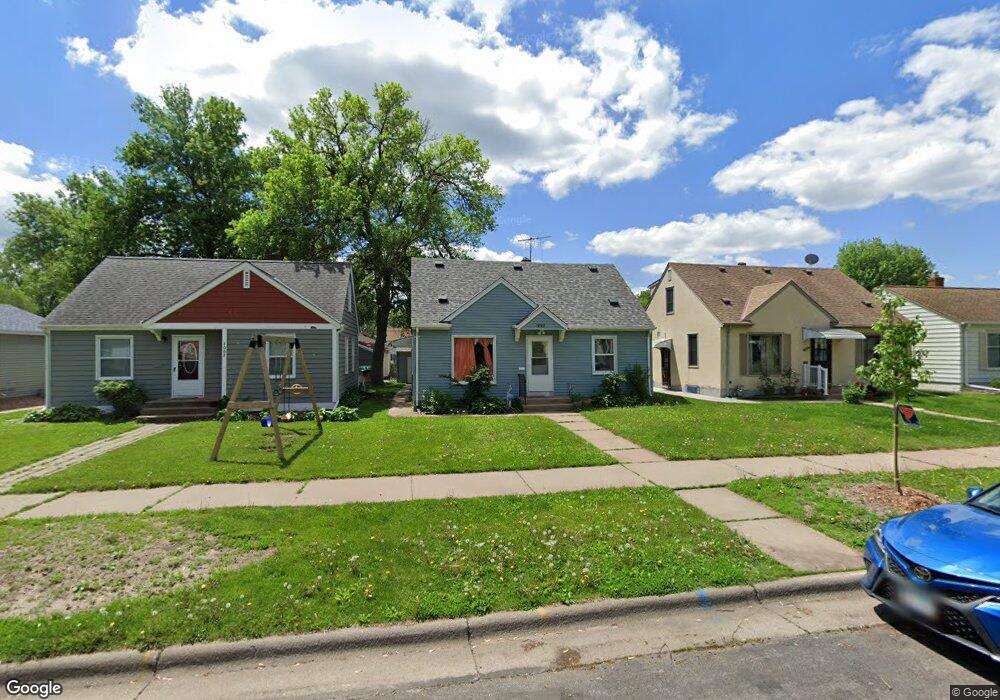
1998 Hawthorne Ave E Saint Paul, MN 55119
Southern Hayden Heights NeighborhoodEstimated Value: $266,000 - $298,000
4
Beds
2
Baths
1,480
Sq Ft
$191/Sq Ft
Est. Value
About This Home
This home is located at 1998 Hawthorne Ave E, Saint Paul, MN 55119 and is currently estimated at $282,841, approximately $191 per square foot. 1998 Hawthorne Ave E is a home located in Ramsey County with nearby schools including The Heights Community School, Txuj Ci HMong Language and Culture Upper Campus, and Johnson Senior High School.
Ownership History
Date
Name
Owned For
Owner Type
Purchase Details
Closed on
Apr 25, 2022
Sold by
Lee Juavah and Lee Alizabeth
Bought by
Nyo Aung and Jwey Aye
Current Estimated Value
Home Financials for this Owner
Home Financials are based on the most recent Mortgage that was taken out on this home.
Original Mortgage
$274,025
Outstanding Balance
$256,287
Interest Rate
3.85%
Mortgage Type
New Conventional
Estimated Equity
$26,554
Purchase Details
Closed on
Dec 12, 2018
Sold by
Lee Song Vang
Bought by
Lee Juavah and Lee Alizabeth Pa
Purchase Details
Closed on
Apr 18, 2011
Sold by
The Bank Of New York Mellon
Bought by
Lee Norm and Lee Song
Purchase Details
Closed on
Jun 22, 2001
Sold by
Heidenreich William R and Heidenreich Elaine C
Bought by
Fish Joseph J and Fisk Jennifer J
Create a Home Valuation Report for This Property
The Home Valuation Report is an in-depth analysis detailing your home's value as well as a comparison with similar homes in the area
Home Values in the Area
Average Home Value in this Area
Purchase History
| Date | Buyer | Sale Price | Title Company |
|---|---|---|---|
| Nyo Aung | $282,500 | -- | |
| Lee Juavah | -- | None Available | |
| Lee Norm | $66,000 | -- | |
| Fish Joseph J | $133,000 | -- |
Source: Public Records
Mortgage History
| Date | Status | Borrower | Loan Amount |
|---|---|---|---|
| Open | Nyo Aung | $274,025 |
Source: Public Records
Tax History Compared to Growth
Tax History
| Year | Tax Paid | Tax Assessment Tax Assessment Total Assessment is a certain percentage of the fair market value that is determined by local assessors to be the total taxable value of land and additions on the property. | Land | Improvement |
|---|---|---|---|---|
| 2025 | $3,886 | $269,000 | $30,000 | $239,000 |
| 2023 | $3,886 | $259,500 | $25,000 | $234,500 |
| 2022 | $3,418 | $230,700 | $25,000 | $205,700 |
| 2021 | $2,962 | $198,700 | $25,000 | $173,700 |
| 2020 | $2,716 | $186,300 | $19,400 | $166,900 |
| 2019 | $2,988 | $158,400 | $19,400 | $139,000 |
| 2018 | $2,646 | $160,200 | $19,400 | $140,800 |
| 2017 | $2,316 | $148,600 | $19,400 | $129,200 |
| 2016 | $2,130 | $0 | $0 | $0 |
| 2015 | $2,172 | $124,500 | $19,400 | $105,100 |
| 2014 | $1,800 | $0 | $0 | $0 |
Source: Public Records
Map
Nearby Homes
- 1976 Orange Ave E
- 1931 Hawthorne Ave E
- 2032 Hyacinth Ave E
- 1891 Maryland Ave E
- 1868 Ivy Ave E
- 2311 Nokomis Ave
- 1406 Furness Pkwy
- 2112 Cottage Ave E
- 2102 Sherwood Ave
- 1126 Breen St
- 1806 Sherwood Ave
- 1732 Maryland Ave E
- 1250 Mcknight Rd N
- 1828 Arlington Ave E
- 1950 Case Ave E
- 1111 Breen St
- 1711 Maryland Ave E
- 1675 Maryland Ave E
- 2106 Stillwater Ave E
- 1664 Orange Ave E
- 1994 Hawthorne Ave E
- 1990 Hawthorne Ave E
- 2006 Hawthorne Ave E
- 2006 2006 Hawthorne-Avenue-e
- 1986 Hawthorne Ave E
- 2010 Hawthorne Ave E
- 1995 Maryland-Avenue-
- 1995 Maryland Ave E
- 1991 Maryland Ave E
- 1999 Maryland Ave E
- 1982 Hawthorne Ave E
- 2014 Hawthorne Ave E
- 2014 2014 Hawthorne-Avenue-e
- 2005 Maryland Ave E
- 2014 2014 E Hawthorne-Avenue-e
- 1983 Maryland Ave E
- 1997 Hawthorne Ave E
- 2001 Hawthorne Ave E
- 2018 Hawthorne Ave E
- 1989 Hawthorne Ave E