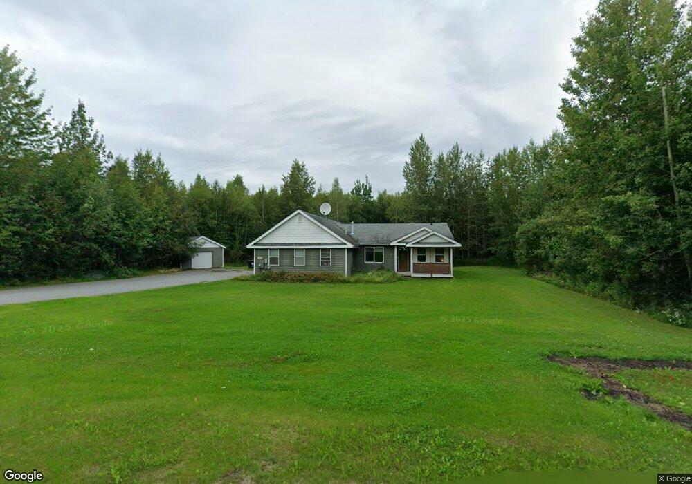
1998 S Creekside Dr Wasilla, AK 99654
Gateway NeighborhoodEstimated Value: $332,000 - $522,000
3
Beds
2
Baths
1,753
Sq Ft
$261/Sq Ft
Est. Value
About This Home
This home is located at 1998 S Creekside Dr, Wasilla, AK 99654 and is currently estimated at $457,134, approximately $260 per square foot. 1998 S Creekside Dr is a home located in Matanuska-Susitna Borough with nearby schools including Fred & Sara Machetanz Elementary School, Teeland Middle School, and Colony High School.
Ownership History
Date
Name
Owned For
Owner Type
Purchase Details
Closed on
Apr 17, 2018
Sold by
Dahl Clay R and Dahl Ann R
Bought by
Lhad Invetments Llc
Current Estimated Value
Purchase Details
Closed on
Dec 10, 2003
Sold by
Dahl Clay R and Cad Enterprises
Bought by
Dahl Clay R
Home Financials for this Owner
Home Financials are based on the most recent Mortgage that was taken out on this home.
Original Mortgage
$211,500
Interest Rate
8.3%
Mortgage Type
Purchase Money Mortgage
Purchase Details
Closed on
May 31, 2002
Sold by
Creekside Preserve Inc
Bought by
Dahl Clay R and Cad Enterprises
Home Financials for this Owner
Home Financials are based on the most recent Mortgage that was taken out on this home.
Original Mortgage
$155,200
Interest Rate
6.74%
Mortgage Type
Construction
Create a Home Valuation Report for This Property
The Home Valuation Report is an in-depth analysis detailing your home's value as well as a comparison with similar homes in the area
Home Values in the Area
Average Home Value in this Area
Purchase History
| Date | Buyer | Sale Price | Title Company |
|---|---|---|---|
| Lhad Invetments Llc | -- | None Available | |
| Dahl Clay R | -- | -- | |
| Dahl Clay R | -- | -- |
Source: Public Records
Mortgage History
| Date | Status | Borrower | Loan Amount |
|---|---|---|---|
| Previous Owner | Dahl Clay R | $211,500 | |
| Previous Owner | Dahl Clay R | $155,200 |
Source: Public Records
Tax History Compared to Growth
Tax History
| Year | Tax Paid | Tax Assessment Tax Assessment Total Assessment is a certain percentage of the fair market value that is determined by local assessors to be the total taxable value of land and additions on the property. | Land | Improvement |
|---|---|---|---|---|
| 2025 | $5,698 | $467,000 | $51,000 | $416,000 |
| 2024 | $5,698 | $456,800 | $51,000 | $405,800 |
| 2023 | $5,361 | $440,000 | $51,000 | $389,000 |
| 2022 | $5,204 | $400,900 | $51,000 | $349,900 |
| 2021 | $5,119 | $356,100 | $51,000 | $305,100 |
| 2020 | $4,999 | $337,000 | $51,000 | $286,000 |
| 2019 | $4,823 | $322,400 | $51,000 | $271,400 |
| 2018 | $4,744 | $318,800 | $51,000 | $267,800 |
| 2017 | $4,644 | $312,100 | $51,000 | $261,100 |
| 2016 | $4,528 | $312,100 | $51,000 | $261,100 |
| 2015 | $3,957 | $294,400 | $42,000 | $252,400 |
| 2014 | $3,957 | $284,600 | $42,000 | $242,600 |
Source: Public Records
Map
Nearby Homes
- 2078 S Withers Rd
- 2720 S Capon Place
- 5740 E Blue Lupine Dr
- 5794 E Morning Mist Dr
- 940 S Serrano Dr
- 850 S Hassler Dr
- 5044 E Loft Cir
- 3241 S Barn Gable Loop
- 2206 S Sanctuary Dr
- 3261 S Charming Valley Loop
- 2154 S Sanctuary Dr
- 2317 S Sanctuary Dr
- 2445 S Sanctuary Dr
- 495 S Harriette St
- 530 S Harriette St
- 6645 E Gateway Dr
- 6675 E Gateway Dr
- 2600 S Sanctuary Dr
- 6730 E Exquisite Dr
- 1571 S Middle Mesa Dr
- L16 Creekside Heights
- 2048 S Creekside Dr
- L1 B11 Nelson
- L4 B9 Paddock Loop
- L4 B9 Stable Cir
- L2 B10 Paddock
- L1 B10 Creekside Dr
- 1931 S Bronco Cir
- 1932 S Creekside Dr
- 2085 S Creekside Dr
- 1961 S Bronco Cir
- 2086 S Creekside Dr
- 1951 S Creekside Dr
- 1947 S Bronco Cir
- 2037 S Creekside Dr
- L29 B8 Nelson Rd
- 1881 S Bronco Cir
- 5072 E Brome Ave
- L5 B11 Paddock Dr
- 5042 E Brome Ave