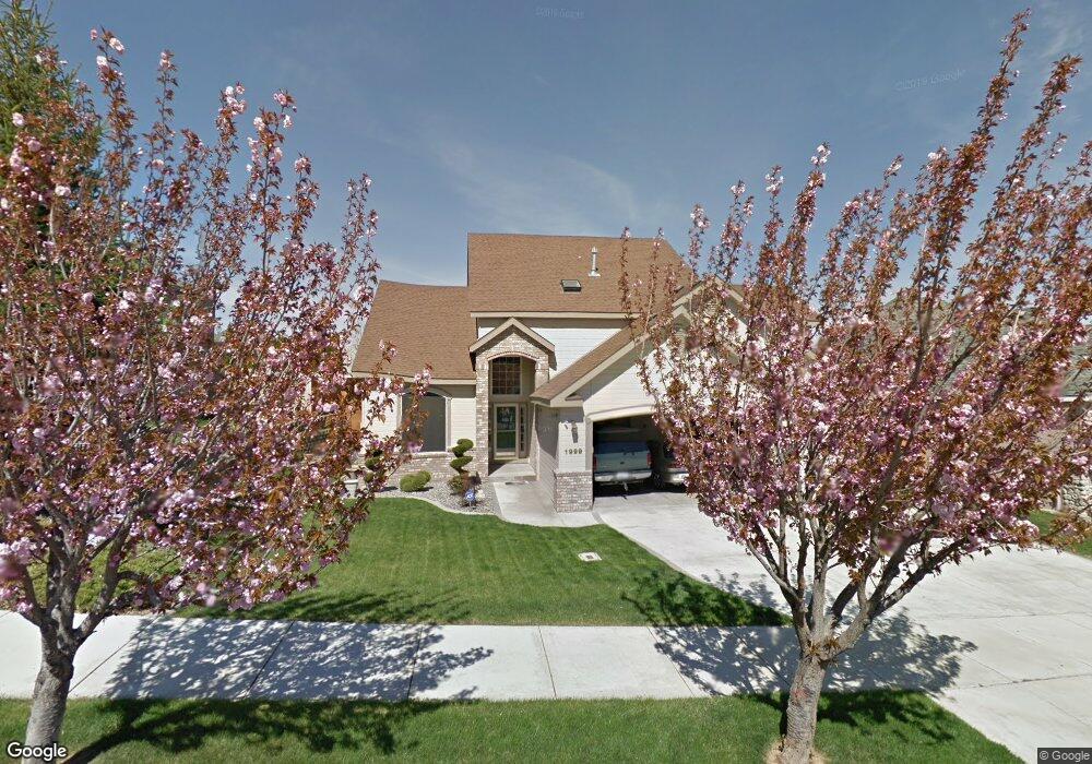
1999 Newhaven Loop Richland, WA 99352
Estimated Value: $545,625 - $607,000
3
Beds
3
Baths
2,548
Sq Ft
$225/Sq Ft
Est. Value
About This Home
This home is located at 1999 Newhaven Loop, Richland, WA 99352 and is currently estimated at $573,406, approximately $225 per square foot. 1999 Newhaven Loop is a home located in Benton County with nearby schools including Orchard Elementary School, Carmichael Middle School, and Richland High School.
Ownership History
Date
Name
Owned For
Owner Type
Purchase Details
Closed on
Jun 13, 2008
Sold by
Cook Lonnie H and Cook Lori A
Bought by
Cartier Shannon M
Current Estimated Value
Home Financials for this Owner
Home Financials are based on the most recent Mortgage that was taken out on this home.
Original Mortgage
$214,708
Outstanding Balance
$135,290
Interest Rate
6.04%
Mortgage Type
Purchase Money Mortgage
Estimated Equity
$438,116
Create a Home Valuation Report for This Property
The Home Valuation Report is an in-depth analysis detailing your home's value as well as a comparison with similar homes in the area
Home Values in the Area
Average Home Value in this Area
Purchase History
| Date | Buyer | Sale Price | Title Company |
|---|---|---|---|
| Cartier Shannon M | $268,385 | Chicago Title |
Source: Public Records
Mortgage History
| Date | Status | Borrower | Loan Amount |
|---|---|---|---|
| Open | Cartier Shannon M | $214,708 |
Source: Public Records
Tax History
| Year | Tax Paid | Tax Assessment Tax Assessment Total Assessment is a certain percentage of the fair market value that is determined by local assessors to be the total taxable value of land and additions on the property. | Land | Improvement |
|---|---|---|---|---|
| 2025 | $543 | $526,370 | $95,000 | $431,370 |
| 2024 | $4,549 | $526,370 | $95,000 | $431,370 |
| 2023 | $4,549 | $487,150 | $95,000 | $392,150 |
| 2022 | $4,605 | $447,780 | $65,000 | $382,780 |
| 2021 | $4,209 | $416,750 | $65,000 | $351,750 |
| 2020 | $4,199 | $365,020 | $65,000 | $300,020 |
| 2019 | $3,671 | $344,330 | $65,000 | $279,330 |
| 2018 | $3,688 | $323,640 | $65,000 | $258,640 |
| 2017 | $3,232 | $271,910 | $65,000 | $206,910 |
| 2016 | $3,580 | $269,810 | $48,000 | $221,810 |
| 2015 | $3,632 | $269,810 | $48,000 | $221,810 |
| 2014 | -- | $269,810 | $48,000 | $221,810 |
| 2013 | -- | $269,810 | $48,000 | $221,810 |
Source: Public Records
Map
Nearby Homes
- 183 Mcintosh Ct
- 154 Orchard Way
- 145 Greenview Dr
- 242 Greenview Dr
- 316 Soaring Hawk St
- 245 High Meadows St
- 2340 Storehouse Ave Lot A2
- 2172 Newhaven Loop
- 2127 Sheridan Place
- 369 Temple Meadow Ln
- 119 Casa Sueno Ct
- 1983 Greenbrook Blvd
- 125 Casa Sueno Ct
- 2420 Morency Dr
- 1942 Sky Meadow Ave
- 2508 Falconcrest Loop
- 464 Agier Dr
- 1 Keene Rd Unit Lot 1
- 2 Keene Rd Unit Lot 2
- 4 Keene Rd Unit Lot 4
- 1989 Newhaven Loop
- 2009 Newhaven Loop
- 192 Mcintosh Ct
- 190 Mcintosh Ct
- 1969 Newhaven Loop
- 2019 Newhaven Loop
- 1992 Newhaven Loop
- 1998 Newhaven Loop
- 1988 Newhaven Loop
- 194 Mcintosh Ct
- 1968 Newhaven Loop
- 188 Mcintosh Ct
- 2029 Newhaven Loop
- 2008 Newhaven Loop
- 1963 Newhaven Loop
- 1964 Newhaven Loop
- 2014 Newhaven Loop
- 196 Mcintosh Ct
- 186 Mcintosh Ct
- 2039 Newhaven Loop
Your Personal Tour Guide
Ask me questions while you tour the home.