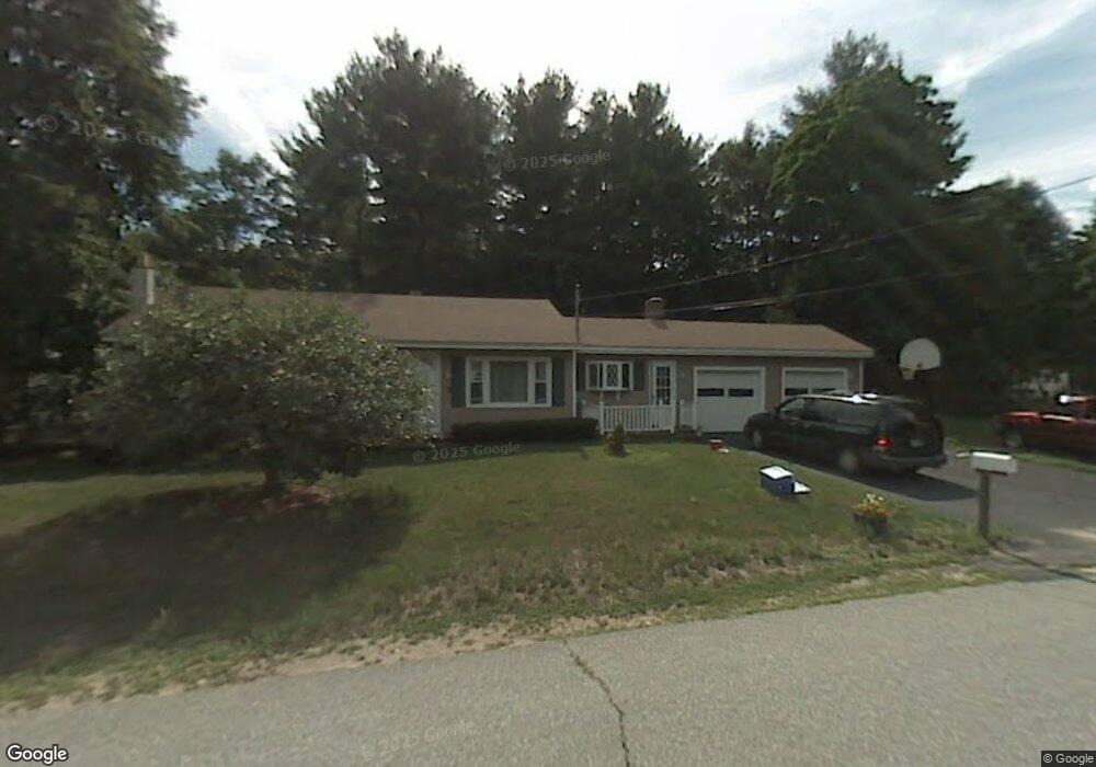
2 Albert St Pelham, NH 03076
Estimated Value: $422,000 - $532,000
3
Beds
2
Baths
1,554
Sq Ft
$309/Sq Ft
Est. Value
About This Home
This home is located at 2 Albert St, Pelham, NH 03076 and is currently estimated at $479,670, approximately $308 per square foot. 2 Albert St is a home located in Hillsborough County with nearby schools including Pelham Elementary School, Pelham Memorial School, and Pelham High School.
Ownership History
Date
Name
Owned For
Owner Type
Purchase Details
Closed on
May 19, 2022
Sold by
Mcbee Elizabeth A and Mcbee Christopher R
Bought by
Mcbee Elizabeth A
Current Estimated Value
Home Financials for this Owner
Home Financials are based on the most recent Mortgage that was taken out on this home.
Original Mortgage
$282,700
Outstanding Balance
$265,665
Interest Rate
4.13%
Mortgage Type
Adjustable Rate Mortgage/ARM
Estimated Equity
$214,005
Purchase Details
Closed on
Jul 29, 2013
Sold by
Jozokos Jonathan S
Bought by
Mcbee Christopher R and Mcbee Elizabeth A
Purchase Details
Closed on
Jun 17, 2010
Sold by
Howard Phillip D and Howard Corrine C
Bought by
Jozokos Jonathan S
Home Financials for this Owner
Home Financials are based on the most recent Mortgage that was taken out on this home.
Original Mortgage
$223,000
Interest Rate
5.03%
Mortgage Type
Purchase Money Mortgage
Purchase Details
Closed on
Jul 15, 2003
Sold by
Will John R and Will April
Bought by
Howard Phillip and Howard Corrine
Purchase Details
Closed on
Jul 17, 2000
Sold by
Mann Dewey G and Mann Maureen
Bought by
Will John and Will April
Create a Home Valuation Report for This Property
The Home Valuation Report is an in-depth analysis detailing your home's value as well as a comparison with similar homes in the area
Home Values in the Area
Average Home Value in this Area
Purchase History
| Date | Buyer | Sale Price | Title Company |
|---|---|---|---|
| Mcbee Elizabeth A | -- | None Available | |
| Mcbee Elizabeth A | -- | None Available | |
| Mcbee Elizabeth A | -- | None Available | |
| Mcbee Christopher R | $239,900 | -- | |
| Jozokos Jonathan S | $234,900 | -- | |
| Howard Phillip | $249,900 | -- | |
| Will John | $160,000 | -- | |
| Mcbee Christopher R | $239,900 | -- | |
| Jozokos Jonathan S | $234,900 | -- | |
| Howard Phillip | $249,900 | -- | |
| Will John | $160,000 | -- |
Source: Public Records
Mortgage History
| Date | Status | Borrower | Loan Amount |
|---|---|---|---|
| Open | Mcbee Elizabeth A | $282,700 | |
| Closed | Mcbee Elizabeth A | $282,700 | |
| Previous Owner | Will John | $223,000 |
Source: Public Records
Tax History
| Year | Tax Paid | Tax Assessment Tax Assessment Total Assessment is a certain percentage of the fair market value that is determined by local assessors to be the total taxable value of land and additions on the property. | Land | Improvement |
|---|---|---|---|---|
| 2024 | $5,678 | $309,600 | $111,600 | $198,000 |
| 2023 | $5,632 | $309,600 | $111,600 | $198,000 |
| 2022 | $5,393 | $309,600 | $111,600 | $198,000 |
| 2021 | $4,941 | $309,600 | $111,600 | $198,000 |
| 2020 | $4,759 | $235,600 | $90,200 | $145,400 |
| 2019 | $4,571 | $235,600 | $90,200 | $145,400 |
| 2018 | $4,953 | $230,800 | $90,200 | $140,600 |
| 2017 | $4,951 | $230,800 | $90,200 | $140,600 |
| 2016 | $4,835 | $230,800 | $90,200 | $140,600 |
| 2015 | $4,508 | $193,800 | $85,900 | $107,900 |
| 2014 | $4,432 | $193,800 | $85,900 | $107,900 |
| 2013 | $4,432 | $193,800 | $85,900 | $107,900 |
Source: Public Records
Map
Nearby Homes
- 6 David Dr
- 4 Wilshire Ln Unit 4
- 4 Wilshire Ln
- 6 Wilshire Ln Unit 6
- 40 Westfall Rd
- 10 Oakland Ridge Rd Unit 11
- 9 Cornstalk Ln
- 5 Lori Ln
- 4 Haystack Cir
- 45 Currier Rd
- 94 Tanager Cir Unit 94
- 2 Aspen Dr
- 2 Aspen Dr Unit Lot 146-17
- 6 Hemlock Dr
- 43 & 53 5th St
- 29 Saddle Rd
- 28 Bridal Path Rd
- 17 Spare St
- 1905 Lakeview Ave
- 2 S Shore Dr
Your Personal Tour Guide
Ask me questions while you tour the home.