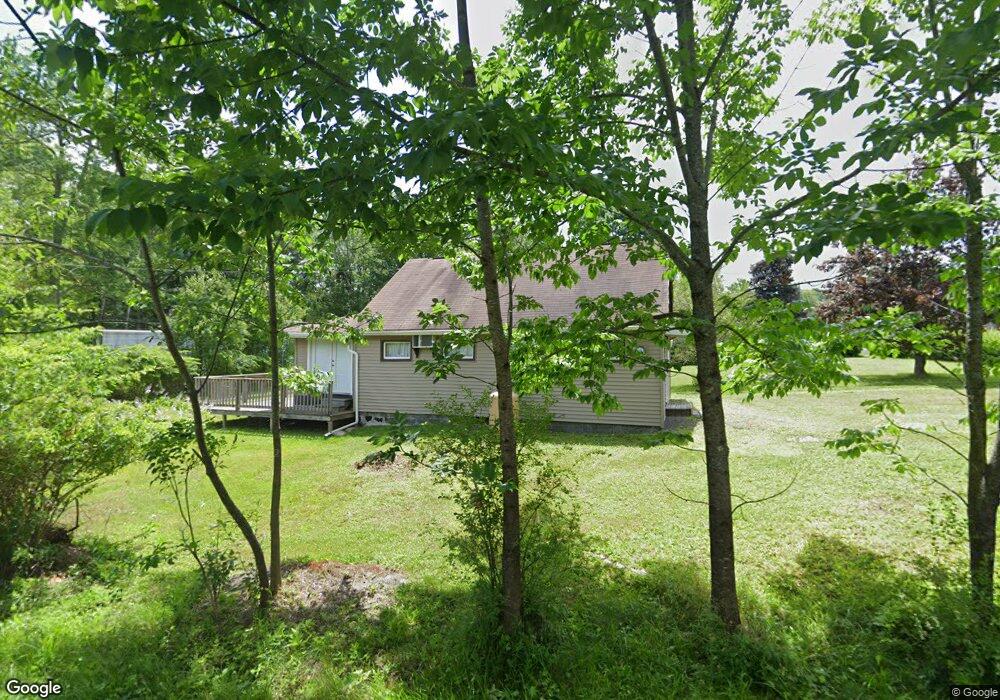
2 Apache Dr Heath, MA 01346
Heath NeighborhoodEstimated Value: $133,000 - $197,000
2
Beds
1
Bath
1,148
Sq Ft
$147/Sq Ft
Est. Value
About This Home
This home is located at 2 Apache Dr, Heath, MA 01346 and is currently estimated at $168,819, approximately $147 per square foot. 2 Apache Dr is a home with nearby schools including Mohawk Trail Regional High School.
Ownership History
Date
Name
Owned For
Owner Type
Purchase Details
Closed on
Nov 3, 2017
Sold by
Great Northern Managem
Bought by
Banoey Zenaida A and Banoey Narciso P
Current Estimated Value
Purchase Details
Closed on
May 15, 2014
Sold by
Doherty John J
Bought by
Great Northern Mgmt Co
Purchase Details
Closed on
Oct 2, 2002
Sold by
Monks John
Bought by
Doherty John J
Create a Home Valuation Report for This Property
The Home Valuation Report is an in-depth analysis detailing your home's value as well as a comparison with similar homes in the area
Home Values in the Area
Average Home Value in this Area
Purchase History
| Date | Buyer | Sale Price | Title Company |
|---|---|---|---|
| Banoey Zenaida A | $73,000 | -- | |
| Banoey Zenaida A | $73,000 | -- | |
| Great Northern Mgmt Co | $25,000 | -- | |
| Great Northern Mgmt Co | $25,000 | -- | |
| Doherty John J | $47,000 | -- | |
| Doherty John J | $47,000 | -- |
Source: Public Records
Tax History
| Year | Tax Paid | Tax Assessment Tax Assessment Total Assessment is a certain percentage of the fair market value that is determined by local assessors to be the total taxable value of land and additions on the property. | Land | Improvement |
|---|---|---|---|---|
| 2025 | $1,879 | $99,900 | $21,400 | $78,500 |
| 2024 | $2,000 | $97,900 | $21,400 | $76,500 |
| 2023 | $2,023 | $88,400 | $21,400 | $67,000 |
| 2022 | $1,798 | $83,600 | $21,400 | $62,200 |
| 2021 | $1,714 | $76,100 | $21,400 | $54,700 |
| 2020 | $1,702 | $76,500 | $21,400 | $55,100 |
| 2019 | $1,680 | $77,800 | $21,900 | $55,900 |
| 2018 | $1,697 | $77,800 | $21,900 | $55,900 |
| 2017 | $1,681 | $80,100 | $21,600 | $58,500 |
| 2016 | $1,651 | $80,500 | $21,600 | $58,900 |
| 2015 | $1,735 | $86,900 | $21,600 | $65,300 |
Source: Public Records
Map
Nearby Homes
- 3 Flagg Hill Rd
- 8 Deer Run Path
- 23 E Brook Dr
- 14 South Rd
- 0 W Oxbow Rd Unit 73453651
- 0 W Oxbow Rd Unit 248444
- 594 Massachusetts 8a
- 24 W Oxbow Rd
- 1451 Massachusetts 2
- 1451 Route 2 E
- 2155 Massachusetts 2
- 2151 Route 2
- Lot 121 Davis Mine Rd
- 251 Phillips Hill Rd
- 442 Mcmillan Rd
- 168 Main St
- 829 Pennel Hill Rd
- 295 Jacksonville Rd
- 1192 Chapel Hill Rd
- 0 Warfield Rd
- 4 Apache Dr
- 14 Mohawk Beach Dr
- 6 Apache Dr
- 10 Mohawk Beach Dr
- 9 Teepee Ln
- 20 Tepee Ln
- 9 Tepee Ln
- 10/11 Tepee Ln
- 2 Waterfall Dr
- 10 Mohawk Beach Dr
- 63 Waterfalls Dr
- 1 & 3 Waterfalls Dr
- 1 Mohawk Beach Dr
- 19 Apache Dr
- 5 Waterfall Dr
- 118 Taylor Brook Rd
- 128 Taylor Brook Rd
- 136 Taylor Brook Rd
- 0 Taylor Brook Rd Unit 30170027
- 0 Taylor Brook Rd Unit 30103369
Your Personal Tour Guide
Ask me questions while you tour the home.