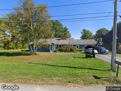
2 Carroll St Falmouth, ME 04105
Falmouth Foreside NeighborhoodEstimated Value: $785,000 - $1,327,000
2
Beds
3
Baths
2,692
Sq Ft
$424/Sq Ft
Est. Value
About This Home
This home is located at 2 Carroll St, Falmouth, ME 04105 and is currently estimated at $1,142,703, approximately $424 per square foot. 2 Carroll St is a home located in Cumberland County with nearby schools including Falmouth Middle School, Falmouth High School, and Baxter Academy for Tech & Sciences.
Ownership History
Date
Name
Owned For
Owner Type
Purchase Details
Closed on
Mar 2, 2010
Sold by
Drew Barbara C
Bought by
Stowell Matthew J and Stowell Susan R
Current Estimated Value
Home Financials for this Owner
Home Financials are based on the most recent Mortgage that was taken out on this home.
Original Mortgage
$385,000
Interest Rate
5.11%
Mortgage Type
Purchase Money Mortgage
Create a Home Valuation Report for This Property
The Home Valuation Report is an in-depth analysis detailing your home's value as well as a comparison with similar homes in the area
Home Values in the Area
Average Home Value in this Area
Purchase History
| Date | Buyer | Sale Price | Title Company |
|---|---|---|---|
| Stowell Matthew J | -- | -- |
Source: Public Records
Mortgage History
| Date | Status | Borrower | Loan Amount |
|---|---|---|---|
| Open | Stowell Matthew J | $376,000 | |
| Closed | Stowell Matthew J | $385,000 | |
| Previous Owner | Drew Charles G | $191,033 |
Source: Public Records
Tax History Compared to Growth
Tax History
| Year | Tax Paid | Tax Assessment Tax Assessment Total Assessment is a certain percentage of the fair market value that is determined by local assessors to be the total taxable value of land and additions on the property. | Land | Improvement |
|---|---|---|---|---|
| 2023 | $11,375 | $899,900 | $549,500 | $350,400 |
| 2022 | $10,727 | $899,900 | $549,500 | $350,400 |
| 2021 | $8,896 | $510,400 | $299,500 | $210,900 |
| 2020 | $8,702 | $510,400 | $299,500 | $210,900 |
| 2019 | $8,610 | $510,400 | $299,500 | $210,900 |
| 2018 | $8,406 | $510,400 | $299,500 | $210,900 |
| 2017 | $7,972 | $510,400 | $299,500 | $210,900 |
| 2016 | $7,702 | $510,400 | $299,500 | $210,900 |
| 2015 | $7,467 | $510,400 | $299,500 | $210,900 |
| 2014 | $6,609 | $478,700 | $299,500 | $179,200 |
| 2012 | -- | $478,500 | $299,500 | $179,000 |
Source: Public Records
Map
Nearby Homes
- 56 Carroll St
- 5 Cobblestone St Unit 53
- 72 Us Route 1
- 9 Phillips Rd
- 11 Mckinley Rd
- 66 Colonial Village
- 17 Us Route 1
- 16 U S 1
- 75 Clearwater Dr Unit 305
- 8 Joshua Way
- 15 Mussel Cove Ln
- 12 Mussel Cove Ln
- 1040 Ocean Ave
- 6 Lunt Rd
- 12 Cleaves Farm Rd
- 48 Ridge Rd Unit 3
- 42 Wordsworth St
- 267 U S 1 Unit 507
- 267 U S 1 Unit 311
- 267 U S 1 Unit 211