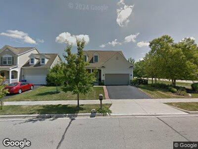
2 Fieldcrest Dr Unit KP7469 Delaware, OH 43015
Estimated Value: $377,000 - $438,000
4
Beds
3
Baths
1,949
Sq Ft
$209/Sq Ft
Est. Value
About This Home
This home is located at 2 Fieldcrest Dr Unit KP7469, Delaware, OH 43015 and is currently estimated at $407,393, approximately $209 per square foot. 2 Fieldcrest Dr Unit KP7469 is a home located in Delaware County with nearby schools including James Conger Elementary School, John C. Dempsey Middle School, and Rutherford B. Hayes High School.
Ownership History
Date
Name
Owned For
Owner Type
Purchase Details
Closed on
May 24, 2019
Sold by
Grossman Constance Marie and Grossman Constance M
Bought by
Casanova Jeanne Lisa
Current Estimated Value
Purchase Details
Closed on
Mar 18, 2008
Sold by
Beazer Homes Investments Llc
Bought by
Grossman Constance M
Home Financials for this Owner
Home Financials are based on the most recent Mortgage that was taken out on this home.
Original Mortgage
$146,000
Interest Rate
6.1%
Mortgage Type
Purchase Money Mortgage
Create a Home Valuation Report for This Property
The Home Valuation Report is an in-depth analysis detailing your home's value as well as a comparison with similar homes in the area
Home Values in the Area
Average Home Value in this Area
Purchase History
| Date | Buyer | Sale Price | Title Company |
|---|---|---|---|
| Grossman Constance M | $183,400 | Lawyers Title |
Source: Public Records
Mortgage History
| Date | Status | Borrower | Loan Amount |
|---|---|---|---|
| Open | Grossman Constance M | $120,000 | |
| Closed | Grossman Constance M | $146,000 |
Source: Public Records
Tax History Compared to Growth
Tax History
| Year | Tax Paid | Tax Assessment Tax Assessment Total Assessment is a certain percentage of the fair market value that is determined by local assessors to be the total taxable value of land and additions on the property. | Land | Improvement |
|---|---|---|---|---|
| 2024 | $5,957 | $126,180 | $20,760 | $105,420 |
| 2023 | $5,968 | $126,180 | $20,760 | $105,420 |
| 2022 | $4,643 | $85,190 | $15,470 | $69,720 |
| 2021 | $4,746 | $85,190 | $15,470 | $69,720 |
| 2020 | $4,800 | $85,190 | $15,470 | $69,720 |
| 2019 | $4,413 | $70,980 | $12,880 | $58,100 |
| 2018 | $4,474 | $70,980 | $12,880 | $58,100 |
| 2017 | $3,947 | $59,860 | $10,820 | $49,040 |
| 2016 | $3,443 | $59,860 | $10,820 | $49,040 |
| 2015 | $3,462 | $59,860 | $10,820 | $49,040 |
| 2014 | $3,517 | $59,860 | $10,820 | $49,040 |
| 2013 | $3,537 | $59,860 | $10,820 | $49,040 |
Source: Public Records
Map
Nearby Homes
- 799 Ferguson Ave
- 1863 Ashburn Dr
- 700 Ferguson Ave
- 179 Harvard Loop
- 688 Ferguson Ave
- 119 Harvard Loop
- 178 Stockard Loop
- 255 Lofton Cir
- 6689 Riverrun Ln
- 19 Deerfield Place
- 452 Rochdale Run
- 349 E Central Ave
- 320 Rochdale Run
- 0 Fair Ave
- 77 Fair Ave
- 10 Smith St
- 281 E Central Ave
- 249 Rochdale Run
- 36 Oldham Ct
- 157 Joy Ave
- 2 Fieldcrest Dr
- 2 Fieldcrest Dr Unit KP7469
- 4 Fieldcrest Dr
- 1950 Berwick Ct
- 6 Fieldcrest Dr
- 1944 Berwick Ct
- 1277 Bowtown Rd
- 1200 State Route 521
- 1957 Berwick Ct
- 1938 Berwick Ct
- 14 Fieldcrest Dr
- 1201 Bowtown Rd
- 1932 Berwick Ct
- 20 Fieldcrest Dr
- 1951 Berwick Ct
- 1301 Bowtown Rd
- 3 Barrhill Dr
- 1926 Berwick Ct
- 1945 Berwick Ct
- 26 Fieldcrest Dr