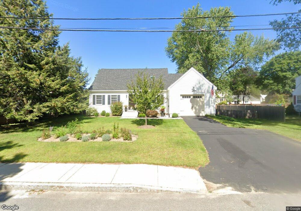
2 Middlebrook Rd Dover, NH 03820
Dover Point NeighborhoodEstimated Value: $581,872 - $638,000
4
Beds
2
Baths
2,005
Sq Ft
$307/Sq Ft
Est. Value
About This Home
This home is located at 2 Middlebrook Rd, Dover, NH 03820 and is currently estimated at $614,718, approximately $306 per square foot. 2 Middlebrook Rd is a home located in Strafford County with nearby schools including Garrison School, Dover Middle School, and Dover Senior High School.
Ownership History
Date
Name
Owned For
Owner Type
Purchase Details
Closed on
Mar 16, 2010
Sold by
Choate Heidi R
Bought by
Schultz Elliot and Schultz Kalli
Current Estimated Value
Home Financials for this Owner
Home Financials are based on the most recent Mortgage that was taken out on this home.
Original Mortgage
$200,000
Outstanding Balance
$132,820
Interest Rate
5.02%
Mortgage Type
Purchase Money Mortgage
Estimated Equity
$481,898
Purchase Details
Closed on
Oct 25, 2001
Sold by
Marino Paul R and Marino Suzanne G
Bought by
Chabot Scott D and Chabot Heidi R
Home Financials for this Owner
Home Financials are based on the most recent Mortgage that was taken out on this home.
Original Mortgage
$185,000
Interest Rate
6.86%
Create a Home Valuation Report for This Property
The Home Valuation Report is an in-depth analysis detailing your home's value as well as a comparison with similar homes in the area
Home Values in the Area
Average Home Value in this Area
Purchase History
| Date | Buyer | Sale Price | Title Company |
|---|---|---|---|
| Schultz Elliot | $250,000 | -- | |
| Chabot Scott D | $204,900 | -- |
Source: Public Records
Mortgage History
| Date | Status | Borrower | Loan Amount |
|---|---|---|---|
| Open | Chabot Scott D | $200,000 | |
| Previous Owner | Chabot Scott D | $10,000 | |
| Previous Owner | Chabot Scott D | $185,000 |
Source: Public Records
Tax History
| Year | Tax Paid | Tax Assessment Tax Assessment Total Assessment is a certain percentage of the fair market value that is determined by local assessors to be the total taxable value of land and additions on the property. | Land | Improvement |
|---|---|---|---|---|
| 2024 | $9,490 | $522,300 | $177,900 | $344,400 |
| 2023 | $8,748 | $467,800 | $161,800 | $306,000 |
| 2022 | $8,521 | $429,500 | $153,700 | $275,800 |
| 2021 | $8,287 | $381,900 | $129,400 | $252,500 |
| 2020 | $8,118 | $326,700 | $117,300 | $209,400 |
| 2019 | $8,020 | $318,400 | $113,200 | $205,200 |
| 2018 | $7,708 | $309,300 | $105,100 | $204,200 |
| 2017 | $7,430 | $287,200 | $89,000 | $198,200 |
| 2016 | $6,791 | $258,300 | $84,700 | $173,600 |
| 2015 | $6,650 | $249,900 | $80,500 | $169,400 |
| 2014 | $6,500 | $249,900 | $80,500 | $169,400 |
| 2011 | $5,783 | $230,200 | $68,400 | $161,800 |
Source: Public Records
Map
Nearby Homes
- 20 Village Dr
- 6 Hayden Dr
- 13 Stark Ave
- 31 Rosanna Dr
- 55 Pointe Place Unit 108
- 55 Pointe Place Unit 208
- 55 Pointe Place Unit 201
- 55 Pointe Place Unit 304
- 38 Tideview Dr
- 20 Lenox Dr Unit c
- 22 Lenox Dr Unit D
- 6 Revolution Dr
- 17 Lenox Dr Unit A
- 29 Lenox Dr Unit B
- 16 Lenox Dr Unit C
- 21 Lenox Dr Unit A
- 15 Lenox Dr Unit A
- 51 Constitution Way
- 26 Lenox Dr Unit D
- 23 Lenox Dr Unit A
- 4 Middlebrook Rd
- 118 Stark Ave
- 3 Hawthorne Rd
- 5 Hawthorne Rd
- 1 Middlebrook Rd
- 116 Stark Ave
- 5 Middlebrook Rd
- 6 Middlebrook Rd
- 7 Hawthorne Rd
- 4 Hawthorne Rd
- 20 Elliot Park
- 1 Elliot Park
- 106 Stark Ave
- 9 Hawthorne Rd
- 19 Elliot Park
- 0 Dover Point Rd Unit 4507201
- 10 Middlebrook Rd
- 7 Middlebrook Rd
- 6 Hawthorne Rd
- 8 Hawthorne Rd
Your Personal Tour Guide
Ask me questions while you tour the home.