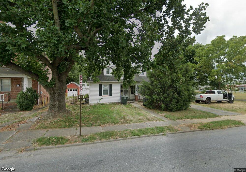
2 Monroe Ave Frederick, MD 21701
East Frederick NeighborhoodEstimated Value: $366,205 - $735,000
Studio
2
Baths
1,514
Sq Ft
$325/Sq Ft
Est. Value
About This Home
This home is located at 2 Monroe Ave, Frederick, MD 21701 and is currently estimated at $492,051, approximately $325 per square foot. 2 Monroe Ave is a home located in Frederick County with nearby schools including Spring Ridge Elementary School, Gov. Thomas Johnson Middle School, and Gov. Thomas Johnson High School.
Ownership History
Date
Name
Owned For
Owner Type
Purchase Details
Closed on
Aug 4, 2018
Sold by
Gbg Farm Llc
Bought by
Bkj Properties Llc
Current Estimated Value
Purchase Details
Closed on
Feb 29, 2016
Sold by
Kob Properties Llc
Bought by
Gbg Farm Llc
Purchase Details
Closed on
Dec 27, 2004
Sold by
Zahler Kristen M
Bought by
Kob Properties Llc
Purchase Details
Closed on
Jun 5, 2003
Sold by
Michael Larry E
Bought by
Zahter Kristen M and Bare Scott R
Create a Home Valuation Report for This Property
The Home Valuation Report is an in-depth analysis detailing your home's value as well as a comparison with similar homes in the area
Home Values in the Area
Average Home Value in this Area
Purchase History
| Date | Buyer | Sale Price | Title Company |
|---|---|---|---|
| Bkj Properties Llc | -- | None Available | |
| Gbg Farm Llc | $450,000 | Attorney | |
| Kob Properties Llc | -- | -- | |
| Zahter Kristen M | $160,000 | -- |
Source: Public Records
Mortgage History
| Date | Status | Borrower | Loan Amount |
|---|---|---|---|
| Closed | Zahter Kristen M | -- |
Source: Public Records
Tax History
| Year | Tax Paid | Tax Assessment Tax Assessment Total Assessment is a certain percentage of the fair market value that is determined by local assessors to be the total taxable value of land and additions on the property. | Land | Improvement |
|---|---|---|---|---|
| 2025 | $4,407 | $254,200 | $87,500 | $166,700 |
| 2024 | $4,407 | $235,633 | $0 | $0 |
| 2023 | $3,954 | $217,067 | $0 | $0 |
| 2022 | $3,610 | $198,500 | $71,000 | $127,500 |
| 2021 | $3,471 | $190,467 | $0 | $0 |
| 2020 | $3,315 | $182,433 | $0 | $0 |
| 2019 | $3,172 | $174,400 | $62,700 | $111,700 |
| 2018 | $3,104 | $174,000 | $0 | $0 |
| 2017 | $3,142 | $174,400 | $0 | $0 |
| 2016 | $3,228 | $173,200 | $0 | $0 |
| 2015 | $3,228 | $173,200 | $0 | $0 |
| 2014 | $3,228 | $173,200 | $0 | $0 |
Source: Public Records
Map
Nearby Homes
- 497 Sagner Ave
- 442 Ensemble Way
- 443 Ensemble Way
- 445 Ensemble Way
- 455 Ensemble Way
- 719 Compass Way
- 457 Ensemble Way
- 459 Ensemble Way
- 725 Compass Way
- 417 Ensemble Way
- 726 Compass Way
- 415 Ensemble Way
- 413 Ensemble Way
- 411 Ensemble Way
- 270 Ensemble Way
- 459 Hanson St
- 391 Ensemble Way
- 715 Courier Ln
- 485 Hanson St
- 163 B And o Ave
- 4 Monroe Ave
- 6 Monroe Ave
- 801 E Patrick St
- 803 E Patrick St
- 8 Monroe Ave
- 805 E Patrick St
- 11 Orchard Ave
- 100 Monroe Ave
- 822 E Patrick St
- 102 Monroe Ave
- 818 E Patrick St
- 812 E Patrick St
- 824 E Patrick St
- 826 E Patrick St
- 810 E Patrick St
- 901 E Patrick St
- 820 E Patrick St
- 104 Monroe Ave
- 808 E Patrick St
- 816 E Patrick St
Your Personal Tour Guide
Ask me questions while you tour the home.