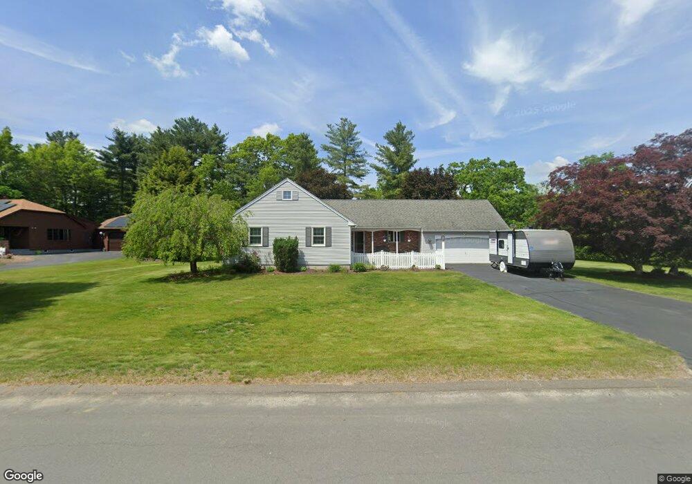
2 Parsons Way Southampton, MA 01073
Estimated Value: $476,954 - $546,000
3
Beds
2
Baths
1,524
Sq Ft
$337/Sq Ft
Est. Value
About This Home
This home is located at 2 Parsons Way, Southampton, MA 01073 and is currently estimated at $513,989, approximately $337 per square foot. 2 Parsons Way is a home located in Hampshire County with nearby schools including William E Norris School, Calvary Baptist Christian School, and White Oak School.
Ownership History
Date
Name
Owned For
Owner Type
Purchase Details
Closed on
Oct 29, 2009
Sold by
Babyak Richard E and Babyak Jeanne A
Bought by
Robles Franncis and Robles Kathleen Harvey
Current Estimated Value
Home Financials for this Owner
Home Financials are based on the most recent Mortgage that was taken out on this home.
Original Mortgage
$200,000
Outstanding Balance
$130,992
Interest Rate
5.06%
Mortgage Type
Purchase Money Mortgage
Estimated Equity
$382,997
Create a Home Valuation Report for This Property
The Home Valuation Report is an in-depth analysis detailing your home's value as well as a comparison with similar homes in the area
Home Values in the Area
Average Home Value in this Area
Purchase History
| Date | Buyer | Sale Price | Title Company |
|---|---|---|---|
| Robles Franncis | $329,900 | -- |
Source: Public Records
Mortgage History
| Date | Status | Borrower | Loan Amount |
|---|---|---|---|
| Open | Robles Franncis | $200,000 |
Source: Public Records
Tax History Compared to Growth
Tax History
| Year | Tax Paid | Tax Assessment Tax Assessment Total Assessment is a certain percentage of the fair market value that is determined by local assessors to be the total taxable value of land and additions on the property. | Land | Improvement |
|---|---|---|---|---|
| 2025 | $5,915 | $417,400 | $116,300 | $301,100 |
| 2024 | $5,754 | $403,800 | $116,300 | $287,500 |
| 2023 | $5,295 | $369,500 | $116,300 | $253,200 |
| 2022 | $5,357 | $355,500 | $116,600 | $238,900 |
| 2021 | $5,173 | $323,900 | $106,400 | $217,500 |
| 2020 | $5,134 | $324,500 | $106,400 | $218,100 |
| 2019 | $5,009 | $307,100 | $106,400 | $200,700 |
| 2018 | $7,396 | $281,800 | $95,900 | $185,900 |
| 2017 | $7,088 | $281,800 | $95,900 | $185,900 |
| 2015 | $4,394 | $279,700 | $87,200 | $192,500 |
Source: Public Records
Map
Nearby Homes
- 43 Pomeroy Meadow Rd
- 23 Wolcott Rd
- 216 College Hwy
- 17 Glendale Rd
- 68 College Hwy
- Lot 6 Gil Farm Rd
- Lot 5 Gil Farm Rd
- 12 Golden Cir
- 38 College Hwy
- 77 Crooked Ledge Rd
- 40 Strong Rd
- 7 Quigley Rd
- 0 Glendale Rd
- 26 Eastwood Ln
- 119 Brickyard Rd
- Lot 5 Brickyard Rd
- 19 Lead Mine Rd
- 23 John St
- 40 Division St
- LOT 3 Brickyard Rd
- 1 Parsons Way
- 18 Pomeroy Meadow Rd
- 20A Pomeroy Meadow Rd Unit A
- 4 Parsons Way
- 25 Pomeroy Meadow Rd
- 17 Pomeroy Meadow Rd
- 3 Parsons Way
- 6 Parsons Way
- 4 Rosalie Ln
- 16 Pomeroy Meadow Rd
- 26 Pomeroy Meadow Rd
- 27 Pomeroy Meadow Rd
- 1 Rosalie Ln
- 8 Parsons Way
- 5 Parsons Way
- 12 Pomeroy Meadow Rd
- 6 Rosalie Ln
- 15 Mountain View Cir
- 3 Rosalie Ln
- 17 Mountain View Cir