L
Seller's Agent in 2015
LINK Email Cache
LINK
Estimated Value: $1,279,000 - $1,503,000
Not listed in LINK
Last Agent to Sell the Property
LINK Email Cache
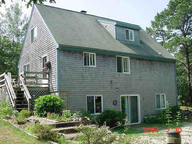
LINK Listed on: 07/15/2015
| Date | Buyer | Sale Price | Title Company |
|---|---|---|---|
| Spencerita Llc | $450,777 | -- | |
| Moreis Heidi Marie | $300,000 | -- |
| Date | Status | Borrower | Loan Amount |
|---|---|---|---|
| Open | Spencerita Llc | $360,000 | |
| Previous Owner | Moreis Heidi Marie | $300,000 |
| Date | Event | Price | List to Sale | Price per Sq Ft |
|---|---|---|---|---|
| 07/15/2015 07/15/15 | Sold | $459,777 | -- | $327 / Sq Ft |
| Year | Tax Paid | Tax Assessment Tax Assessment Total Assessment is a certain percentage of the fair market value that is determined by local assessors to be the total taxable value of land and additions on the property. | Land | Improvement |
|---|---|---|---|---|
| 2025 | $2,824 | $1,065,700 | $335,000 | $730,700 |
| 2024 | $2,465 | $966,600 | $335,000 | $631,600 |
| 2023 | $2,265 | $898,900 | $304,000 | $594,900 |
| 2022 | $2,056 | $678,700 | $304,000 | $374,700 |
| 2021 | $14,820 | $651,200 | $304,000 | $347,200 |
| 2020 | $2,027 | $605,200 | $276,400 | $328,800 |
| 2019 | $2,342 | $605,200 | $276,400 | $328,800 |
| 2018 | $2,026 | $523,600 | $276,400 | $247,200 |
| 2017 | $1,796 | $505,800 | $276,400 | $229,400 |
| 2016 | $1,740 | $480,600 | $275,800 | $204,800 |
| 2015 | $1,696 | $488,800 | $275,800 | $213,000 |
L
Seller's Agent in 2015
LINK Email Cache
LINK
Source: LINK (Vineyard)
MLS Number: 29092
APN: EDGA-000010-000014