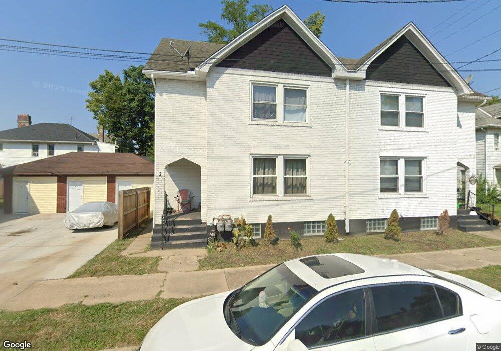
2 Shafor St Middletown, OH 45042
Sunset-Park Place Neighborhood
5
Beds
4
Baths
3,024
Sq Ft
3,049
Sq Ft Lot
About This Home
This home is located at 2 Shafor St, Middletown, OH 45042. 2 Shafor St is a home located in Butler County with nearby schools including Wildwood Elementary School, Highview 6th Grade Center, and Middletown Middle School.
Create a Home Valuation Report for This Property
The Home Valuation Report is an in-depth analysis detailing your home's value as well as a comparison with similar homes in the area
Home Values in the Area
Average Home Value in this Area
Tax History
| Year | Tax Paid | Tax Assessment Tax Assessment Total Assessment is a certain percentage of the fair market value that is determined by local assessors to be the total taxable value of land and additions on the property. | Land | Improvement |
|---|---|---|---|---|
| 2023 | $2,155 | -- | -- | -- |
| 2022 | $3,409 | $36,820 | $3,970 | $32,850 |
| 2021 | $2,112 | $36,820 | $3,970 | $32,850 |
| 2020 | $2,200 | $36,820 | $3,970 | $32,850 |
| 2019 | $1,989 | $27,440 | $4,120 | $23,320 |
| 2018 | $1,777 | $27,440 | $4,120 | $23,320 |
| 2017 | $1,780 | $27,440 | $4,120 | $23,320 |
| 2016 | $1,334 | $15,430 | $2,040 | $13,390 |
| 2015 | $1,030 | $15,430 | $2,040 | $13,390 |
| 2014 | $1,729 | $15,430 | $2,040 | $13,390 |
| 2013 | $1,729 | $31,180 | $4,120 | $27,060 |
Source: Public Records
Map
Nearby Homes
- 19 Mckinley St
- 102 Franklin St
- 2119 Central Ave
- 2208 Linden Ave
- 2619 Central Ave
- 2420 Superior Ave
- 2023 Arlington Ave
- 308 Bellemonte St
- 2304 Flemming Rd
- 6800 Fielders Way
- 21 Kenwood Dr
- 14 Moore St
- 2418 Sherman Ave
- 2124 Sherman Ave
- 501 Stanley St
- 325 Moore St
- 1814.5 Logan Ave
- 427 Mckinley St
- 319 Crawford St
- 2312 S Sutphin St
Your Personal Tour Guide
Ask me questions while you tour the home.