
Seller's Agent in 2026
Lisa Paulette
Coldwell Banker Realty - Framingham
(617) 967-5890
131 Total Sales
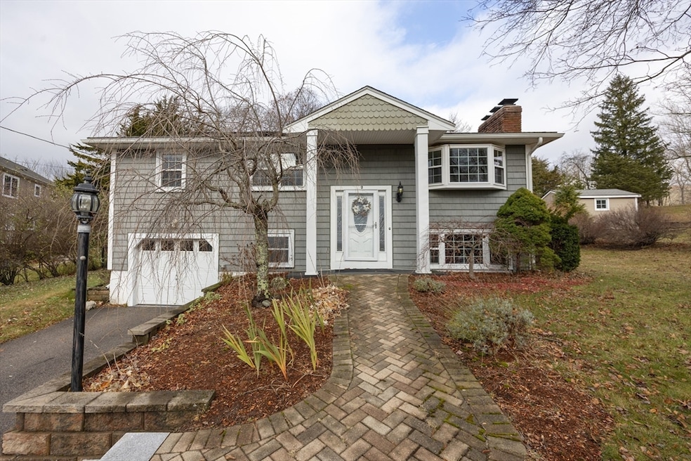
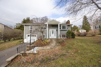
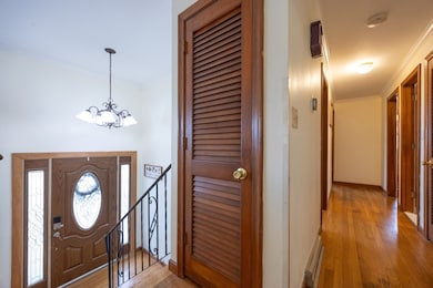
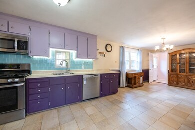
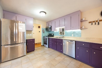

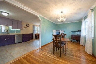
This inviting 3-bedroom, 2-bath split-level home is located in a neighborhood with easy access to the highway and area amenities. It sits on a fenced yard with a brand-new patio. The spacious kitchen features a pantry, offers direct access to the yard, and flows seamlessly into the dining room. A large dining room opens to the bright living room, complete with a fireplace and bay window. Down the hall are three comfortable bedrooms and a renovated full bathroom showcasing a large tiled shower. The lower level provides a fourth bedroom or office and full bathroom with walk-in shower. A generous family room with a second fireplace creates an ideal gathering space. A bonus room at the back of the home offers flexibility for play, fitness, or hobbies. Completing the lower level is a convenient laundry room and a walk-out to the tree-lined yard. Important features include: heat system 2020, central air 2024, replacement windows, new heat pump, mini-split in lower level and solar panels.
Last Agent to Sell the Property
Coldwell Banker Realty - Framingham Listed on: 12/01/2025
| Date | Type | Sale Price | Title Company |
|---|---|---|---|
| Quit Claim Deed | $455,000 | None Available | |
| Deed | $34,000 | -- |
| Date | Status | Loan Amount | Loan Type |
|---|---|---|---|
| Open | $341,250 | Purchase Money Mortgage |
| Date | Event | Price | List to Sale | Price per Sq Ft |
|---|---|---|---|---|
| 02/20/2026 02/20/26 | Sold | $645,000 | -0.8% | $295 / Sq Ft |
| 12/07/2025 12/07/25 | Pending | -- | -- | -- |
| 12/01/2025 12/01/25 | For Sale | $650,000 | -- | $297 / Sq Ft |
| Year | Tax Paid | Tax Assessment Tax Assessment Total Assessment is a certain percentage of the fair market value that is determined by local assessors to be the total taxable value of land and additions on the property. | Land | Improvement |
|---|---|---|---|---|
| 2025 | $7,250 | $623,900 | $326,700 | $297,200 |
| 2024 | $7,220 | $612,400 | $326,700 | $285,700 |
| 2023 | $6,927 | $550,600 | $278,500 | $272,100 |
| 2022 | $6,189 | $440,500 | $219,300 | $221,200 |
| 2021 | $6,190 | $422,500 | $246,200 | $176,300 |
| 2020 | $5,852 | $403,300 | $236,100 | $167,200 |
| 2019 | $5,764 | $393,200 | $226,000 | $167,200 |
| 2018 | $5,374 | $366,800 | $217,900 | $148,900 |
| 2017 | $5,113 | $350,700 | $201,800 | $148,900 |
| 2016 | $5,040 | $347,600 | $216,700 | $130,900 |
| 2015 | $4,998 | $336,800 | $205,900 | $130,900 |
| 2014 | $4,501 | $311,500 | $180,600 | $130,900 |
Seller's Agent in 2026
Lisa Paulette
Coldwell Banker Realty - Framingham
(617) 967-5890
131 Total Sales
Buyer's Agent in 2026
Tammy Todaro
RE/MAX
(508) 277-2977
135 Total Sales
Source: MLS Property Information Network (MLS PIN)
MLS Number: 73458337
APN: FRAN-000215-000000-000035
Disclaimer: Certain information contained herein is derived from information provided by parties other than Homes.com. All information provided is deemed reliable, but is not guaranteed to be accurate and should be independently verified.
![]() The property listing data and information, or the Images, set forth herein were provided to MLS Property Information Network, Inc. from third party sources, including sellers, lessors and public records, and were compiled by MLS Property Information Network, Inc. The property listing data and information, and the Images, are for the personal, non-commercial use of consumers having a good faith interest in purchasing or leasing listed properties of the type displayed to them and may not be used for any purpose other than to identify prospective properties which such consumers may have a good faith interest in purchasing or leasing. MLS Property Information Network, Inc. and its subscribers disclaim any and all representations and warranties as to the accuracy of the property listing data and information, or as to the accuracy of any of the Images, set forth herein.
The property listing data and information, or the Images, set forth herein were provided to MLS Property Information Network, Inc. from third party sources, including sellers, lessors and public records, and were compiled by MLS Property Information Network, Inc. The property listing data and information, and the Images, are for the personal, non-commercial use of consumers having a good faith interest in purchasing or leasing listed properties of the type displayed to them and may not be used for any purpose other than to identify prospective properties which such consumers may have a good faith interest in purchasing or leasing. MLS Property Information Network, Inc. and its subscribers disclaim any and all representations and warranties as to the accuracy of the property listing data and information, or as to the accuracy of any of the Images, set forth herein.
Ask me questions while you tour the home.