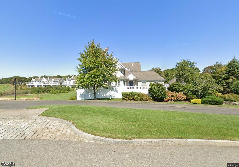
2 Vineyard Reach Unit 2 Mashpee, MA 02649
New Seabury-Popponesset Island NeighborhoodEstimated Value: $2,265,000 - $2,547,000
3
Beds
4
Baths
2,835
Sq Ft
$844/Sq Ft
Est. Value
About This Home
This home is located at 2 Vineyard Reach Unit 2, Mashpee, MA 02649 and is currently estimated at $2,392,927, approximately $844 per square foot. 2 Vineyard Reach Unit 2 is a home located in Barnstable County with nearby schools including Kenneth C. Coombs School, Quashnet School, and Mashpee Middle School.
Ownership History
Date
Name
Owned For
Owner Type
Purchase Details
Closed on
Feb 28, 2023
Sold by
Misty T
Bought by
Joe and Sandy Grainger
Current Estimated Value
Purchase Details
Closed on
Dec 14, 2022
Sold by
Grainger Joseph F and Grainger Sandra J
Bought by
Misty T
Purchase Details
Closed on
Jun 20, 2011
Sold by
Vineyard Reach Llc
Bought by
Gralnger Joseph F and Gralnger Sandra J
Create a Home Valuation Report for This Property
The Home Valuation Report is an in-depth analysis detailing your home's value as well as a comparison with similar homes in the area
Home Values in the Area
Average Home Value in this Area
Purchase History
| Date | Buyer | Sale Price | Title Company |
|---|---|---|---|
| Joe | -- | None Available | |
| Misty T | -- | None Available | |
| Gralnger Joseph F | $958,000 | -- | |
| Gralnger Joseph F | $958,000 | -- |
Source: Public Records
Tax History
| Year | Tax Paid | Tax Assessment Tax Assessment Total Assessment is a certain percentage of the fair market value that is determined by local assessors to be the total taxable value of land and additions on the property. | Land | Improvement |
|---|---|---|---|---|
| 2025 | $12,741 | $1,924,600 | $0 | $1,924,600 |
| 2024 | $11,921 | $1,854,000 | $0 | $1,854,000 |
| 2023 | $12,523 | $1,786,500 | $0 | $1,786,500 |
| 2022 | $11,932 | $1,460,500 | $0 | $1,460,500 |
| 2021 | $9,999 | $1,102,400 | $0 | $1,102,400 |
| 2020 | $9,790 | $1,077,000 | $0 | $1,077,000 |
| 2019 | $9,388 | $1,037,400 | $0 | $1,037,400 |
| 2018 | $10,820 | $1,213,000 | $0 | $1,213,000 |
| 2017 | $12,251 | $1,333,100 | $0 | $1,333,100 |
| 2016 | $11,857 | $1,283,200 | $0 | $1,283,200 |
| 2015 | $11,265 | $1,236,500 | $0 | $1,236,500 |
| 2014 | $11,324 | $1,206,000 | $0 | $1,206,000 |
Source: Public Records
Map
Nearby Homes
- 5 Coastline Dr
- 40 Triton Way
- 36 Troon Way
- 46 Greensward Cir
- 25 Milestone Way Unit 25
- 25 Milestone Way
- 15 Brant Rock Rd Unit 765
- 21 Milestone Way Unit 620
- 4 Hyannis Point Rd Unit 4
- 5 Hydrangea Ln Unit 782
- 33 Landmark Ave
- 22 Mid Iron Way Unit 7511
- 6 Hammock Pond Rd
- 6 Hammock Pond Rd Unit 6
- 3 Hyannis Point Rd Unit 790
- 3 Hyannis Point Rd
- 14 Hammock Pond Rd Unit 789
- 51 Fairway Ln
- 101 Greensward Rd
- 51 Walton Heath Way
- 6 Vineyard Reach
- 4 Vineyard Reach
- 2 Vineyard Reach
- 4 Vineyard Reach Unit 4
- 6 Vineyard Reach Unit 6
- 2 Vineyard Reach
- 4 Vineyard Reach
- 4 Vineyard Reach Unit 4
- 14 Vineyard Reach
- 12 Vineyard Reach
- 10 Vineyard Reach
- 8 Vineyard Reach
- 10 Vineyard Reach Unit 10
- 12 Vineyard Reach Unit 12
- 10 Vineyard Reach
- 8 Vineyard Reach
- 14 Vineyard Reach
- 12 Vineyard Reach
- 14 Vineyard Reach Unit 14
- 8 Vineyard Reach Unit 8
Your Personal Tour Guide
Ask me questions while you tour the home.