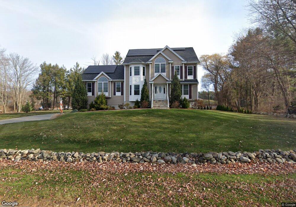
2 Wild Rose Dr Andover, MA 01810
West Andover NeighborhoodEstimated Value: $1,405,865 - $1,598,000
4
Beds
3
Baths
3,200
Sq Ft
$464/Sq Ft
Est. Value
About This Home
This home is located at 2 Wild Rose Dr, Andover, MA 01810 and is currently estimated at $1,483,216, approximately $463 per square foot. 2 Wild Rose Dr is a home located in Essex County with nearby schools including Henry C. Sanborn Elementary School, Andover West Middle School, and Andover High School.
Ownership History
Date
Name
Owned For
Owner Type
Purchase Details
Closed on
Mar 1, 2011
Sold by
Jeffco Inc
Bought by
Patel Shardul S
Current Estimated Value
Home Financials for this Owner
Home Financials are based on the most recent Mortgage that was taken out on this home.
Original Mortgage
$475,000
Interest Rate
4.75%
Mortgage Type
Purchase Money Mortgage
Purchase Details
Closed on
Oct 12, 2010
Sold by
Ciaraldi Samuel A Jr E and Ciaraldi C
Bought by
Jeffco Inc
Create a Home Valuation Report for This Property
The Home Valuation Report is an in-depth analysis detailing your home's value as well as a comparison with similar homes in the area
Home Values in the Area
Average Home Value in this Area
Purchase History
| Date | Buyer | Sale Price | Title Company |
|---|---|---|---|
| Patel Shardul S | $675,000 | -- | |
| Patel Shardul S | $675,000 | -- | |
| Jeffco Inc | $215,000 | -- | |
| Jeffco Inc | $215,000 | -- |
Source: Public Records
Mortgage History
| Date | Status | Borrower | Loan Amount |
|---|---|---|---|
| Open | Jeffco Inc | $417,000 | |
| Closed | Jeffco Inc | $475,000 | |
| Closed | Jeffco Inc | $475,000 |
Source: Public Records
Tax History Compared to Growth
Tax History
| Year | Tax Paid | Tax Assessment Tax Assessment Total Assessment is a certain percentage of the fair market value that is determined by local assessors to be the total taxable value of land and additions on the property. | Land | Improvement |
|---|---|---|---|---|
| 2024 | $15,036 | $1,167,400 | $468,600 | $698,800 |
| 2023 | $14,414 | $1,055,200 | $422,000 | $633,200 |
| 2022 | $13,606 | $931,900 | $367,000 | $564,900 |
| 2021 | $13,067 | $854,600 | $333,700 | $520,900 |
| 2020 | $12,574 | $837,700 | $325,600 | $512,100 |
| 2019 | $12,512 | $819,400 | $316,000 | $503,400 |
| 2018 | $12,030 | $769,200 | $304,000 | $465,200 |
| 2017 | $11,558 | $761,400 | $297,900 | $463,500 |
| 2016 | $11,320 | $763,800 | $297,900 | $465,900 |
| 2015 | $10,888 | $727,300 | $286,300 | $441,000 |
Source: Public Records
Map
Nearby Homes
- 4 Alonesos Way
- 41 W Parish Dr
- 69 High Plain Rd
- 15 Geneva Rd
- 14 Geneva Rd
- 17 Rose Glen Dr
- 13 Leah Way
- 4 Caileigh Ct
- 23 Michael Way Unit 35
- 18 Bryan Ln Unit 18
- 25 Clubview Dr Unit 25
- 13 Clubview Dr Unit 13
- 4 Hazelwood Cir
- 2 Haskell Rd
- 7 Stouffer Cir
- 83 Lowell St
- 16 Cuba St
- 22 Haggetts Pond Rd
- 26 Mary Lou Ln
- 19 Smithshire Estates
- 4 Wild Rose Dr
- 1 Wild Rose Dr Unit D
- 1 Wild Rose Dr Unit C
- 1 Wild Rose Dr Unit B
- 1 Wild Rose Dr Unit A
- 1 Wild Rose Dr
- 1 Wild Rose Dr Unit 1
- 1 Wild Rose Dr Unit 2
- 1 Wild Rose Dr Unit 4
- 1 Wild Rose Dr Unit 3
- 264 Lowell St
- 116 Wild Rose Dr
- 6 Wild Rose Dr
- 278 Lowell St
- 114 Wild Rose Dr
- 5 Wild Rose Dr
- 277 Lowell St
- 259 Lowell St
- 101 Wild Rose Dr
- 8 Wild Rose Dr