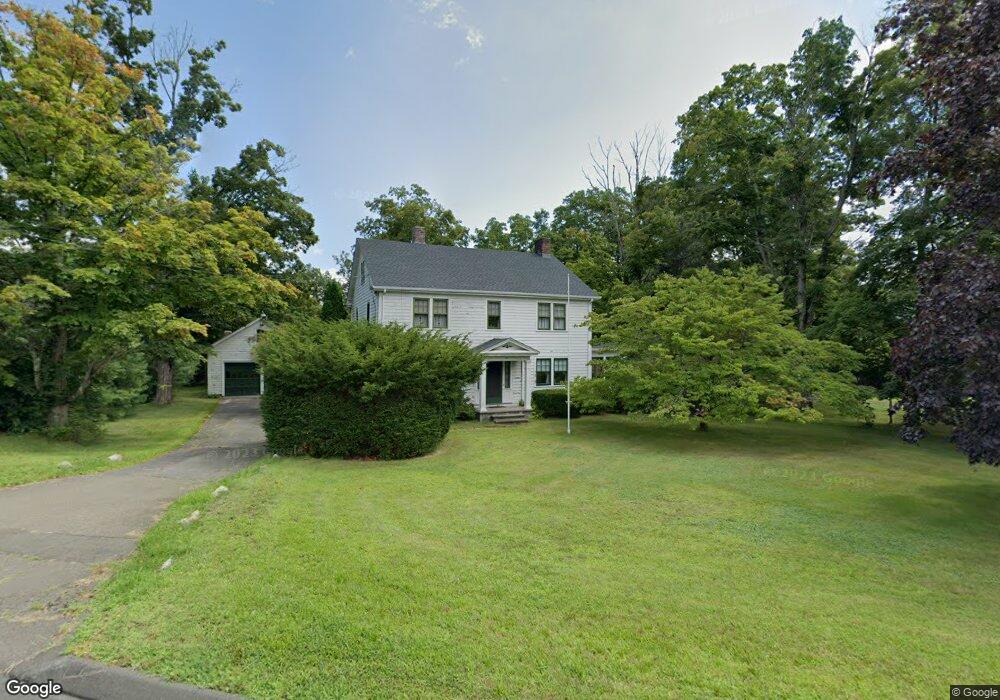
2 Winslow Place Weatogue, CT 06089
Estimated Value: $439,000 - $721,000
4
Beds
2
Baths
2,360
Sq Ft
$221/Sq Ft
Est. Value
About This Home
This home is located at 2 Winslow Place, Weatogue, CT 06089 and is currently estimated at $521,235, approximately $220 per square foot. 2 Winslow Place is a home with nearby schools including Latimer Lane School, Henry James Memorial School, and Simsbury High School.
Ownership History
Date
Name
Owned For
Owner Type
Purchase Details
Closed on
Oct 30, 2024
Sold by
Little James C and Little Jonathan D
Bought by
Hida Lindita
Current Estimated Value
Home Financials for this Owner
Home Financials are based on the most recent Mortgage that was taken out on this home.
Original Mortgage
$250,000
Outstanding Balance
$247,497
Interest Rate
6.09%
Mortgage Type
Purchase Money Mortgage
Estimated Equity
$273,738
Create a Home Valuation Report for This Property
The Home Valuation Report is an in-depth analysis detailing your home's value as well as a comparison with similar homes in the area
Home Values in the Area
Average Home Value in this Area
Purchase History
| Date | Buyer | Sale Price | Title Company |
|---|---|---|---|
| Hida Lindita | $425,000 | None Available |
Source: Public Records
Mortgage History
| Date | Status | Borrower | Loan Amount |
|---|---|---|---|
| Open | Hida Lindita | $250,000 |
Source: Public Records
Tax History Compared to Growth
Tax History
| Year | Tax Paid | Tax Assessment Tax Assessment Total Assessment is a certain percentage of the fair market value that is determined by local assessors to be the total taxable value of land and additions on the property. | Land | Improvement |
|---|---|---|---|---|
| 2025 | $9,515 | $278,530 | $69,510 | $209,020 |
| 2024 | $8,879 | $266,560 | $69,510 | $197,050 |
| 2023 | $8,482 | $266,560 | $69,510 | $197,050 |
| 2022 | $7,886 | $204,150 | $76,520 | $127,630 |
| 2021 | $7,886 | $204,150 | $76,520 | $127,630 |
| 2020 | $7,572 | $204,150 | $76,520 | $127,630 |
| 2019 | $7,619 | $204,150 | $76,520 | $127,630 |
| 2018 | $7,674 | $204,150 | $76,520 | $127,630 |
| 2017 | $7,882 | $203,350 | $73,590 | $129,760 |
| 2016 | $7,548 | $203,350 | $73,590 | $129,760 |
| 2015 | $7,548 | $203,350 | $73,590 | $129,760 |
| 2014 | $7,552 | $203,350 | $73,590 | $129,760 |
Source: Public Records
Map
Nearby Homes
- 15 Sand Hill Rd
- 308 Hopmeadow St
- 44 Simsbury Manor Dr
- 7 Tamarack Ln
- 3 Cobtail Way
- 4 Stebbins Brook Ln
- 3 Stebbins Brook Ln
- 16 Stratton Forest Way
- 10 Pepperidge Ct
- 3 Minister Brook Dr
- 47 Long View Dr
- 29 Minister Brook Dr
- 301 Bushy Hill Rd
- 40 Firetown Rd Unit 39
- 48 Library Ln Unit 48
- 545 Simsbury Rd
- 15 Pinnacle Mountain Rd
- 2 Pent Rd
- 8 Crane Place
- 4 Adams Rd
- 2 Winslow Place
- 348 Hopmeadow St
- 365 Hopmeadow St
- 33 Canal St
- 343 Hopmeadow St
- 367 Hopmeadow St
- 41 Canal St
- 41 Canal St Unit 2
- 46 Canal St
- 43 Canal St
- 327 Hopmeadow St
- 327 Hopmeadow St
- 381 Hopmeadow St
- 16 Stratton Brook Rd
- 15 Stratton Brook Rd
- 47 Canal St
- 9 Sand Hill Rd
- 18 Stratton Brook Rd
- 18 Stratton Brook Rd
- 18 Stratton Brook Rd