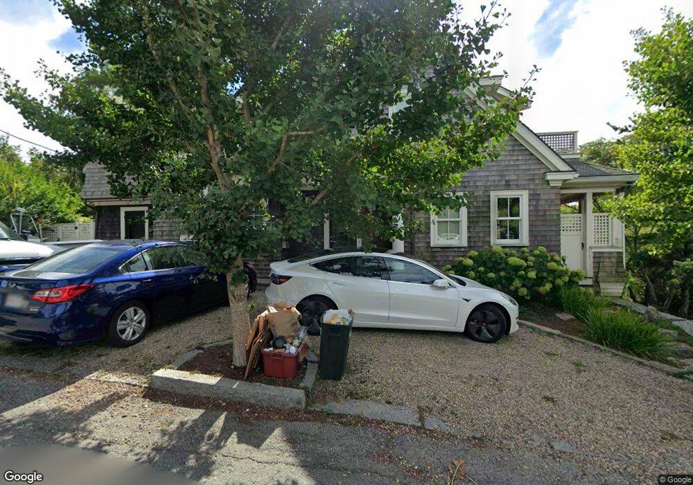
20 Andrews St Gloucester, MA 01930
Estimated Value: $856,000 - $1,790,000
3
Beds
4
Baths
2,898
Sq Ft
$461/Sq Ft
Est. Value
About This Home
This home is located at 20 Andrews St, Gloucester, MA 01930 and is currently estimated at $1,336,239, approximately $461 per square foot. 20 Andrews St is a home located in Essex County with nearby schools including Plum Cove School, Ralph B O'maley Middle School, and Gloucester High School.
Ownership History
Date
Name
Owned For
Owner Type
Purchase Details
Closed on
Apr 12, 2021
Sold by
Stone Sandra and Stone Stanley W
Bought by
Morris Marissa
Current Estimated Value
Home Financials for this Owner
Home Financials are based on the most recent Mortgage that was taken out on this home.
Original Mortgage
$1,356,000
Outstanding Balance
$1,211,529
Interest Rate
2.9%
Mortgage Type
Purchase Money Mortgage
Estimated Equity
$124,710
Purchase Details
Closed on
Oct 29, 2004
Sold by
Stone Stanley W
Bought by
Stone Stanley W
Home Financials for this Owner
Home Financials are based on the most recent Mortgage that was taken out on this home.
Original Mortgage
$150,000
Interest Rate
5.74%
Mortgage Type
Purchase Money Mortgage
Purchase Details
Closed on
Oct 25, 2001
Sold by
20 Andrews St Tr 2001 and Perkins
Bought by
Stone Stanley W
Create a Home Valuation Report for This Property
The Home Valuation Report is an in-depth analysis detailing your home's value as well as a comparison with similar homes in the area
Purchase History
| Date | Buyer | Sale Price | Title Company |
|---|---|---|---|
| Morris Marissa | $1,695,000 | None Available | |
| Morris Marissa | $1,695,000 | None Available | |
| Stone Stanley W | -- | -- | |
| Stone Stanley W | $275,000 | -- |
Source: Public Records
Mortgage History
| Date | Status | Borrower | Loan Amount |
|---|---|---|---|
| Open | Morris Marissa | $1,356,000 | |
| Closed | Morris Marissa | $1,356,000 | |
| Previous Owner | Stone Stanley W | $256,000 | |
| Previous Owner | Stone Stanley W | $150,000 |
Source: Public Records
Tax History
| Year | Tax Paid | Tax Assessment Tax Assessment Total Assessment is a certain percentage of the fair market value that is determined by local assessors to be the total taxable value of land and additions on the property. | Land | Improvement |
|---|---|---|---|---|
| 2025 | $11,606 | $1,194,000 | $429,300 | $764,700 |
| 2024 | $11,351 | $1,166,600 | $408,900 | $757,700 |
| 2023 | $11,800 | $1,114,300 | $365,000 | $749,300 |
| 2022 | $11,117 | $947,700 | $317,500 | $630,200 |
| 2021 | $10,757 | $864,700 | $288,700 | $576,000 |
| 2020 | $10,058 | $815,700 | $272,200 | $543,500 |
| 2019 | $9,478 | $746,900 | $272,200 | $474,700 |
| 2018 | $9,078 | $702,100 | $272,200 | $429,900 |
| 2017 | $8,699 | $659,500 | $259,100 | $400,400 |
| 2016 | $8,214 | $603,500 | $246,000 | $357,500 |
| 2015 | $8,205 | $601,100 | $254,500 | $346,600 |
Source: Public Records
Map
Nearby Homes
- 43 High St Unit B
- 1030 Washington St
- 10 Emerald St
- 9 Hickory St
- 4 Ciaramitaro Ct
- 136 Leonard St
- 94 Phillips Ave
- 13 Phillips Ave
- 32 Haven Ave
- 33 Quarry Ridge Ln Unit 33
- 5 Boulder Top
- 13 Rowe Point
- 672 Washington St
- 5 Smith St Unit R
- 1 Charte Ct
- 1 Main St Unit R
- 1 Main St Unit C
- 1 Jewett St Unit 2
- 177 Main St
- 226 Atlantic St
- 7 Lanes Cove Rd
- 22 Andrews St
- 17 Andrews St
- 12 Andrews St
- 10 Andrews St
- 2 Langsford St
- 17 Andrews St
- 2 Sunset Point Rd
- 4 Langsford St
- 6 Langsford St
- 6 Langsford St Unit 1
- 6 Langsford St Unit 2
- 6R Langsford St
- 9 Andrews St
- 6 Andrews St
- 4 Sunset Point Rd
- 5 Langsford St
- 24 Andrews St
- 35 Andrews St
- 5 Sunset Point Rd
Your Personal Tour Guide
Ask me questions while you tour the home.