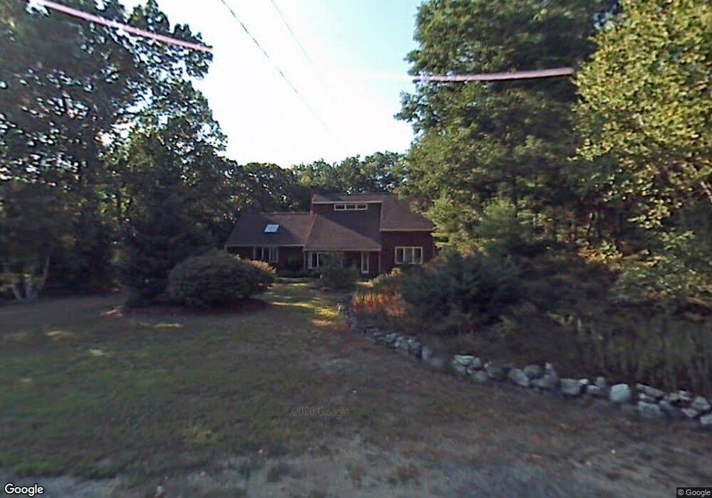
20 Brookside Terrace Atkinson, NH 03811
Estimated Value: $669,000 - $736,000
3
Beds
2
Baths
2,564
Sq Ft
$271/Sq Ft
Est. Value
About This Home
This home is located at 20 Brookside Terrace, Atkinson, NH 03811 and is currently estimated at $695,501, approximately $271 per square foot. 20 Brookside Terrace is a home located in Rockingham County with nearby schools including Atkinson Academy, Timberlane Regional Middle School, and Timberlane Regional High School.
Ownership History
Date
Name
Owned For
Owner Type
Purchase Details
Closed on
Jan 25, 2021
Sold by
Hatton Frederick S and Hatton Mary F
Bought by
Minnehat Ft
Current Estimated Value
Create a Home Valuation Report for This Property
The Home Valuation Report is an in-depth analysis detailing your home's value as well as a comparison with similar homes in the area
Home Values in the Area
Average Home Value in this Area
Purchase History
| Date | Buyer | Sale Price | Title Company |
|---|---|---|---|
| Minnehat Ft | -- | None Available |
Source: Public Records
Tax History
| Year | Tax Paid | Tax Assessment Tax Assessment Total Assessment is a certain percentage of the fair market value that is determined by local assessors to be the total taxable value of land and additions on the property. | Land | Improvement |
|---|---|---|---|---|
| 2024 | $7,216 | $558,500 | $258,200 | $300,300 |
| 2023 | $8,098 | $558,500 | $258,200 | $300,300 |
| 2022 | $6,769 | $551,700 | $258,200 | $293,500 |
| 2021 | $6,819 | $551,700 | $258,200 | $293,500 |
| 2020 | $6,342 | $345,800 | $172,200 | $173,600 |
| 2019 | $6,110 | $345,800 | $172,200 | $173,600 |
| 2018 | $6,200 | $345,800 | $172,200 | $173,600 |
| 2017 | $6,328 | $345,800 | $172,200 | $173,600 |
| 2016 | $6,183 | $345,800 | $172,200 | $173,600 |
| 2015 | $6,301 | $329,900 | $166,700 | $163,200 |
| 2014 | $5,631 | $294,800 | $130,000 | $164,800 |
| 2013 | $5,601 | $294,800 | $130,000 | $164,800 |
Source: Public Records
Map
Nearby Homes
- 20 Chandler Dr
- 9 Village Dr
- 127 Cowbell Crossing
- 17 Winslow Dr
- 3 Pages Ln
- 20 Larson Dr
- 18 Christine Dr
- 120 Chases Grove Rd
- 114 Chases Grove Rd
- 15 Marilyn Dr
- 3 Longview Dr Unit 305
- 1 Longview Dr Unit 110
- 1 Longview Dr Unit 203
- 1 Longview Dr Unit 101
- 1 Longview Dr Unit 108
- 1 Longview Dr Unit 401
- 1 Longview Dr Unit 306
- 1 Longview Dr Unit 205
- 1 Longview Dr Unit 106
- 1 Longview Dr Unit 210
- 18 Brookside Terrace
- 21 Brookside Terrace
- 23 Brookside Terrace
- 19 Brookside Terrace
- 13 Belknap Dr
- 25 Brookside Terrace
- 11 Belknap Dr
- 16 Brookside Terrace
- 17 Brookside Terrace
- 14 Brookside Terrace
- 9 Emery Dr
- 9 Belknap Dr
- 11 Emery Dr
- 15 Brookside Terrace
- 22 Stonewall Terrace
- 13 Emery Dr
- 14 Belknap Dr
- 12 Belknap Dr
- 10 Emery Dr
- 12 Brookside Terrace
Your Personal Tour Guide
Ask me questions while you tour the home.