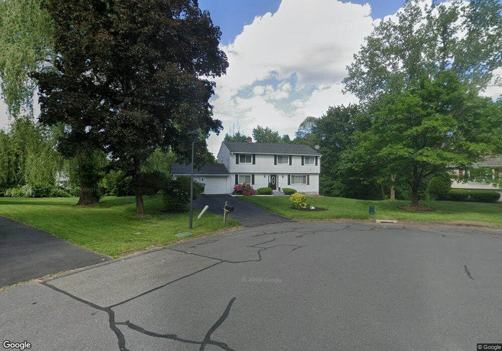
20 Cardston Cir Windsor, CT 06095
West Windsor NeighborhoodEstimated Value: $382,000 - $440,000
4
Beds
3
Baths
2,091
Sq Ft
$193/Sq Ft
Est. Value
About This Home
This home is located at 20 Cardston Cir, Windsor, CT 06095 and is currently estimated at $402,808, approximately $192 per square foot. 20 Cardston Cir is a home located in Hartford County with nearby schools including Poquonock Elementary School, Clover Street School, and Sage Park Middle School.
Ownership History
Date
Name
Owned For
Owner Type
Purchase Details
Closed on
Dec 6, 2012
Sold by
Roberts Neville G
Bought by
Gilchrist Angela
Current Estimated Value
Purchase Details
Closed on
Dec 19, 1994
Sold by
Broadus William and Clanton Deborah
Bought by
Roberts Neville and Gilchrist Angela
Create a Home Valuation Report for This Property
The Home Valuation Report is an in-depth analysis detailing your home's value as well as a comparison with similar homes in the area
Home Values in the Area
Average Home Value in this Area
Purchase History
| Date | Buyer | Sale Price | Title Company |
|---|---|---|---|
| Gilchrist Angela | -- | -- | |
| Roberts Neville | $140,000 | -- |
Source: Public Records
Mortgage History
| Date | Status | Borrower | Loan Amount |
|---|---|---|---|
| Open | Roberts Neville | $184,488 | |
| Closed | Roberts Neville | $152,024 | |
| Closed | Roberts Neville | $118,675 |
Source: Public Records
Tax History Compared to Growth
Tax History
| Year | Tax Paid | Tax Assessment Tax Assessment Total Assessment is a certain percentage of the fair market value that is determined by local assessors to be the total taxable value of land and additions on the property. | Land | Improvement |
|---|---|---|---|---|
| 2025 | $6,859 | $241,080 | $58,730 | $182,350 |
| 2024 | $7,310 | $241,080 | $58,730 | $182,350 |
| 2023 | $5,464 | $162,610 | $40,880 | $121,730 |
| 2022 | $5,410 | $162,610 | $40,880 | $121,730 |
| 2021 | $5,410 | $162,610 | $40,880 | $121,730 |
| 2020 | $5,384 | $162,610 | $40,880 | $121,730 |
| 2019 | $5,265 | $162,610 | $40,880 | $121,730 |
| 2018 | $4,875 | $147,910 | $40,880 | $107,030 |
| 2017 | $4,800 | $147,910 | $40,880 | $107,030 |
| 2016 | $4,662 | $147,910 | $40,880 | $107,030 |
| 2015 | $4,573 | $147,910 | $40,880 | $107,030 |
| 2014 | $4,507 | $147,910 | $40,880 | $107,030 |
Source: Public Records
Map
Nearby Homes
- 5 Eagleton Dr
- 580 W Wolcott Ave
- 2 Sandra Dr
- 15 Kelsey Place
- 26 Kelsey Place
- 12 London Rd
- 39 Wade Ave
- 18 Englewood Ave
- 31 Farmstead Cir
- 1083 Blue Hills Ave Unit G
- 18 Walsh St
- 1130 Blue Hills Ave
- 45 E Wintonbury Ave
- 17 Mills Rd
- 67 Elizabeth Ave
- 29 Quail Hollow Dr
- 99 Pepperbush Way
- 13 Patton Rd
- 10 Greenbriar Dr Unit 12
- 35 Fairfield Ln
- 16 Cardston Cir
- 55 Tamarack Dr
- 25 Cardston Cir
- 61 Tamarack Dr
- 49 Tamarack Dr
- 10 Cardston Cir
- 36 Maythorpe Dr
- 15 Cardston Cir
- 45 Tamarack Dr
- 40 Maythorpe Dr
- 69 Tamarack Dr
- 86 Willowcrest Dr
- 46 Maythorpe Dr
- 74 Willowcrest Dr
- 42 Willowcrest Dr
- 4 Regency Dr
- 36 Willowcrest Dr
- 64 Willowcrest Dr
- 37 Tamarack Dr
- 48 Willowcrest Dr