Estimated Value: $647,059 - $710,000
4
Beds
3
Baths
2,640
Sq Ft
$257/Sq Ft
Est. Value
About This Home
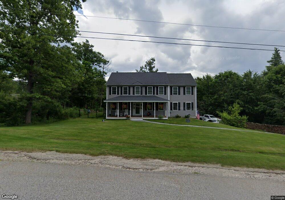
This home is located at 20 Eastman Way Unit 186-40, Weare, NH 03281 and is currently estimated at $678,515, approximately $257 per square foot. 20 Eastman Way Unit 186-40 is a home located in Hillsborough County with nearby schools including Center Woods Elementary School, Weare Middle School, and John Stark Regional High School.
Ownership History
Date
Name
Owned For
Owner Type
Purchase Details
Closed on
Mar 25, 2020
Sold by
Hodges Daniel and Frost Amanda J
Bought by
Frost Brian A and Frost Amanda J
Current Estimated Value
Home Financials for this Owner
Home Financials are based on the most recent Mortgage that was taken out on this home.
Original Mortgage
$257,000
Outstanding Balance
$200,906
Interest Rate
3.4%
Mortgage Type
New Conventional
Estimated Equity
$477,609
Purchase Details
Closed on
Jun 29, 2012
Sold by
Bolton Christopher J
Bought by
Roger D Hardy Constr L
Create a Home Valuation Report for This Property
The Home Valuation Report is an in-depth analysis detailing your home's value as well as a comparison with similar homes in the area
Home Values in the Area
Average Home Value in this Area
Purchase History
| Date | Buyer | Sale Price | Title Company |
|---|---|---|---|
| Frost Brian A | -- | None Available | |
| Roger D Hardy Constr L | $60,000 | -- |
Source: Public Records
Mortgage History
| Date | Status | Borrower | Loan Amount |
|---|---|---|---|
| Open | Frost Brian A | $257,000 |
Source: Public Records
Tax History Compared to Growth
Tax History
| Year | Tax Paid | Tax Assessment Tax Assessment Total Assessment is a certain percentage of the fair market value that is determined by local assessors to be the total taxable value of land and additions on the property. | Land | Improvement |
|---|---|---|---|---|
| 2024 | $8,568 | $420,200 | $130,000 | $290,200 |
| 2023 | $7,917 | $420,200 | $130,000 | $290,200 |
| 2022 | $7,311 | $420,200 | $130,000 | $290,200 |
| 2021 | $7,219 | $419,700 | $130,000 | $289,700 |
| 2020 | $7,271 | $303,600 | $92,100 | $211,500 |
| 2019 | $7,198 | $303,600 | $92,100 | $211,500 |
| 2018 | $6,992 | $303,600 | $92,100 | $211,500 |
| 2016 | $6,792 | $303,600 | $92,100 | $211,500 |
| 2015 | $6,326 | $282,300 | $92,100 | $190,200 |
| 2014 | $6,148 | $276,800 | $92,100 | $184,700 |
| 2013 | $5,886 | $270,600 | $87,500 | $183,100 |
Source: Public Records
Map
Nearby Homes
- 103 Renshaw Rd
- 624 S Stark Hwy
- 77 Gould Rd
- 174 S Stark Hwy Unit 13
- 174 S Stark Hwy Unit 1
- 174 S Stark Hwy Unit 23
- 93 Daniels Rd
- 849 River Rd
- 179 Oak Hill Rd
- 95 Wright Dr
- 450 Weare Rd
- 3 Stephanie Rd
- 0 Huntington Hill Rd Unit 69
- 196 Deering Center Rd
- 342 Weare Rd
- 238 Old Francestown Rd
- 88 Saunders Rd
- 10 Sap House Rd
- 34 Lull Rd
- 22 Fairway Dr
- 20 Eastman Way
- 86 Rolling Hill Dr
- 26 Eastman Way
- 26 Eastman Way
- 68 Rolling Hill Dr
- 33 Eastman Way
- 31 Eastman Way
- 37 Eastman Way
- 35 Eastman Way
- 39 Eastman Way
- 100 Rolling Hill Dr
- 32 Eastman Way
- 77 Rolling Hill Dr
- 85 Rolling Hill Dr
- 102 Rolling Hill Dr
- 36 Eastman Way
- 93 Rolling Hill Dr
- 55 Eastman Way
- 38 Eastman Way
- 40 Eastman Way